TopoQuest Logo
Do you find TopoQuest useful?
Help keep TopoQuest running and adding new maps/features by donating!
Bitcoin:  19c7KJd3qBynnjoSw5npx9KScwjBe4ifkT
Litecoin:  LXs6TkuXGGXo1vDsWCkWVdjQX94eUKd6ui
Home View Maps Find Maps Find Places Resources & Links


Eversonville, Missouri Topographic Map

USGS Map Title: Eversonville, MO
USGS Map MRC: 39093H3
DRG (GeoTIFF) Download: o39093h3.tif


Neighboring USGS Topographic Map Quads:


  Laredo, MO  
40093A4
 

  Lindley, MO  
40093A3
 

  Browning, MO  
40093A2
 

  Chula, MO  
39093H4
 

  Eversonville, MO  
39093H3
 

  Linneus, MO  
39093H2
 

  Wheeling, MO  
39093G4
 

  Meadville, MO  
39093G3
 

  Laclede, MO  
39093G2


Map MRC Location:

N40°
W94°
N40°
W93°
H8 H7 H6 H5 H4 H3 H2 H1
G8 G7 G6 G5 G4 G3 G2 G1
F8 F7 F6 F5 F4 F3 F2 F1
E8 E7 E6 E5 E4 E3 E2 E1
D8 D7 D6 D5 D4 D3 D2 D1
C8 C7 C6 C5 C4 C3 C2 C1
B8 B7 B6 B5 B4 B3 B2 B1
A8 A7 A6 A5 A4 A3 A2 A1
N39°
W94°
N39°
W93°

Eversonville, MO USGS 1:24K Topographic Map Preview:
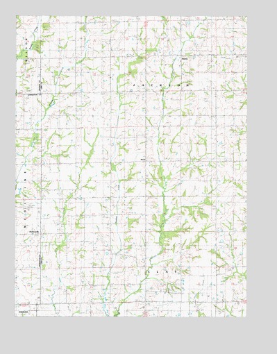
Eversonville, MO USGS Topographic Map
Click on map above to begin viewing in our Map Viewer.

This topographic map contains these locations and features:
Feature Name Type Latitude Longitude GNIS ID View Map
Antioch Church (historical)ChurchN39.9536°W93.3222°713336View Map
Banner SchoolSchoolN39.9447°W93.3744°713620View Map
Bethel ChurchChurchN39.8811°W93.2672°714073View Map
East Strawberry School (historical)SchoolN39.8928°W93.2610°717347View Map
EversonvillePopulated PlaceN39.9089°W93.3599°735606View Map
HeclaPopulated PlaceN39.9397°W93.3041°740919View Map
Kirby School (historical)SchoolN39.9256°W93.2872°720643View Map
Morris ChapelChurchN39.9692°W93.2522°722648View Map
Mount Olive ChurchChurchN39.9653°W93.2905°722824View Map
Mount Olive School (historical)SchoolN39.9547°W93.2860°722829View Map
Newton School (historical)SchoolN39.9025°W93.3452°723344View Map
Parson Creek Church (historical)ChurchN39.8875°W93.3224°724058View Map
Parsons Creek CemeteryCemeteryN39.8878°W93.3231°2702415View Map
ShafterPopulated PlaceN39.9839°W93.2849°726257View Map
South Sebago School (historical)SchoolN39.9384°W93.3308°726788View Map
Tharp School (historical)SchoolN39.9009°W93.3185°735880View Map
Township of JacksonCivilN39.9797°W93.2910°766919View Map
Van Home CemeteryCemeteryN39.9533°W93.3710°1782132View Map
Van Horne CemeteryCemeteryN39.9528°W93.3688°728117View Map
West Liberty School (historical)SchoolN39.9825°W93.3316°728596View Map
West Strawberry School (historical)SchoolN39.8895°W93.2860°728630View Map
White Cloud School (historical)SchoolN39.8939°W93.3713°728730View Map

Note: Coordinates in the location and feature list above are referenced to NAD83 datum.


Copyright (C) 2008-2025 Ryan Niemi / Sunset Dynamics ... All Rights Reserved