TopoQuest Logo
Do you find TopoQuest useful?
Help keep TopoQuest running and adding new maps/features by donating!
Bitcoin:  19c7KJd3qBynnjoSw5npx9KScwjBe4ifkT
Litecoin:  LXs6TkuXGGXo1vDsWCkWVdjQX94eUKd6ui
Home View Maps Find Maps Find Places Resources & Links


Lisbon, New York Topographic Map

USGS Map Title: Lisbon, NY
USGS Map MRC: 44075F3
DRG (GeoTIFF) Download: o44075f3.tif


Neighboring USGS Topographic Map Quads:


  Red Mills, NY  
44075G4
 

  Sparrowhawk Point, NY  
44075G3
 

  Waddington, NY  
44075G2
 

  Ogdensburg East, NY  
44075F4
 

  Lisbon, NY  
44075F3
 

  Morley, NY  
44075F2
 

  Heuvelton, NY  
44075E4
 

  Rensselaer Falls, NY  
44075E3
 

  Canton, NY  
44075E2


Map MRC Location:

N45°
W76°
N45°
W75°
H8 H7 H6 H5 H4 H3 H2 H1
G8 G7 G6 G5 G4 G3 G2 G1
F8 F7 F6 F5 F4 F3 F2 F1
E8 E7 E6 E5 E4 E3 E2 E1
D8 D7 D6 D5 D4 D3 D2 D1
C8 C7 C6 C5 C4 C3 C2 C1
B8 B7 B6 B5 B4 B3 B2 B1
A8 A7 A6 A5 A4 A3 A2 A1
N44°
W76°
N44°
W75°

Lisbon, NY USGS 1:24K Topographic Map Preview:
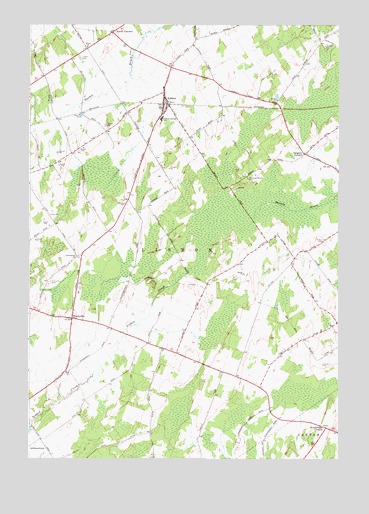
Lisbon, NY USGS Topographic Map
Click on map above to begin viewing in our Map Viewer.

This topographic map contains these locations and features:
Feature Name Type Latitude Longitude GNIS ID View Map
Covenanter ChurchChurchN44.6834°W75.3558°976193View Map
Flack FarmsLocaleN44.7431°W75.3142°2559383View Map
FlackvillePopulated PlaceN44.6653°W75.3574°976314View Map
Flackville CemeteryCemeteryN44.6758°W75.3672°976315View Map
Fulton CemeteryCemeteryN44.6879°W75.2564°976335View Map
Gregory CornersLocaleN44.7131°W75.2641°976378View Map
Hepburn Library of LisbonBuildingN44.7251°W75.3207°2597619View Map
LisbonPopulated PlaceN44.7273°W75.3210°976551View Map
Lisbon CemeteryCemeteryN44.7405°W75.3547°976552View Map
Lisbon Central SchoolSchoolN44.7231°W75.3216°976553View Map
Lisbon Orthodox Presbyterian ChurchChurchN44.7277°W75.3205°2597597View Map
Lisbon Post OfficePost OfficeN44.7320°W75.3209°2599006View Map
Lisbon Volunteer Fire CompanyBuildingN44.7318°W75.3200°2735277View Map
Livingston FarmsLocaleN44.7431°W75.3283°2702697View Map
North CornersLocaleN44.7478°W75.3413°976732View Map
School Number 14 (historical)SchoolN44.6572°W75.3208°2120140View Map
School Number 17 (historical)SchoolN44.6333°W75.2503°2120141View Map
School Number 18 (historical)SchoolN44.6458°W75.2814°2120142View Map
School Number 21 (historical)SchoolN44.7128°W75.2644°2120143View Map
School Number 22 (historical)SchoolN44.6642°W75.2508°2120144View Map
School Number 23 (historical)SchoolN44.7278°W75.2747°2120145View Map
School Number 26 (historical)SchoolN44.6828°W75.2681°2120147View Map
School Number 30 (historical)SchoolN44.6306°W75.3697°2120148View Map
School Number 32 (historical)SchoolN44.6764°W75.3025°2120149View Map
School Number 4 (historical)SchoolN44.7431°W75.3514°2120136View Map
School Number 6 (historical)SchoolN44.6639°W75.3478°2120137View Map
School Number 7 (historical)SchoolN44.6906°W75.3425°2120138View Map
School Number 9 (historical)SchoolN44.7114°W75.3622°2120139View Map
Town of LisbonCivilN44.7106°W75.3186°979154View Map
White ChurchChurchN44.7437°W75.3519°977267View Map
Woodbridge CornersLocaleN44.6337°W75.2552°977301View Map

Note: Coordinates in the location and feature list above are referenced to NAD83 datum.


Copyright (C) 2008-2025 Ryan Niemi / Sunset Dynamics ... All Rights Reserved