TopoQuest Logo
Do you find TopoQuest useful?
Help keep TopoQuest running and adding new maps/features by donating!
Bitcoin:  19c7KJd3qBynnjoSw5npx9KScwjBe4ifkT
Litecoin:  LXs6TkuXGGXo1vDsWCkWVdjQX94eUKd6ui
Home View Maps Find Maps Find Places Resources & Links


Lithia, Florida Topographic Map

USGS Map Title: Lithia, FL
USGS Map MRC: 27082G2
DRG (GeoTIFF) Download: o27082g2.tif


Neighboring USGS Topographic Map Quads:


  Brandon, FL  
27082H3
 

  Dover, FL  
27082H2
 

  Nichols, FL  
27082H1
 

  Riverview, FL  
27082G3
 

  Lithia, FL  
27082G2
 

  Keysville, FL  
27082G1
 

  Wimauma, FL  
27082F3
 

  Fort Lonesome, FL  
27082F2
 

  Duette NE, FL  
27082F1


Map MRC Location:

N28°
W83°
N28°
W82°
H8 H7 H6 H5 H4 H3 H2 H1
G8 G7 G6 G5 G4 G3 G2 G1
F8 F7 F6 F5 F4 F3 F2 F1
E8 E7 E6 E5 E4 E3 E2 E1
D8 D7 D6 D5 D4 D3 D2 D1
C8 C7 C6 C5 C4 C3 C2 C1
B8 B7 B6 B5 B4 B3 B2 B1
A8 A7 A6 A5 A4 A3 A2 A1
N27°
W83°
N27°
W82°

Lithia, FL USGS 1:24K Topographic Map Preview:
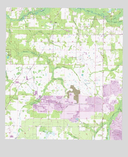
Lithia, FL USGS Topographic Map
Click on map above to begin viewing in our Map Viewer.

This topographic map contains these locations and features:
Feature Name Type Latitude Longitude GNIS ID View Map
Aldermans FordPopulated PlaceN27.8625°W82.1456°300120View Map
Aldermans Ford ParkParkN27.8714°W82.1475°2569385View Map
Bevis Elementary SchoolSchoolN27.8491°W82.2319°2107556View Map
BoyettePopulated PlaceN27.8175°W82.2226°295147View Map
Browns LakesLakeN27.8278°W82.2475°279494View Map
Cabbage HammockIslandN27.8078°W82.1943°279789View Map
Candlewood AcresPopulated PlaceN27.8441°W82.1484°2482705View Map
Capitano EstatesPopulated PlaceN27.8657°W82.1889°2482721View Map
Chapman HammockIslandN27.8186°W82.1901°280306View Map
Cimino Elementary SchoolSchoolN27.8749°W82.2399°2107561View Map
Climer EstatesPopulated PlaceN27.8301°W82.1910°2482864View Map
Coleman HammockIslandN27.8328°W82.2245°280644View Map
Conway EstatesPopulated PlaceN27.8524°W82.1388°2482902View Map
Devore Gundog and Equestrian EstatesPopulated PlaceN27.8384°W82.1644°2482299View Map
Dixon Country EstatesPopulated PlaceN27.8513°W82.1480°2482312View Map
Doe BranchPopulated PlaceN27.8241°W82.1809°2482314View Map
Doe BranchStreamN27.8178°W82.1818°281637View Map
Doe Creek ReservePopulated PlaceN27.8256°W82.1808°2482315View Map
Dorman AcresPopulated PlaceN27.8409°W82.2042°2482324View Map
Dorman MeadowsPopulated PlaceN27.8449°W82.1775°2482325View Map
Dorman RanchPopulated PlaceN27.8403°W82.1792°2482326View Map
Fish HawkPopulated PlaceN27.8506°W82.2109°1853251View Map
Fish Hawk Census Designated PlaceCensusN27.8511°W82.2164°2402482View Map
Fish Hawk FarmsPopulated PlaceN27.8483°W82.2042°2482513View Map
Fish Hawk TrailsPopulated PlaceN27.8622°W82.1876°2482514View Map
Fishhawk CreekStreamN27.8645°W82.2445°282511View Map
Fishhawk Creek Elementary SchoolSchoolN27.8422°W82.2186°2485548View Map
Fishhawk RanchPopulated PlaceN27.8505°W82.2385°2482518View Map
Great OaksPopulated PlaceN27.8019°W82.1477°2483331View Map
Hammock Oaks ReservePopulated PlaceN27.8321°W82.1959°2483387View Map
Hendry EstatesPopulated PlaceN27.7755°W82.1519°2483448View Map
Hillsborough County Fire Rescue Station 2 LithiaBuildingN27.8498°W82.1737°2131660View Map
Hinton RanchPopulated PlaceN27.8702°W82.1895°2483534View Map
Holland AcresPopulated PlaceN27.7682°W82.1445°2483541View Map
Hood Manor EstatesPopulated PlaceN27.8693°W82.1766°2483557View Map
Hurrah BaySwampN27.7573°W82.2057°284416View Map
Hurrah CreekStreamN27.7692°W82.1354°284418View Map
Hurrah LakeLakeN27.7550°W82.1391°284419View Map
Jacobs RunPopulated PlaceN27.8425°W82.1443°2483624View Map
Karlson AcresPopulated PlaceN27.8259°W82.2424°2483666View Map
Kavita EstatesPopulated PlaceN27.8446°W82.1847°2483669View Map
Lightfoot AcresPopulated PlaceN27.8389°W82.1713°2483034View Map
LithiaPopulated PlaceN27.8503°W82.1748°285575View Map
LithiaLocaleN27.8603°W82.1979°285576View Map
Lithia CemeteryCemeteryN27.8581°W82.1615°285577View Map
Lithia EstatesPopulated PlaceN27.8462°W82.1661°2483058View Map
Lithia PinesPopulated PlaceN27.8542°W82.1268°2483059View Map
Lithia Post OfficePost OfficeN27.8508°W82.1500°2485503View Map
Lithia RanchPopulated PlaceN27.8364°W82.1848°2483060View Map
Lithia SpringsSpringN27.8670°W82.2309°285578View Map
Little Fishhawk CreekStreamN27.8645°W82.2312°285679View Map
Long Flat CreekStreamN27.8000°W82.1868°285990View Map
Lynn EstatesPopulated PlaceN27.8346°W82.2011°2483120View Map
Mannhurst Oak ManorsPopulated PlaceN27.8073°W82.1419°2483173View Map
Martindale AcresPopulated PlaceN27.8588°W82.1734°2484190View Map
McCollough BranchStreamN27.8742°W82.1745°286581View Map
McDonald BranchStreamN27.8700°W82.1534°286606View Map
Miller EstatesPopulated PlaceN27.8392°W82.1723°2484278View Map
Natures PlacePopulated PlaceN27.8328°W82.1417°2484350View Map
North Prong Alafia RiverStreamN27.8625°W82.1393°287854View Map
Parkside VillagePopulated PlaceN27.8482°W82.2289°2484582View Map
PicnicLocaleN27.7625°W82.1456°288781View Map
PinecrestPopulated PlaceN27.8500°W82.1456°288922View Map
Pinecrest Elementary SchoolSchoolN27.8490°W82.1471°297780View Map
Pollard BranchStreamN27.7798°W82.1270°289153View Map
Princess EstatesPopulated PlaceN27.8438°W82.1434°2483945View Map
Pringle BranchStreamN27.7839°W82.2229°289326View Map
Serenity AcresPopulated PlaceN27.8479°W82.1782°2484893View Map
Shelley Lakes EstatesPopulated PlaceN27.7501°W82.2471°2484932View Map
South Boyette Railroad StationLocaleN27.7886°W82.2426°300121View Map
South County EstatesPopulated PlaceN27.7501°W82.2426°2484987View Map
South Prong Alafia RiverStreamN27.8625°W82.1393°291412View Map
Stallion HammockIslandN27.7856°W82.2162°291610View Map
Stanchester AirportAirportN27.8067°W82.1413°2676640View Map
Streetman AcresPopulated PlaceN27.8711°W82.1771°2485074View Map
Tierra de AmigosPopulated PlaceN27.8483°W82.1528°2485293View Map
Villages At LithiaPopulated PlaceN27.7637°W82.2397°2485437View Map
WBVM-FM (Tampa)TowerN27.8195°W82.2404°309151View Map
Wendel WoodPopulated PlaceN27.7938°W82.1539°2484657View Map
Wimauma-Lithia DivisionCensusN27.7645°W82.1973°1935976View Map
Wimauma-Riverview DivisionCivilN27.7649°W82.2024°2585634View Map
WMNF-FM (Tampa)TowerN27.8181°W82.2418°309150View Map
WTVT-TV (Tampa)TowerN27.8195°W82.2404°309211View Map
WYNF-FM (Tampa)TowerN27.8195°W82.2404°309152View Map

Note: Coordinates in the location and feature list above are referenced to NAD83 datum.


Copyright (C) 2008-2025 Ryan Niemi / Sunset Dynamics ... All Rights Reserved