TopoQuest Logo
Do you find TopoQuest useful?
Help keep TopoQuest running and adding new maps/features by donating!
Bitcoin:  19c7KJd3qBynnjoSw5npx9KScwjBe4ifkT
Litecoin:  LXs6TkuXGGXo1vDsWCkWVdjQX94eUKd6ui
Home View Maps Find Maps Find Places Resources & Links


Little Aguja Mountain, Texas Topographic Map

USGS Map Title: Little Aguja Mountain, TX
USGS Map MRC: 30103G8
DRG (GeoTIFF) Download: o30103g8.tif


Neighboring USGS Topographic Map Quads:


  Buckhorn Mountain, TX  
30104H1
 

  Antelope Flat, TX  
30103H8
 

  Toyahvale, TX  
30103H7
 

  Friend Mountain, TX  
30104G1
 

  Little Aguja Mountain, TX  
30103G8
 

  Big Aguja Mountain, TX  
30103G7
 

  Mount Locke, TX  
30104F1
 

  Casket Mountain, TX  
30103F8
 

  Swayback Mountain, TX  
30103F7


Map MRC Location:

N31°
W104°
N31°
W103°
H8 H7 H6 H5 H4 H3 H2 H1
G8 G7 G6 G5 G4 G3 G2 G1
F8 F7 F6 F5 F4 F3 F2 F1
E8 E7 E6 E5 E4 E3 E2 E1
D8 D7 D6 D5 D4 D3 D2 D1
C8 C7 C6 C5 C4 C3 C2 C1
B8 B7 B6 B5 B4 B3 B2 B1
A8 A7 A6 A5 A4 A3 A2 A1
N30°
W104°
N30°
W103°

Little Aguja Mountain, TX USGS 1:24K Topographic Map Preview:
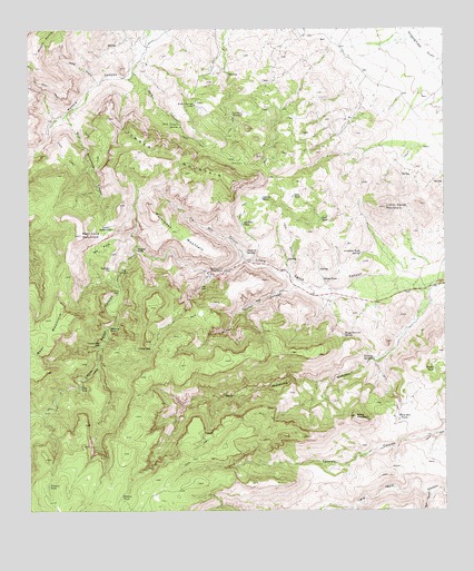
Little Aguja Mountain, TX USGS Topographic Map
Click on map above to begin viewing in our Map Viewer.

This topographic map contains these locations and features:
Feature Name Type Latitude Longitude GNIS ID View Map
Airplane Tank SpringSpringN30.8170°W103.9008°1350915View Map
Balance RockPillarN30.7974°W103.9763°1351443View Map
Bear CanyonValleyN30.7545°W103.8804°1372433View Map
Bear Cave MountainSummitN30.8218°W103.9846°1351661View Map
Bear MountainSummitN30.7999°W103.9955°1372446View Map
Big Bear TankReservoirN30.8247°W103.9360°1352014View Map
Blue HoleLakeN30.7821°W103.9852°1352458View Map
Blue Waterhouse CanyonValleyN30.8521°W103.9885°1352496View Map
Bob Manning CanyonValleyN30.8093°W103.8785°1352543View Map
Buffalo Trail Scout CampLocaleN30.8121°W103.9463°1381547View Map
Carmac TankReservoirN30.7539°W103.9729°1353829View Map
Dark CanyonValleyN30.8639°W103.9689°1355647View Map
Dark Canyon SpringSpringN30.8505°W103.9553°1355651View Map
Deer TankReservoirN30.8317°W103.9208°1355867View Map
Eye of the NeedleArchN30.7808°W103.9906°2678376View Map
Ezras BedgroundFlatN30.8235°W103.9771°1357141View Map
Fishing SpringsSpringN30.7893°W103.8973°1357366View Map
Forbidden MountainSummitN30.8226°W103.9557°1357539View Map
Goat Mountain WindmillLocaleN30.8529°W103.9357°1358092View Map
House Pasture SpringSpringN30.7958°W103.9059°1359710View Map
Jack TankReservoirN30.8258°W103.9125°1360090View Map
Jimenez TankReservoirN30.7567°W103.9949°1360266View Map
Laguna TankReservoirN30.8312°W103.9304°1360830View Map
Little Aguja MountainSummitN30.8288°W103.8930°1361265View Map
Madera Springs LodgeLocaleN30.8554°W103.9502°1362060View Map
Million Dollar CanyonValleyN30.8081°W103.9204°1362927View Map
Needle RockPillarN30.8182°W103.9680°1363640View Map
Orchard SpringSpringN30.8174°W103.9349°1364578View Map
Pig Pen CanyonValleyN30.8151°W103.9359°1365202View Map
Rustlers FlatFlatN30.8132°W103.9757°1367053View Map
The NotchGapN30.8124°W103.9727°1369803View Map
The ParkFlatN30.8188°W103.9782°1369806View Map
The Pole PensLocaleN30.8074°W103.9732°1369808View Map
Timber MountainSummitN30.8379°W103.9513°1369953View Map
Trickey GapGapN30.7921°W103.9632°1370112View Map
Trickey Gap ParkFlatN30.7935°W103.9794°1370113View Map
Walker TankReservoirN30.7865°W103.8786°1370766View Map
White MountainSummitN30.7746°W103.9024°1371382View Map
White Mountain TanksReservoirN30.7737°W103.8894°1371384View Map
White TankReservoirN30.8101°W103.9119°1371422View Map
Wood CanyonValleyN30.8614°W103.9795°1371882View Map

Note: Coordinates in the location and feature list above are referenced to NAD83 datum.


Copyright (C) 2008-2025 Ryan Niemi / Sunset Dynamics ... All Rights Reserved