TopoQuest Logo
Do you find TopoQuest useful?
Help keep TopoQuest running and adding new maps/features by donating!
Bitcoin:  19c7KJd3qBynnjoSw5npx9KScwjBe4ifkT
Litecoin:  LXs6TkuXGGXo1vDsWCkWVdjQX94eUKd6ui
Home View Maps Find Maps Find Places Resources & Links


Bat Cave, North Carolina Topographic Map

USGS Map Title: Bat Cave, NC
USGS Map MRC: 35082D3
DRG (GeoTIFF) Download: o35082d3.tif


Neighboring USGS Topographic Map Quads:


  Oteen, NC  
35082E4
 

  Black Mountain, NC  
35082E3
 

  Moffitt Hill, NC  
35082E2
 

  Fruitland, NC  
35082D4
 

  Bat Cave, NC  
35082D3
 

  Lake Lure, NC  
35082D2
 

  Hendersonville, NC  
35082C4
 

  Cliffield Mountain, NC  
35082C3
 

  Mill Spring, NC  
35082C2


Map MRC Location:

N36°
W83°
N36°
W82°
H8 H7 H6 H5 H4 H3 H2 H1
G8 G7 G6 G5 G4 G3 G2 G1
F8 F7 F6 F5 F4 F3 F2 F1
E8 E7 E6 E5 E4 E3 E2 E1
D8 D7 D6 D5 D4 D3 D2 D1
C8 C7 C6 C5 C4 C3 C2 C1
B8 B7 B6 B5 B4 B3 B2 B1
A8 A7 A6 A5 A4 A3 A2 A1
N35°
W83°
N35°
W82°

Bat Cave, NC USGS 1:24K Topographic Map Preview:
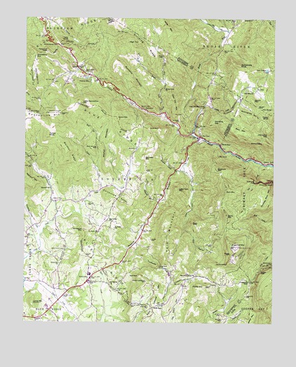
Bat Cave, NC USGS Topographic Map
Click on map above to begin viewing in our Map Viewer.

This topographic map contains these locations and features:
Feature Name Type Latitude Longitude GNIS ID View Map
Allen Hill MountainSummitN35.4682°W82.3015°1018794View Map
Bald MountainSummitN35.4540°W82.2693°1018926View Map
Bald Mountain ChurchChurchN35.4704°W82.2615°980475View Map
Bald RockSummitN35.3940°W82.3162°1018932View Map
Barnwell ChurchChurchN35.4471°W82.3184°980581View Map
Barnwell MountainSummitN35.4426°W82.3148°1018971View Map
Bat CavePopulated PlaceN35.4515°W82.2871°1018981View Map
Bat Cave Post OfficePost OfficeN35.4509°W82.2848°2774241View Map
Bat Cave Volunteer Fire and Rescue DepartmentBuildingN35.4529°W82.2911°2639393View Map
Bead and Lace FallsFallsN35.4471°W82.3384°980681View Map
BearwallowPopulated PlaceN35.4632°W82.3162°1006125View Map
Bearwallow ChurchChurchN35.4785°W82.3451°980762View Map
Bearwallow GapGapN35.4607°W82.3679°980763View Map
Bearwallow MountainSummitN35.4610°W82.3568°980764View Map
Bluerock MountainSummitN35.4376°W82.2782°1019233View Map
Bold BranchStreamN35.4390°W82.3379°981691View Map
Burntshirt MountainSummitN35.4821°W82.3282°1019432View Map
Camp Minnehaha FallsFallsN35.4642°W82.2850°982542View Map
Cedar KnobSummitN35.4607°W82.2515°1019580View Map
Chestnut HillPopulated PlaceN35.4748°W82.3426°1019629View Map
Chickasaw KnobsSummitN35.4273°W82.3334°1019659View Map
Chimney RockPillarN35.4326°W82.2504°983139View Map
Chimney Rock MountainSummitN35.4332°W82.2504°1019663View Map
Chimney Rock ParkParkN35.4333°W82.2514°2374751View Map
Chinquapin GapGapN35.3987°W82.2507°983153View Map
Cloven CliffsCliffN35.4035°W82.2709°983296View Map
Connor CemeteryCemeteryN35.4576°W82.2979°983460View Map
Coon BranchStreamN35.3754°W82.3471°983498View Map
Cox CreekStreamN35.4182°W82.3587°983673View Map
Dividing RidgeRidgeN35.4890°W82.3154°984213View Map
EdneyvillePopulated PlaceN35.3940°W82.3409°984645View Map
Edneyville Census Designated PlaceCensusN35.4025°W82.3372°2584316View Map
Edneyville ChurchChurchN35.3996°W82.3565°984648View Map
Edneyville Fire and Rescue Station 1BuildingN35.3891°W82.3458°2638442View Map
Edneyville Fire and Rescue Station 3BuildingN35.3816°W82.3103°2639646View Map
Edneyville Post OfficePost OfficeN35.3950°W82.3401°2774263View Map
Edneyville United Methodist Church CemeteryCemeteryN35.4043°W82.3547°984647View Map
Esmeralda (historical)Populated PlaceN35.4429°W82.2637°1008427View Map
Fall CreekStreamN35.4404°W82.2557°1020210View Map
Ferguson PeakSummitN35.4862°W82.3640°1020234View Map
Flat CreekStreamN35.4951°W82.2734°1011257View Map
Fork MountainSummitN35.4110°W82.3051°1020311View Map
Garden SpotGapN35.4635°W82.2573°985559View Map
GertonPopulated PlaceN35.4793°W82.3482°985642View Map
Gerton Census Designated PlaceCensusN35.4758°W82.3504°2628627View Map
Gerton Post OfficePost OfficeN35.4789°W82.3469°2774010View Map
Gerton Volunteer Fire Department and RescueBuildingN35.4784°W82.3470°2638502View Map
Grant MountainSummitN35.4596°W82.3290°1020494View Map
Grassy CreekStreamN35.4626°W82.2862°985949View Map
Haircomb GapGapN35.4523°W82.2532°986288View Map
Hickory CreekStreamN35.4523°W82.2912°1020700View Map
Hickorynut FallsFallsN35.4329°W82.2595°986721View Map
Hickorynut GapGapN35.4890°W82.3582°1020718View Map
High TopSummitN35.4904°W82.3179°1020763View Map
Hill CemeteryCemeteryN35.4609°W82.2959°986794View Map
Hog RockPillarN35.3985°W82.3073°986892View Map
Hominy Mill BranchStreamN35.4376°W82.2979°987008View Map
Lake CharlesReservoirN35.4785°W82.2534°983043View Map
Laurel ForkStreamN35.4298°W82.3365°988189View Map
Lewis MountainSummitN35.3837°W82.3707°1021137View Map
Liberty ChurchChurchN35.4257°W82.3562°988411View Map
Little Bearwallow MountainSummitN35.4651°W82.3462°1021172View Map
Little CreekStreamN35.4373°W82.2948°1021181View Map
Little Fork MountainSummitN35.4301°W82.2984°1021189View Map
Marshall RidgeRidgeN35.4443°W82.3540°989383View Map
Maxwell MillPopulated PlaceN35.4301°W82.3615°1021371View Map
Middle Fork ChurchChurchN35.4715°W82.3048°989775View Map
Middle Fork Hickory CreekStreamN35.4610°W82.3059°1021426View Map
Miller MountainSummitN35.4998°W82.3079°1021464View Map
Mills GapGapN35.3815°W82.3101°990025View Map
Mitchell MountainSummitN35.4529°W82.3315°1021503View Map
Mount Moriah ChurchChurchN35.3912°W82.3318°990438View Map
Mountain Home ChurchChurchN35.3946°W82.2887°990698View Map
Nanny MountainSummitN35.4660°W82.2601°1021602View Map
OttanolaPopulated PlaceN35.3918°W82.2784°1021764View Map
Ottanola GapGapN35.3923°W82.2615°991713View Map
Paris GapGapN35.4485°W82.2771°991849View Map
Point LookoutSummitN35.3921°W82.3134°992620View Map
Point Lookout MountainSummitN35.3901°W82.3090°1022019View Map
Poplar MountainSummitN35.3901°W82.2832°992696View Map
Puncheon Camp CreekStreamN35.4104°W82.3668°992906View Map
Rainbow FallsFallsN35.4491°W82.2563°992994View Map
Rattlesnake KnobSummitN35.4810°W82.2673°1022160View Map
Raven CliffsCliffN35.4165°W82.2904°993061View Map
Raven RockSummitN35.4546°W82.3129°1022166View Map
Reedypatch CreekStreamN35.4510°W82.2859°993209View Map
Rich MountainSummitN35.4307°W82.2734°1022266View Map
Roaringrock MountainSummitN35.4598°W82.2604°1022314View Map
Runaway Farm LakeReservoirN35.4035°W82.3315°998938View Map
Runaway Farm Lake DamDamN35.4035°W82.3315°998939View Map
Saint Pauls ChurchChurchN35.4126°W82.3379°1022462View Map
Saint Peters ChurchChurchN35.4140°W82.3296°994116View Map
Saint Peters SchoolSchoolN35.4140°W82.3296°994122View Map
ShumontPopulated PlaceN35.4710°W82.2587°1022625View Map
Slickrock BranchStreamN35.4243°W82.3073°994916View Map
Standing GapGapN35.4579°W82.2798°995400View Map
Stony MountainSummitN35.4190°W82.2729°1022811View Map
Strawberry GapGapN35.4843°W82.3698°995608View Map
Sugarloaf CreekStreamN35.4071°W82.2893°995654View Map
Sugarloaf MountainSummitN35.4065°W82.2687°995657View Map
Tater KnobSummitN35.4907°W82.3559°1022893View Map
The CascadesFallsN35.4623°W82.2737°995962View Map
The PinnaclesCliffN35.3996°W82.2729°996004View Map
Toms FallsFallsN35.4848°W82.3060°996151View Map
Toms ForkStreamN35.4737°W82.3046°1022965View Map
Township of EdneyvilleCivilN35.4238°W82.3248°1026789View Map
Turkey KnobSummitN35.4518°W82.3632°1023007View Map
Turnbreeches CreekStreamN35.4082°W82.3193°996355View Map
Twin SpringsSpringN35.4634°W82.2507°996388View Map
Village of Chimney Rock VillageCivilN35.4503°W82.2550°2407430View Map
Whiteside MountainSummitN35.4132°W82.3451°1023225View Map
Worlds EdgeCliffN35.3960°W82.2557°997636View Map

Note: Coordinates in the location and feature list above are referenced to NAD83 datum.


Copyright (C) 2008-2024 Ryan Niemi / Sunset Dynamics ... All Rights Reserved