TopoQuest Logo
Do you find TopoQuest useful?
Help keep TopoQuest running and adding new maps/features by donating!
Bitcoin:  19c7KJd3qBynnjoSw5npx9KScwjBe4ifkT
Litecoin:  LXs6TkuXGGXo1vDsWCkWVdjQX94eUKd6ui
Home View Maps Find Maps Find Places Resources & Links


Little Glass Mountain, California Topographic Map

USGS Map Title: Little Glass Mountain, CA
USGS Map MRC: 41121E6
DRG (GeoTIFF) Download: o41121e6.tif


Neighboring USGS Topographic Map Quads:


  Sharp Mountain, CA  
41121F7
 

  Bonita Butte, CA  
41121F6
 

  Schonchin Butte, CA  
41121F5
 

  Garner Mountain, CA  
41121E7
 

  Little Glass Mountain, CA  
41121E6
 

  Medicine Lake, CA  
41121E5
 

  Horse Peak, CA  
41121D7
 

  Snag Hill, CA  
41121D6
 

  Porcupine Butte, CA  
41121D5


Map MRC Location:

N42°
W122°
N42°
W121°
H8 H7 H6 H5 H4 H3 H2 H1
G8 G7 G6 G5 G4 G3 G2 G1
F8 F7 F6 F5 F4 F3 F2 F1
E8 E7 E6 E5 E4 E3 E2 E1
D8 D7 D6 D5 D4 D3 D2 D1
C8 C7 C6 C5 C4 C3 C2 C1
B8 B7 B6 B5 B4 B3 B2 B1
A8 A7 A6 A5 A4 A3 A2 A1
N41°
W122°
N41°
W121°

Little Glass Mountain, CA USGS 1:24K Topographic Map Preview:
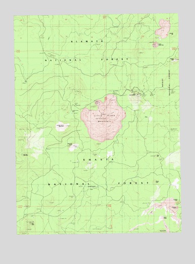
Little Glass Mountain, CA USGS Topographic Map
Click on map above to begin viewing in our Map Viewer.

This topographic map contains these locations and features:
Feature Name Type Latitude Longitude GNIS ID View Map
Badger PeakSummitN41.5985°W121.6292°256423View Map
Bray WellWellN41.5874°W121.7436°1657752View Map
Buck HillSummitN41.5182°W121.7433°276863View Map
Chimney CraterCraterN41.5135°W121.6308°258287View Map
Cinder ConeSummitN41.5285°W121.6478°258371View Map
Crater Glass FlowCraterN41.6071°W121.6428°274629View Map
Doe PeakSummitN41.5057°W121.7414°259435View Map
Fawn HillSummitN41.5179°W121.7256°276862View Map
Giant CraterCraterN41.5082°W121.6411°260540View Map
Grasshopper FlatFlatN41.5260°W121.6953°260798View Map
Grouse HillSummitN41.6132°W121.6311°1658683View Map
Hopper HillSummitN41.5204°W121.7097°276866View Map
Little Glass MountainSummitN41.5674°W121.6861°262604View Map
Little Mount HoffmanSummitN41.5788°W121.6597°262675View Map
Paint Pot CraterCraterN41.5502°W121.7092°264448View Map
Pumice Stone MountainSummitN41.5613°W121.7144°265060View Map
Pumice Stone WellWellN41.5682°W121.7083°265061View Map
Red Cap MountainSummitN41.5452°W121.7464°1659479View Map
Red HillSummitN41.5429°W121.6450°265278View Map
Shastine CraterCraterN41.5179°W121.6303°266056View Map
Tilted Rock Lava FlowLavaN41.5368°W121.7139°276861View Map
Waste Water Ponds 647 DamDamN41.6199°W121.6294°1664411View Map

Note: Coordinates in the location and feature list above are referenced to NAD83 datum.


Copyright (C) 2008-2025 Ryan Niemi / Sunset Dynamics ... All Rights Reserved