TopoQuest Logo
Do you find TopoQuest useful?
Help keep TopoQuest running and adding new maps/features by donating!
Bitcoin:  19c7KJd3qBynnjoSw5npx9KScwjBe4ifkT
Litecoin:  LXs6TkuXGGXo1vDsWCkWVdjQX94eUKd6ui
Home View Maps Find Maps Find Places Resources & Links


Bates, Idaho Topographic Map

USGS Map Title: Bates, ID
USGS Map MRC: 43111F2
DRG (GeoTIFF) Download: o43111f2.tif


Neighboring USGS Topographic Map Quads:


  Packsaddle Lake, ID  
43111G3
 

  Tetonia, ID  
43111G2
 

  Clawson, ID  
43111G1
 

  Garns Mountain, ID  
43111F3
 

  Bates, ID  
43111F2
 

  Driggs, ID  
43111F1
 

  Stouts Mountain, ID  
43111E3
 

  Fourth of July Peak, ID  
43111E2
 

  Victor, ID  
43111E1


Map MRC Location:

N44°
W112°
N44°
W111°
H8 H7 H6 H5 H4 H3 H2 H1
G8 G7 G6 G5 G4 G3 G2 G1
F8 F7 F6 F5 F4 F3 F2 F1
E8 E7 E6 E5 E4 E3 E2 E1
D8 D7 D6 D5 D4 D3 D2 D1
C8 C7 C6 C5 C4 C3 C2 C1
B8 B7 B6 B5 B4 B3 B2 B1
A8 A7 A6 A5 A4 A3 A2 A1
N43°
W112°
N43°
W111°

Bates, ID USGS 1:24K Topographic Map Preview:
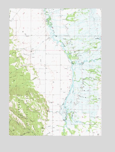
Bates, ID USGS Topographic Map
Click on map above to begin viewing in our Map Viewer.

This topographic map contains these locations and features:
Feature Name Type Latitude Longitude GNIS ID View Map
BatesPopulated PlaceN43.6916°W111.2008°397413View Map
Bates BridgeBridgeN43.6966°W111.1652°395075View Map
Bates CemeteryCemeteryN43.7080°W111.2213°397414View Map
Bates SchoolSchoolN43.6896°W111.2002°395077View Map
Big BendBendN43.6533°W111.1755°397432View Map
Boquet CreekStreamN43.6341°W111.1761°397464View Map
Boquet RidgeRidgeN43.6352°W111.2180°397465View Map
Boquet SpringsSpringN43.6319°W111.2036°397466View Map
Buxton BridgeBridgeN43.7235°W111.1880°397509View Map
Cedron CemeteryCemeteryN43.6580°W111.1944°397539View Map
Center BasinBasinN43.6305°W111.2438°397540View Map
Curlew GulchValleyN43.6283°W111.1663°380170View Map
Darby CreekStreamN43.6791°W111.1633°397603View Map
Dick CreekStreamN43.6941°W111.1663°380584View Map
Dry ForkStreamN43.6410°W111.2074°397653View Map
Elliott CreekStreamN43.6713°W111.1655°381425View Map
Fish CreekStreamN43.6741°W111.1305°397701View Map
Foster SloughStreamN43.6752°W111.1636°381951View Map
Fox CreekStreamN43.6508°W111.1712°381994View Map
Fox Creek East Access AreaLocaleN43.6527°W111.1713°401331View Map
Fox Creek West Access AreaLocaleN43.6485°W111.1694°401332View Map
Government ForkStreamN43.6407°W111.2469°382473View Map
Henderson CreekStreamN43.6407°W111.2058°397784View Map
Lizard LakeReservoirN43.6786°W111.2419°397864View Map
Log HollowValleyN43.6741°W111.2174°397867View Map
Mahogany CreekStreamN43.7213°W111.1927°386379View Map
Middle Twin CreekStreamN43.7149°W111.2077°386878View Map
Mine CanyonValleyN43.6291°W111.2180°386983View Map
Nickerson Bridge Access AreaLocaleN43.6958°W111.1641°401021View Map
North Twin CreekStreamN43.7249°W111.1936°387856View Map
Paradise CreekStreamN43.6552°W111.1777°397975View Map
Paradise SpringSpringN43.6493°W111.1954°388190View Map
Patterson CreekStreamN43.6308°W111.1769°388274View Map
Patterson RidgeRidgeN43.6460°W111.2438°397981View Map
Rainbow BendBendN43.7055°W111.1694°398023View Map
South Fork Patterson CreekStreamN43.6291°W111.2183°393921View Map
South Twin CreekStreamN43.6960°W111.2219°391082View Map
Teton BasinBasinN43.6666°W111.1674°399012View Map
Teton CreekStreamN43.6953°W111.1642°391948View Map
Teton Creek Access AreaLocaleN43.6944°W111.1649°399259View Map
Three ForksAreaN43.7371°W111.1980°398242View Map
Trail CreekStreamN43.6341°W111.1728°392287View Map
Twin ForksPopulated PlaceN43.7319°W111.1938°398274View Map
Two ForksPopulated PlaceN43.7130°W111.1772°398284View Map
Woods CreekStreamN43.7174°W111.1813°393679View Map

Note: Coordinates in the location and feature list above are referenced to NAD83 datum.


Copyright (C) 2008-2025 Ryan Niemi / Sunset Dynamics ... All Rights Reserved