TopoQuest Logo
Do you find TopoQuest useful?
Help keep TopoQuest running and adding new maps/features by donating!
Bitcoin:  19c7KJd3qBynnjoSw5npx9KScwjBe4ifkT
Litecoin:  LXs6TkuXGGXo1vDsWCkWVdjQX94eUKd6ui
Home View Maps Find Maps Find Places Resources & Links


London SW, Kentucky Topographic Map

USGS Map Title: London SW, KY
USGS Map MRC: 37084A2
DRG (GeoTIFF) Download: o37084a2.tif


Neighboring USGS Topographic Map Quads:


  Billows, KY  
37084B3
 

  Bernstadt, KY  
37084B2
 

  London, KY  
37084B1
 

  Ano, KY  
37084A3
 

  London SW, KY  
37084A2
 

  Lily, KY  
37084A1
 

  Sawyer, KY  
36084H3
 

  Vox, KY  
36084H2
 

  Corbin, KY  
36084H1


Map MRC Location:

N38°
W85°
N38°
W84°
H8 H7 H6 H5 H4 H3 H2 H1
G8 G7 G6 G5 G4 G3 G2 G1
F8 F7 F6 F5 F4 F3 F2 F1
E8 E7 E6 E5 E4 E3 E2 E1
D8 D7 D6 D5 D4 D3 D2 D1
C8 C7 C6 C5 C4 C3 C2 C1
B8 B7 B6 B5 B4 B3 B2 B1
A8 A7 A6 A5 A4 A3 A2 A1
N37°
W85°
N37°
W84°

London SW, KY USGS 1:24K Topographic Map Preview:
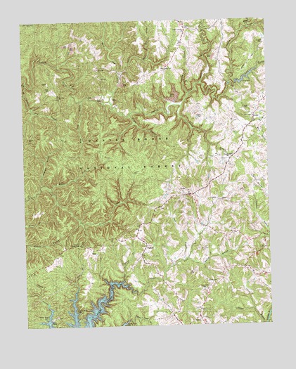
London SW, KY USGS Topographic Map
Click on map above to begin viewing in our Map Viewer.

This topographic map contains these locations and features:
Feature Name Type Latitude Longitude GNIS ID View Map
Adams BranchStreamN37.0004°W84.1280°510213View Map
Bald Rock Lookout TowerTowerN37.0334°W84.2222°517091View Map
Bald Rock Picnic AreaLocaleN37.0345°W84.2216°517071View Map
Benge General Store (historical)BuildingN37.0358°W84.2044°2723122View Map
Big Dog BranchStreamN37.1006°W84.2483°510649View Map
Buck BranchStreamN37.0270°W84.1683°510992View Map
BunchLocaleN37.0998°W84.2363°511060View Map
Clifty BranchStreamN37.0948°W84.1647°511406View Map
Cold HillSummitN37.0813°W84.1322°2723125View Map
Cold Hill SchoolSchoolN37.0534°W84.1647°511455View Map
Daylight BranchStreamN37.0579°W84.2413°511748View Map
Early CemeteryCemeteryN37.0890°W84.1366°511982View Map
East Prong White Oak CreekStreamN37.1129°W84.2041°517511View Map
Fish Trap BranchStreamN37.0926°W84.2194°512164View Map
Floyd CemeteryCemeteryN37.0976°W84.2355°512210View Map
Griffin BranchStreamN37.0868°W84.1944°512460View Map
Hart Baptist ChurchChurchN37.0831°W84.1274°512576View Map
HightopPopulated PlaceN37.0329°W84.1877°512700View Map
Hightop SchoolSchoolN37.0356°W84.2038°512703View Map
KeavyPopulated PlaceN37.0037°W84.1610°513100View Map
Keavy DivisionCivilN37.0218°W84.2218°1937087View Map
Keavy Fire Department Station 1BuildingN37.0000°W84.1684°2636306View Map
Keavy Fire Department Station 2BuildingN37.0344°W84.1362°2637311View Map
Laurel BranchStreamN37.0904°W84.1683°513220View Map
Laurel Chapel Christian ChurchChurchN37.0856°W84.1319°513235View Map
Laurel County Fire Department Station 2BuildingN37.0852°W84.1312°2637312View Map
Little Dog BranchStreamN37.0956°W84.2491°513475View Map
Little White Oak CreekStreamN37.1023°W84.1991°513535View Map
Locust Grove CemeteryCemeteryN37.0148°W84.1585°513564View Map
Locust Grove ChurchChurchN37.0176°W84.1544°513565View Map
London Community ChurchChurchN37.1204°W84.1663°516592View Map
Long BranchStreamN37.0990°W84.1433°513604View Map
Maple Grove SchoolSchoolN37.0598°W84.1266°513776View Map
McDaniel ChapelChurchN37.0559°W84.1349°513856View Map
Middle Fork Cane CreekStreamN37.0573°W84.2369°513924View Map
Mitchell CreekStreamN37.1215°W84.1333°514033View Map
Moores ChapelChurchN37.0301°W84.2135°514046View Map
New Hope ChurchChurchN37.0945°W84.2310°514238View Map
Nix CemeteryCemeteryN37.1018°W84.2091°514273View Map
Oak Ridge SchoolSchoolN37.0354°W84.1324°514304View Map
Pine Creek ChurchChurchN37.1248°W84.2452°514575View Map
Pine Hill United Baptist ChurchChurchN37.0548°W84.1685°514586View Map
Pleasant View CemeteryCemeteryN37.0684°W84.1447°516591View Map
Pleasant View ChurchChurchN37.0684°W84.1441°514658View Map
Powder Mill CreekStreamN37.0995°W84.1585°514748View Map
Sinking Creek Baptist ChurchChurchN37.1051°W84.1763°515435View Map
Sparks CemeteryCemeteryN37.0856°W84.1583°515566View Map
Sublimity ChurchChurchN37.0612°W84.1488°515770View Map
Sulphur Spring BranchStreamN37.0179°W84.2013°515809View Map
Sutton BranchStreamN37.0276°W84.1663°515821View Map
West Prong White Oak CreekStreamN37.1176°W84.2077°517516View Map
White Oak Baptist ChurchChurchN37.1056°W84.2099°516313View Map
White Oak CreekStreamN37.0909°W84.2035°516320View Map
Whitson SchoolSchoolN37.1154°W84.1669°516343View Map
Wyan SchoolSchoolN37.0840°W84.1272°516491View Map

Note: Coordinates in the location and feature list above are referenced to NAD83 datum.


Copyright (C) 2008-2025 Ryan Niemi / Sunset Dynamics ... All Rights Reserved