TopoQuest Logo
Do you find TopoQuest useful?
Help keep TopoQuest running and adding new maps/features by donating!
Bitcoin:  19c7KJd3qBynnjoSw5npx9KScwjBe4ifkT
Litecoin:  LXs6TkuXGGXo1vDsWCkWVdjQX94eUKd6ui
Home View Maps Find Maps Find Places Resources & Links


Long Branch, Texas Topographic Map

USGS Map Title: Long Branch, TX
USGS Map MRC: 32094A5
DRG (GeoTIFF) Download: o32094a5.tif


Neighboring USGS Topographic Map Quads:


  Church Hill, TX  
32094B6
 

  Fair Play, TX  
32094B5
 

  Beckville, TX  
32094B4
 

  Minden, TX  
32094A6
 

  Long Branch, TX  
32094A5
 

  Lake Murvaul, TX  
32094A4
 

  Mount Enterprise, TX  
31094H6
 

  Caledonia, TX  
31094H5
 

  Timpson, TX  
31094H4


Map MRC Location:

N33°
W95°
N33°
W94°
H8 H7 H6 H5 H4 H3 H2 H1
G8 G7 G6 G5 G4 G3 G2 G1
F8 F7 F6 F5 F4 F3 F2 F1
E8 E7 E6 E5 E4 E3 E2 E1
D8 D7 D6 D5 D4 D3 D2 D1
C8 C7 C6 C5 C4 C3 C2 C1
B8 B7 B6 B5 B4 B3 B2 B1
A8 A7 A6 A5 A4 A3 A2 A1
N32°
W95°
N32°
W94°

Long Branch, TX USGS 1:24K Topographic Map Preview:
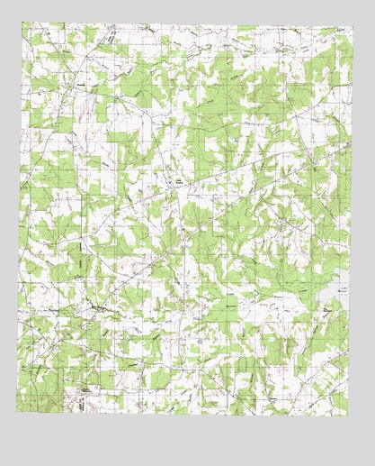
Long Branch, TX USGS Topographic Map
Click on map above to begin viewing in our Map Viewer.

This topographic map contains these locations and features:
Feature Name Type Latitude Longitude GNIS ID View Map
Baker CemeteryCemeteryN32.0449°W94.5858°1329945View Map
Bearden BranchStreamN32.0379°W94.6002°1330257View Map
Bethel ChurchChurchN32.1060°W94.5094°1330495View Map
Bethel ChurchChurchN32.1088°W94.5997°1330496View Map
Billy DitchStreamN32.0263°W94.6113°1330690View Map
Boynton CemeteryCemeteryN32.0657°W94.5888°1331163View Map
Brantley BranchStreamN32.0318°W94.6097°1372705View Map
Buckner BranchStreamN32.1082°W94.5894°1331512View Map
Buckner CemeteryCemeteryN32.1093°W94.6027°1331513View Map
Caney BranchStreamN32.0299°W94.5747°1372915View Map
Cooper CreekStreamN32.0099°W94.5585°1373203View Map
Corinth ChurchChurchN32.0479°W94.5938°1333361View Map
DotsonPopulated PlaceN32.0049°W94.5299°1378218View Map
Dry BranchStreamN32.0471°W94.5283°1334642View Map
Friendship ChurchChurchN32.0077°W94.5794°1336231View Map
Glade CreekStreamN32.0374°W94.5516°1336549View Map
Greems MountainSummitN32.0074°W94.6005°1889879View Map
Grisham BranchStreamN32.0335°W94.5438°1373934View Map
Hainty BranchStreamN32.1196°W94.5446°1337228View Map
Hog MountainSummitN32.0338°W94.5116°1337904View Map
Hord SloughStreamN32.0374°W94.5385°1338083View Map
Hudman BranchStreamN32.0296°W94.5672°1338215View Map
Jones BranchStreamN32.1166°W94.5383°1338828View Map
Keaton Springs BranchStreamN32.0371°W94.5066°1338973View Map
Long BranchPopulated PlaceN32.0729°W94.5680°1378605View Map
Long Branch Post OfficePost OfficeN32.0743°W94.5686°2731419View Map
Long Branch-Dotson DivisionCivilN32.0460°W94.5024°1938934View Map
Madkin CreekStreamN32.0307°W94.5499°1374773View Map
Murphy CreekStreamN32.0071°W94.5080°1375072View Map
New Zion ChurchChurchN32.0118°W94.5516°1342551View Map
Osburn BranchStreamN32.1121°W94.5660°1343322View Map
PinehillPopulated PlaceN32.1046°W94.6052°1378869View Map
Robinson BranchStreamN32.1177°W94.5569°1345330View Map
Roquemore CemeteryCemeteryN32.0877°W94.5060°1345547View Map
Sand CreekStreamN32.0441°W94.5144°1346507View Map
Shady Grove ChurchChurchN32.0807°W94.5408°1346937View Map
Shaw BranchStreamN32.1213°W94.5149°1346988View Map

Note: Coordinates in the location and feature list above are referenced to NAD83 datum.


Copyright (C) 2008-2025 Ryan Niemi / Sunset Dynamics ... All Rights Reserved