TopoQuest Logo
Do you find TopoQuest useful?
Help keep TopoQuest running and adding new maps/features by donating!
Bitcoin:  19c7KJd3qBynnjoSw5npx9KScwjBe4ifkT
Litecoin:  LXs6TkuXGGXo1vDsWCkWVdjQX94eUKd6ui
Home View Maps Find Maps Find Places Resources & Links


Long Creek, Illinois Topographic Map

USGS Map Title: Long Creek, IL
USGS Map MRC: 39088G7
DRG (GeoTIFF) Download: o39088g7.tif


Neighboring USGS Topographic Map Quads:


  Forsyth, IL  
39088H8
 

  Argenta, IL  
39088H7
 

  Cerro Gordo, IL  
39088H6
 

  Decatur, IL  
39088G8
 

  Long Creek, IL  
39088G7
 

  La Place, IL  
39088G6
 

  Macon East, IL  
39088F8
 

  Dalton City, IL  
39088F7
 

  Lovington, IL  
39088F6


Map MRC Location:

N40°
W89°
N40°
W88°
H8 H7 H6 H5 H4 H3 H2 H1
G8 G7 G6 G5 G4 G3 G2 G1
F8 F7 F6 F5 F4 F3 F2 F1
E8 E7 E6 E5 E4 E3 E2 E1
D8 D7 D6 D5 D4 D3 D2 D1
C8 C7 C6 C5 C4 C3 C2 C1
B8 B7 B6 B5 B4 B3 B2 B1
A8 A7 A6 A5 A4 A3 A2 A1
N39°
W89°
N39°
W88°

Long Creek, IL USGS 1:24K Topographic Map Preview:
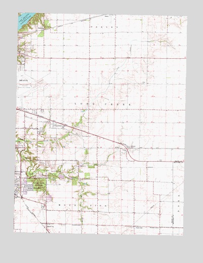
Long Creek, IL USGS Topographic Map
Click on map above to begin viewing in our Map Viewer.

This topographic map contains these locations and features:
Feature Name Type Latitude Longitude GNIS ID View Map
Airport Industrial ParkLocaleN39.8245°W88.8667°1816657View Map
Antioch ChurchChurchN39.8203°W88.8723°1721135View Map
Big CreekStreamN39.8014°W88.8679°404393View Map
Blue Door School (historical)SchoolN39.8656°W88.7840°1721138View Map
Bois d'Arc School (historical)SchoolN39.8348°W88.8220°1721140View Map
Bois Du Sangamon Nature PreserveParkN39.8648°W88.8726°2013473View Map
Camp WarrenLocaleN39.7853°W88.8429°405510View Map
CasnerPopulated PlaceN39.8003°W88.7912°405685View Map
Corman Acres AirportAirportN39.7633°W88.7793°427429View Map
Ehrhart School (historical)SchoolN39.8470°W88.8712°1816732View Map
Excelsior SchoolSchoolN39.8461°W88.8701°1721148View Map
Florey CemeteryCemeteryN39.8110°W88.8319°408470View Map
Fort Daniel Conservation AreaParkN39.7778°W88.8256°1964790View Map
Fort Daniel School (historical)SchoolN39.7836°W88.8279°1721152View Map
Hervey CityPopulated PlaceN39.7556°W88.8509°410115View Map
Long CreekPopulated PlaceN39.8120°W88.8476°412559View Map
Mount ZionPopulated PlaceN39.7714°W88.8742°414108View Map
Mount Zion Elementary SchoolSchoolN39.7703°W88.8748°1816658View Map
Mount Zion Fire Protection DistrictBuildingN39.7703°W88.8705°2640476View Map
Mount Zion Police DepartmentBuildingN39.7722°W88.8748°2759006View Map
North Fork CemeteryCemeteryN39.8464°W88.8748°1816677View Map
Point Pleasant CemeteryCemeteryN39.8054°W88.8269°415974View Map
Prairie HallPopulated PlaceN39.7548°W88.7856°423086View Map
Prairie Hall School (historical)SchoolN39.7734°W88.7870°1721169View Map
Ridge CemeteryCemeteryN39.8363°W88.7826°416633View Map
Ridge School (historical)SchoolN39.8436°W88.7787°1721173View Map
Salem Elementary SchoolSchoolN39.8092°W88.8587°417878View Map
SangamonPopulated PlaceN39.8667°W88.8559°423154View Map
Spitler Woods Nature PreserveParkN39.7773°W88.8565°2013475View Map
Spitler Woods State ParkParkN39.7778°W88.8570°418907View Map
Township of Long CreekCivilN39.8232°W88.8271°429278View Map
Village of Long CreekCivilN39.8052°W88.8474°2398470View Map

Note: Coordinates in the location and feature list above are referenced to NAD83 datum.


Copyright (C) 2008-2025 Ryan Niemi / Sunset Dynamics ... All Rights Reserved