TopoQuest Logo
Do you find TopoQuest useful?
Help keep TopoQuest running and adding new maps/features by donating!
Bitcoin:  19c7KJd3qBynnjoSw5npx9KScwjBe4ifkT
Litecoin:  LXs6TkuXGGXo1vDsWCkWVdjQX94eUKd6ui
Home View Maps Find Maps Find Places Resources & Links


La Place, Illinois Topographic Map

USGS Map Title: La Place, IL
USGS Map MRC: 39088G6
DRG (GeoTIFF) Download: o39088g6.tif


Neighboring USGS Topographic Map Quads:


  Argenta, IL  
39088H7
 

  Cerro Gordo, IL  
39088H6
 

  Bement, IL  
39088H5
 

  Long Creek, IL  
39088G7
 

  La Place, IL  
39088G6
 

  Hammond, IL  
39088G5
 

  Dalton City, IL  
39088F7
 

  Lovington, IL  
39088F6
 

  Cadwell, IL  
39088F5


Map MRC Location:

N40°
W89°
N40°
W88°
H8 H7 H6 H5 H4 H3 H2 H1
G8 G7 G6 G5 G4 G3 G2 G1
F8 F7 F6 F5 F4 F3 F2 F1
E8 E7 E6 E5 E4 E3 E2 E1
D8 D7 D6 D5 D4 D3 D2 D1
C8 C7 C6 C5 C4 C3 C2 C1
B8 B7 B6 B5 B4 B3 B2 B1
A8 A7 A6 A5 A4 A3 A2 A1
N39°
W89°
N39°
W88°

La Place, IL USGS 1:24K Topographic Map Preview:
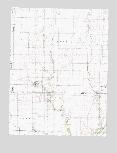
La Place, IL USGS Topographic Map
Click on map above to begin viewing in our Map Viewer.

This topographic map contains these locations and features:
Feature Name Type Latitude Longitude GNIS ID View Map
Asbury ChurchChurchN39.8659°W88.6503°403657View Map
BurrowsvillePopulated PlaceN39.7995°W88.6331°422521View Map
Dawson Farms AirportAirportN39.7660°W88.6696°427478View Map
Ditch Number 3CanalN39.8564°W88.6492°424832View Map
Dora Township Fire Protection District Lake CityBuildingN39.7555°W88.7195°2682553View Map
Hammond Mutual DitchCanalN39.7542°W88.6342°409718View Map
Henry Airport (historical)AirportN39.8098°W88.7484°427121View Map
La Place Post OfficePost OfficeN39.8000°W88.7163°1822191View Map
Lake CityPopulated PlaceN39.7545°W88.7201°411705View Map
LaPlacePopulated PlaceN39.8000°W88.7176°411659View Map
LaPlace CemeteryCemeteryN39.8170°W88.7067°411660View Map
LaPlace CemeteryCemeteryN39.8170°W88.7073°1934707View Map
LaPlace Census Designated PlaceCensusN39.7978°W88.7156°2628554View Map
LintnerPopulated PlaceN39.8000°W88.6678°412249View Map
Township of Cerro GordoCivilN39.8542°W88.6794°428783View Map
Turner CemeteryCemeteryN39.7623°W88.6342°419949View Map
White Landing Strip (historical)AirportN39.8667°W88.7126°1822207View Map

Note: Coordinates in the location and feature list above are referenced to NAD83 datum.


Copyright (C) 2008-2024 Ryan Niemi / Sunset Dynamics ... All Rights Reserved