TopoQuest Logo
Do you find TopoQuest useful?
Help keep TopoQuest running and adding new maps/features by donating!
Bitcoin:  19c7KJd3qBynnjoSw5npx9KScwjBe4ifkT
Litecoin:  LXs6TkuXGGXo1vDsWCkWVdjQX94eUKd6ui
Home View Maps Find Maps Find Places Resources & Links


Los Alamos, California Topographic Map

USGS Map Title: Los Alamos, CA
USGS Map MRC: 34120F3
DRG (GeoTIFF) Download: o34120f3.tif


Neighboring USGS Topographic Map Quads:


  Orcutt, CA  
34120G4
 

  Sisquoc, CA  
34120G3
 

  Foxen Canyon, CA  
34120G2
 

  Lompoc, CA  
34120F4
 

  Los Alamos, CA  
34120F3
 

  Zaca Creek, CA  
34120F2
 

  Lompoc Hills, CA  
34120E4
 

  Santa Rosa Hills, CA  
34120E3
 

  Solvang, CA  
34120E2


Map MRC Location:

N35°
W121°
N35°
W120°
H8 H7 H6 H5 H4 H3 H2 H1
G8 G7 G6 G5 G4 G3 G2 G1
F8 F7 F6 F5 F4 F3 F2 F1
E8 E7 E6 E5 E4 E3 E2 E1
D8 D7 D6 D5 D4 D3 D2 D1
C8 C7 C6 C5 C4 C3 C2 C1
B8 B7 B6 B5 B4 B3 B2 B1
A8 A7 A6 A5 A4 A3 A2 A1
N34°
W121°
N34°
W120°

Los Alamos, CA USGS 1:24K Topographic Map Preview:
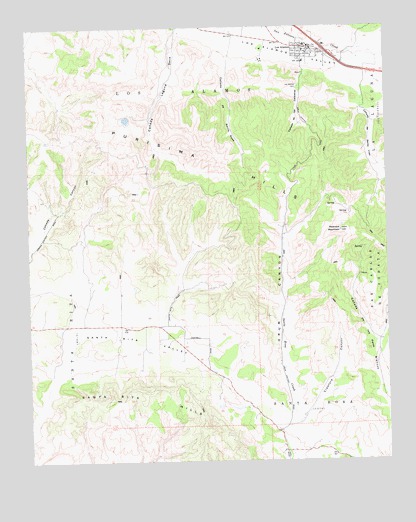
Los Alamos, CA USGS Topographic Map
Click on map above to begin viewing in our Map Viewer.

This topographic map contains these locations and features:
Feature Name Type Latitude Longitude GNIS ID View Map
Acin FarmsLocaleN34.6731°W120.3292°2703692View Map
Arthur Ferrini ParkParkN34.7447°W120.2802°1871747View Map
Babcock Winery and VineyardsBuildingN34.6669°W120.3356°2709161View Map
Caņada De Las CalaverasValleyN34.7383°W120.2790°240145View Map
Caņada De Santa RosaStreamN34.7425°W120.3071°240153View Map
Caņada de Santa YnezValleyN34.7333°W120.2635°255408View Map
Caņada Laguna SecaValleyN34.7486°W120.3229°255411View Map
Crawford CanyonValleyN34.6355°W120.2843°241076View Map
Drum CanyonValleyN34.6364°W120.2854°241622View Map
Los AlamosPopulated PlaceN34.7444°W120.2782°245130View Map
Los Alamos CemeteryCemeteryN34.7323°W120.2812°245132View Map
Los Alamos Census Designated PlaceCensusN34.7375°W120.2783°2408131View Map
Los Alamos County ParkParkN34.7366°W120.2788°1871786View Map
Los Alamos Post OfficePost OfficeN34.7442°W120.2780°1871787View Map
Melville Vineyards and WineryBuildingN34.6667°W120.3306°2709160View Map
Olga Reed Elementary SchoolSchoolN34.7397°W120.2791°1871795View Map
Purisima HillsRidgeN34.6847°W120.2715°273135View Map
Redrock MountainSummitN34.6911°W120.2671°248097View Map
Santa Barbara County Fire Department Station 24BuildingN34.7451°W120.2798°2664712View Map
Santa Rita HillsRidgeN34.6350°W120.3154°1655008View Map
Santa Rita ValleyValleyN34.6558°W120.3618°249102View Map

Note: Coordinates in the location and feature list above are referenced to NAD83 datum.


Copyright (C) 2008-2025 Ryan Niemi / Sunset Dynamics ... All Rights Reserved