TopoQuest Logo
Do you find TopoQuest useful?
Help keep TopoQuest running and adding new maps/features by donating!
Bitcoin:  19c7KJd3qBynnjoSw5npx9KScwjBe4ifkT
Litecoin:  LXs6TkuXGGXo1vDsWCkWVdjQX94eUKd6ui
Home View Maps Find Maps Find Places Resources & Links


Sisquoc, California Topographic Map

USGS Map Title: Sisquoc, CA
USGS Map MRC: 34120G3
DRG (GeoTIFF) Download: o34120g3.tif


Neighboring USGS Topographic Map Quads:


  Santa Maria, CA  
34120H4
 

  Twitchell Dam, CA  
34120H3
 

  Tepusquet Canyon, CA  
34120H2
 

  Orcutt, CA  
34120G4
 

  Sisquoc, CA  
34120G3
 

  Foxen Canyon, CA  
34120G2
 

  Lompoc, CA  
34120F4
 

  Los Alamos, CA  
34120F3
 

  Zaca Creek, CA  
34120F2


Map MRC Location:

N35°
W121°
N35°
W120°
H8 H7 H6 H5 H4 H3 H2 H1
G8 G7 G6 G5 G4 G3 G2 G1
F8 F7 F6 F5 F4 F3 F2 F1
E8 E7 E6 E5 E4 E3 E2 E1
D8 D7 D6 D5 D4 D3 D2 D1
C8 C7 C6 C5 C4 C3 C2 C1
B8 B7 B6 B5 B4 B3 B2 B1
A8 A7 A6 A5 A4 A3 A2 A1
N34°
W121°
N34°
W120°

Sisquoc, CA USGS 1:24K Topographic Map Preview:
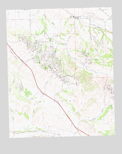
Sisquoc, CA USGS Topographic Map
Click on map above to begin viewing in our Map Viewer.

This topographic map contains these locations and features:
Feature Name Type Latitude Longitude GNIS ID View Map
Benjamin Foxen Elementary SchoolSchoolN34.8666°W120.2963°239484View Map
Blockman School (historical)SchoolN34.8375°W120.3174°1871627View Map
Caņada de las FloresValleyN34.7566°W120.3568°255405View Map
Cat CanyonValleyN34.8633°W120.2927°255439View Map
Cat Canyon Oil FieldOilfieldN34.8278°W120.3293°277366View Map
Howard CanyonValleyN34.7619°W120.2938°243699View Map
Long CanyonValleyN34.8586°W120.2771°245060View Map
Los AlamosCivilN34.7850°W120.3254°245129View Map
Olive School (historical)SchoolN34.8550°W120.2663°1871653View Map
Olivera CanyonValleyN34.8564°W120.2649°246893View Map
Palmer (historical)Populated PlaceN34.8291°W120.3221°1871660View Map
Roadamite (historical)Populated PlaceN34.8439°W120.3260°1871666View Map
Santa Barbara County Fire Department Station 23BuildingN34.8666°W120.2942°2664713View Map
SisquocPopulated PlaceN34.8647°W120.2915°249523View Map
Sisquoc Census Designated PlaceCensusN34.8622°W120.2942°2583144View Map
Sisquoc GrangeLocaleN34.8550°W120.2652°249524View Map
Sisquoc QuarryMineN34.8669°W120.2811°2703879View Map
Tepusquet CreekStreamN34.8619°W120.2560°250346View Map

Note: Coordinates in the location and feature list above are referenced to NAD83 datum.


Copyright (C) 2008-2025 Ryan Niemi / Sunset Dynamics ... All Rights Reserved