TopoQuest Logo
Do you find TopoQuest useful?
Help keep TopoQuest running and adding new maps/features by donating!
Bitcoin:  19c7KJd3qBynnjoSw5npx9KScwjBe4ifkT
Litecoin:  LXs6TkuXGGXo1vDsWCkWVdjQX94eUKd6ui
Home View Maps Find Maps Find Places Resources & Links


Orcutt, California Topographic Map

USGS Map Title: Orcutt, CA
USGS Map MRC: 34120G4
DRG (GeoTIFF) Download: o34120g4.tif


Neighboring USGS Topographic Map Quads:


  Guadalupe, CA  
34120H5
 

  Santa Maria, CA  
34120H4
 

  Twitchell Dam, CA  
34120H3
 

  Casmalia, CA  
34120G5
 

  Orcutt, CA  
34120G4
 

  Sisquoc, CA  
34120G3
 

  Surf, CA  
34120F5
 

  Lompoc, CA  
34120F4
 

  Los Alamos, CA  
34120F3


Map MRC Location:

N35°
W121°
N35°
W120°
H8 H7 H6 H5 H4 H3 H2 H1
G8 G7 G6 G5 G4 G3 G2 G1
F8 F7 F6 F5 F4 F3 F2 F1
E8 E7 E6 E5 E4 E3 E2 E1
D8 D7 D6 D5 D4 D3 D2 D1
C8 C7 C6 C5 C4 C3 C2 C1
B8 B7 B6 B5 B4 B3 B2 B1
A8 A7 A6 A5 A4 A3 A2 A1
N34°
W121°
N34°
W120°

Orcutt, CA USGS 1:24K Topographic Map Preview:
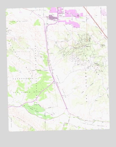
Orcutt, CA USGS Topographic Map
Click on map above to begin viewing in our Map Viewer.

This topographic map contains these locations and features:
Feature Name Type Latitude Longitude GNIS ID View Map
Acorn Shopping CenterLocaleN34.8658°W120.4193°1871625View Map
Barka SloughSwampN34.7710°W120.4665°238987View Map
BicknellPopulated PlaceN34.8166°W120.3932°1660330View Map
Camelback HillSummitN34.8153°W120.3899°1660422View Map
Careaga CanyonValleyN34.7814°W120.3757°255421View Map
Cimarron EstatesPopulated PlaceN34.8638°W120.4027°2090269View Map
Cimarron Estates Mobile Home ParkPopulated PlaceN34.8631°W120.4000°1871632View Map
Craciosa CanyonValleyN34.8655°W120.4535°241063View Map
Delta Continuation High SchoolSchoolN34.8659°W120.4339°1871636View Map
Divide SubstationLocaleN34.8286°W120.4488°1654612View Map
Graciosa CanyonValleyN34.8603°W120.4500°2787956View Map
Graciosa RidgeRidgeN34.8339°W120.4049°242877View Map
Harris CanyonValleyN34.7672°W120.4332°243245View Map
House of Faith ChurchChurchN34.8633°W120.4463°1871641View Map
KSNI-FM (Santa Maria)TowerN34.8355°W120.4027°1663089View Map
Los Alamos ValleyValleyN34.7672°W120.4332°245135View Map
May Grisham SchoolSchoolN34.8624°W120.4402°1871646View Map
Mount SolomonSummitN34.8350°W120.3832°249656View Map
Newlove HillSummitN34.8344°W120.4043°1661103View Map
Oak Knoll Shopping Center NorthLocaleN34.8664°W120.4179°1871651View Map
Oak Knoll Shopping Center SouthLocaleN34.8647°W120.4174°1871652View Map
Oak Knolls Baptist ChurchChurchN34.8664°W120.4191°1871650View Map
OrcuttPopulated PlaceN34.8653°W120.4360°1661153View Map
Orcutt Academy Charter SchoolSchoolN34.8617°W120.4426°2518386View Map
Orcutt Branch Santa Maria Public LibraryBuildingN34.8655°W120.4182°1871654View Map
Orcutt Census Designated PlaceCensusN34.8668°W120.4268°2408999View Map
Orcutt Christian ChurchChurchN34.8686°W120.4346°1871655View Map
Orcutt Junior High SchoolSchoolN34.8622°W120.4410°250806View Map
Orcutt Oil FieldOilfieldN34.8247°W120.3974°277405View Map
Orcutt Post OfficePost OfficeN34.8643°W120.4461°1871656View Map
Orcutt Presbyterian ChurchChurchN34.8689°W120.4221°1871658View Map
Orcutt Union School District OfficeBuildingN34.8619°W120.4427°1871657View Map
Patterson Road SchoolSchoolN34.8680°W120.4311°1871661View Map
Pine CanyonValleyN34.8511°W120.4196°247483View Map
Pine Grove Baptist ChurchChurchN34.8586°W120.4191°1871662View Map
Pine Grove Elementary SchoolSchoolN34.8565°W120.4197°1871663View Map
Ralph Dunlap Elementary SchoolSchoolN34.8695°W120.4136°1871664View Map
Rancho Maria Public Golf CourseLocaleN34.8705°W120.4824°1871665View Map
Saint Joseph Seminary CollegeSchoolN34.8681°W120.4353°2518351View Map
Saint Louis de Montfort ChurchChurchN34.8647°W120.4149°1871668View Map
Saint Louis De Montfort SchoolSchoolN34.8635°W120.4148°1871669View Map
Santa Barbara County Fire Department Station 21BuildingN34.8644°W120.4437°2664714View Map
Santa Barbara County Fire Department Station 22BuildingN34.8656°W120.4018°2664740View Map
Santa Maria Valley Baptist ChurchChurchN34.8647°W120.4193°1871674View Map
Solomon CanyonValleyN34.8589°W120.3977°249655View Map
Solomon HillsRangeN34.8350°W120.3832°1661466View Map
Sunny Hills Estates Mobile Home ParkPopulated PlaceN34.8625°W120.3968°1871676View Map
Todos Santos Y San AntonioCivilN34.8016°W120.4624°250515View Map
Town and Country Trailer EstatesPopulated PlaceN34.8630°W120.4002°1871679View Map
Unity Chapel of Light ChurchChurchN34.8536°W120.4174°1871681View Map
Viggie Flora NurseryBuildingN34.8747°W120.4756°2703687View Map
Whispering Tree NurseryBuildingN34.8647°W120.4394°2703688View Map

Note: Coordinates in the location and feature list above are referenced to NAD83 datum.


Copyright (C) 2008-2025 Ryan Niemi / Sunset Dynamics ... All Rights Reserved