TopoQuest Logo
Do you find TopoQuest useful?
Help keep TopoQuest running and adding new maps/features by donating!
Bitcoin:  19c7KJd3qBynnjoSw5npx9KScwjBe4ifkT
Litecoin:  LXs6TkuXGGXo1vDsWCkWVdjQX94eUKd6ui
Home View Maps Find Maps Find Places Resources & Links


Battleship Butte, Montana Topographic Map

USGS Map Title: Battleship Butte, MT
USGS Map MRC: 46110A1
DRG (GeoTIFF) Download: o46110a1.tif


Neighboring USGS Topographic Map Quads:


  Rein Lake, MT  
46110B2
 

  Porcupine Butte, MT  
46110B1
 

  Melville NW, MT  
46109B8
 

  Amelong Creek, MT  
46110A2
 

  Battleship Butte, MT  
46110A1
 

  Melville, MT  
46109A8
 

  Raspberry Butte, MT  
45110H2
 

  Grosfield Ranch, MT  
45110H1
 

  Otter Creek School, MT  
45109H8


Map MRC Location:

N47°
W111°
N47°
W110°
H8 H7 H6 H5 H4 H3 H2 H1
G8 G7 G6 G5 G4 G3 G2 G1
F8 F7 F6 F5 F4 F3 F2 F1
E8 E7 E6 E5 E4 E3 E2 E1
D8 D7 D6 D5 D4 D3 D2 D1
C8 C7 C6 C5 C4 C3 C2 C1
B8 B7 B6 B5 B4 B3 B2 B1
A8 A7 A6 A5 A4 A3 A2 A1
N46°
W111°
N46°
W110°

Battleship Butte, MT USGS 1:24K Topographic Map Preview:
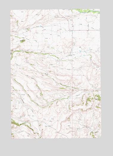
Battleship Butte, MT USGS Topographic Map
Click on map above to begin viewing in our Map Viewer.

This topographic map contains these locations and features:
Feature Name Type Latitude Longitude GNIS ID View Map
04N14E05____01 WellWellN46.1250°W110.0096°814099View Map
04N14E07____01 WellWellN46.1105°W110.0302°814039View Map
04N14E18____01 WellWellN46.0961°W110.0302°813980View Map
04N14E20____01 WellWellN46.0816°W110.0096°813944View Map
Anderson Vose DitchCanalN46.1022°W110.0174°768254View Map
Battleship ButteSummitN46.0947°W110.1074°768561View Map
Billy CreekStreamN46.1033°W110.0007°778791View Map
Bologne CreekStreamN46.0702°W110.0119°769089View Map
Dry CreekStreamN46.0799°W110.0144°782575View Map
Hailstone CreekStreamN46.0011°W110.0866°784448View Map
Hart Parker DitchCanalN46.1052°W110.0407°772185View Map
Horse CreekStreamN46.0355°W110.0682°772534View Map
Melville CemeteryCemeteryN46.1074°W110.0405°774099View Map
Melville ChurchChurchN46.1038°W110.0188°774100View Map
Spring CreekStreamN46.0449°W110.0191°791243View Map
Stevens Number 1 DamDamN46.0449°W110.0824°796616View Map
Stocker DitchCanalN46.0241°W110.1066°791536View Map

Note: Coordinates in the location and feature list above are referenced to NAD83 datum.


Copyright (C) 2008-2024 Ryan Niemi / Sunset Dynamics ... All Rights Reserved