TopoQuest Logo
Do you find TopoQuest useful?
Help keep TopoQuest running and adding new maps/features by donating!
Bitcoin:  19c7KJd3qBynnjoSw5npx9KScwjBe4ifkT
Litecoin:  LXs6TkuXGGXo1vDsWCkWVdjQX94eUKd6ui
Home View Maps Find Maps Find Places Resources & Links


Otter Creek School, Montana Topographic Map

USGS Map Title: Otter Creek School, MT
USGS Map MRC: 45109H8
DRG (GeoTIFF) Download: o45109h8.tif


Neighboring USGS Topographic Map Quads:


  Battleship Butte, MT  
46110A1
 

  Melville, MT  
46109A8
 

  Upper Glaston Lake, MT  
46109A7
 

  Grosfield Ranch, MT  
45110H1
 

  Otter Creek School, MT  
45109H8
 

  Ryan Creek, MT  
45109H7
 

  Carney, MT  
45110G1
 

  Big Timber, MT  
45109G8
 

  Greycliff, MT  
45109G7


Map MRC Location:

N46°
W110°
N46°
W109°
H8 H7 H6 H5 H4 H3 H2 H1
G8 G7 G6 G5 G4 G3 G2 G1
F8 F7 F6 F5 F4 F3 F2 F1
E8 E7 E6 E5 E4 E3 E2 E1
D8 D7 D6 D5 D4 D3 D2 D1
C8 C7 C6 C5 C4 C3 C2 C1
B8 B7 B6 B5 B4 B3 B2 B1
A8 A7 A6 A5 A4 A3 A2 A1
N45°
W110°
N45°
W109°

Otter Creek School, MT USGS 1:24K Topographic Map Preview:
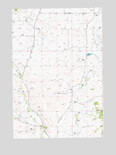
Otter Creek School, MT USGS Topographic Map
Click on map above to begin viewing in our Map Viewer.

This topographic map contains these locations and features:
Feature Name Type Latitude Longitude GNIS ID View Map
01N14E15DAAB01 WellWellN45.8777°W109.9613°813010View Map
02N14E15____01 WellWellN45.9233°W109.9694°813379View Map
02N14E15CBCA01 WellWellN45.9199°W109.9785°813362View Map
02N14E16____01 WellWellN45.9233°W109.9905°813380View Map
02N14E22____01 WellWellN45.9088°W109.9694°813286View Map
02N14E22C___01 WellWellN45.9052°W109.9746°813246View Map
02N14E34A___01 WellWellN45.8836°W109.9641°813056View Map
02N15E05D___01 WellWellN45.9477°W109.8816°813509View Map
02N15E06____01 WellWellN45.9513°W109.9071°813525View Map
02N15E08CAAC01 WellWellN45.9355°W109.8882°813447View Map
02N15E18____01 WellWellN45.9222°W109.9071°813373View Map
03N14E24____01 WellWellN45.9952°W109.9277°813710View Map
Auwater DitchCanalN45.9066°W109.8977°768401View Map
Bear GulchValleyN45.9094°W109.9855°768595View Map
Big Timber Creek CanalCanalN45.9958°W109.9927°768044View Map
Bjorndal RanchLocaleN45.9499°W109.9005°768911View Map
Branae RanchLocaleN45.8788°W109.9152°769188View Map
Cain DamDamN45.9799°W109.9324°795369View Map
Cosgriff RanchLocaleN45.9249°W109.9041°770126View Map
D McCormick RanchLocaleN45.9933°W109.9013°770418View Map
Dry CreekStreamN45.8813°W109.9619°770789View Map
Dry CreekStreamN45.9344°W109.8919°770791View Map
Ellison RanchLocaleN45.9091°W109.9149°771204View Map
Glasston School (historical)SchoolN45.9977°W109.8885°771796View Map
Huyser RanchLocaleN45.9802°W109.9646°772652View Map
J McCormick RanchLocaleN45.9949°W109.9210°772754View Map
Kortum RanchLocaleN45.9741°W109.9869°773128View Map
Kremper RanchLocaleN45.8988°W109.9096°773136View Map
Lavold DamDamN45.9549°W109.8907°797798View Map
Lavold RanchLocaleN45.9388°W109.8902°773263View Map
Lavold ReservoirReservoirN45.9552°W109.8936°773262View Map
Lien GulchValleyN45.9188°W109.9888°768068View Map
Lien RanchLocaleN45.9197°W109.9852°773332View Map
Long GulchValleyN45.9338°W109.9907°773645View Map
Mattice HomesteadLocaleN45.9011°W109.8799°773933View Map
Murray RanchLocaleN45.8913°W109.9110°774518View Map
Nash GulchValleyN45.9036°W109.9077°774552View Map
Nelson RanchLocaleN45.8836°W109.9749°774582View Map
North Fork Sevenmile CreekStreamN45.9177°W109.9152°774805View Map
North of the Yellowstone DivisionCivilN45.9900°W109.9072°1940681View Map
Old Daves CreekStreamN45.8980°W109.9102°768077View Map
Otter Creek School (historical)SchoolN45.9216°W109.9185°774998View Map
Papez Number 1 DamDamN45.9799°W109.9774°796678View Map
Papez Number 2 DamDamN45.9749°W109.9257°796679View Map
Sevenmile CreekStreamN45.9177°W109.9166°776360View Map
Sherod RanchLocaleN45.9927°W109.8835°776482View Map
Smoky DamDamN45.9083°W109.9924°797797View Map
Songstad RanchLocaleN45.9180°W109.9349°776740View Map
South Fork Tenmile CreekStreamN45.9633°W109.9385°776879View Map
Swamp CreekStreamN45.8961°W109.9757°791762View Map
Tangen DrawValleyN45.9799°W109.8816°777418View Map
Tenmile CreekStreamN45.9402°W109.8907°777462View Map
Tenmile DitchCanalN45.9316°W109.8996°777465View Map
Wild Rose School (historical)SchoolN45.9305°W109.9855°778487View Map

Note: Coordinates in the location and feature list above are referenced to NAD83 datum.


Copyright (C) 2008-2025 Ryan Niemi / Sunset Dynamics ... All Rights Reserved