TopoQuest Logo
Do you find TopoQuest useful?
Help keep TopoQuest running and adding new maps/features by donating!
Bitcoin:  19c7KJd3qBynnjoSw5npx9KScwjBe4ifkT
Litecoin:  LXs6TkuXGGXo1vDsWCkWVdjQX94eUKd6ui
Home View Maps Find Maps Find Places Resources & Links


Baxter, Iowa Topographic Map

USGS Map Title: Baxter, IA
USGS Map MRC: 41093G2
DRG (GeoTIFF) Download: o41093g2.tif


Neighboring USGS Topographic Map Quads:


  Collins, IA  
41093H3
 

  Rhodes, IA  
41093H2
 

  Melbourne, IA  
41093H1
 

  Mingo, IA  
41093G3
 

  Baxter, IA  
41093G2
 

  Baxter SE, IA  
41093G1
 

  Mitchellville, IA  
41093F3
 

  Colfax, IA  
41093F2
 

  Newton, IA  
41093F1


Map MRC Location:

N42°
W94°
N42°
W93°
H8 H7 H6 H5 H4 H3 H2 H1
G8 G7 G6 G5 G4 G3 G2 G1
F8 F7 F6 F5 F4 F3 F2 F1
E8 E7 E6 E5 E4 E3 E2 E1
D8 D7 D6 D5 D4 D3 D2 D1
C8 C7 C6 C5 C4 C3 C2 C1
B8 B7 B6 B5 B4 B3 B2 B1
A8 A7 A6 A5 A4 A3 A2 A1
N41°
W94°
N41°
W93°

Baxter, IA USGS 1:24K Topographic Map Preview:
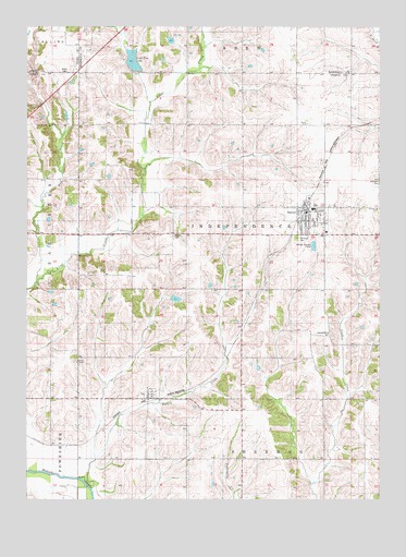
Baxter, IA USGS Topographic Map
Click on map above to begin viewing in our Map Viewer.

This topographic map contains these locations and features:
Feature Name Type Latitude Longitude GNIS ID View Map
Barbee CemeteryCemeteryN41.8417°W93.2002°1999715View Map
BaxterPopulated PlaceN41.8261°W93.1516°454391View Map
Baxter (historical)LocaleN41.8278°W93.1516°1999676View Map
Baxter City HallBuildingN41.8261°W93.1510°1999679View Map
Baxter Elementary SchoolSchoolN41.8267°W93.1497°1999685View Map
Baxter Fire DepartmentBuildingN41.8249°W93.1512°1999677View Map
Baxter High SchoolSchoolN41.8268°W93.1488°2720027View Map
Baxter Medical ClinicHospitalN41.8258°W93.1516°1999681View Map
Baxter Police DepartmentBuildingN41.8261°W93.1510°1999678View Map
Baxter Post OfficePost OfficeN41.8261°W93.1510°1999680View Map
Baxter Public LibraryBuildingN41.8269°W93.1488°1999684View Map
Baxter Rescue UnitBuildingN41.8249°W93.1512°2599667View Map
Bethany CemeteryCemeteryN41.8342°W93.1251°454536View Map
Bethany ChurchChurchN41.8269°W93.1266°454541View Map
Bethel CemeteryCemeteryN41.8197°W93.1982°454555View Map
City of BaxterCivilN41.8252°W93.1525°2394087View Map
Clear Creek Wildlife AreaParkN41.8097°W93.2363°1999542View Map
Congregational United ChurchChurchN41.8239°W93.1516°1999683View Map
Crab Tree LakeLakeN41.8659°W93.2127°455687View Map
DawsonLocaleN41.8347°W93.1446°466113View Map
Dawson Post Office (historical)Post OfficeN41.8347°W93.1446°1999582View Map
Evangelical Free ChurchChurchN41.8264°W93.1446°1999682View Map
Flock CemeteryCemeteryN41.8139°W93.1863°1999714View Map
Independence CemeteryCemeteryN41.7932°W93.1421°457783View Map
IraPopulated PlaceN41.7778°W93.2058°457849View Map
Ira (historical)LocaleN41.7769°W93.2035°1999581View Map
Ira Post Office (historical)Post OfficeN41.7778°W93.2058°1999580View Map
Mud CreekStreamN41.8078°W93.2466°459374View Map
Restland CemeteryCemeteryN41.8193°W93.1544°460592View Map
Township of IndependenceCivilN41.8197°W93.1740°468066View Map
Turkey CreekStreamN41.7530°W93.2277°462362View Map
Union ChapelChurchN41.7861°W93.2324°462443View Map
Union Chapel CemeteryCemeteryN41.7864°W93.2335°1999716View Map

Note: Coordinates in the location and feature list above are referenced to NAD83 datum.


Copyright (C) 2008-2025 Ryan Niemi / Sunset Dynamics ... All Rights Reserved