TopoQuest Logo
Do you find TopoQuest useful?
Help keep TopoQuest running and adding new maps/features by donating!
Bitcoin:  19c7KJd3qBynnjoSw5npx9KScwjBe4ifkT
Litecoin:  LXs6TkuXGGXo1vDsWCkWVdjQX94eUKd6ui
Home View Maps Find Maps Find Places Resources & Links


Mitchellville, Iowa Topographic Map

USGS Map Title: Mitchellville, IA
USGS Map MRC: 41093F3
DRG (GeoTIFF) Download: o41093f3.tif


Neighboring USGS Topographic Map Quads:


  Loring, IA  
41093G4
 

  Mingo, IA  
41093G3
 

  Baxter, IA  
41093G2
 

  Altoona, IA  
41093F4
 

  Mitchellville, IA  
41093F3
 

  Colfax, IA  
41093F2
 

  Rising Sun, IA  
41093E4
 

  Runnells, IA  
41093E3
 

  Prairie City, IA  
41093E2


Map MRC Location:

N42°
W94°
N42°
W93°
H8 H7 H6 H5 H4 H3 H2 H1
G8 G7 G6 G5 G4 G3 G2 G1
F8 F7 F6 F5 F4 F3 F2 F1
E8 E7 E6 E5 E4 E3 E2 E1
D8 D7 D6 D5 D4 D3 D2 D1
C8 C7 C6 C5 C4 C3 C2 C1
B8 B7 B6 B5 B4 B3 B2 B1
A8 A7 A6 A5 A4 A3 A2 A1
N41°
W94°
N41°
W93°

Mitchellville, IA USGS 1:24K Topographic Map Preview:
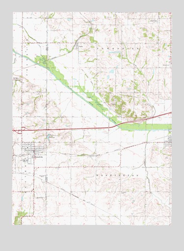
Mitchellville, IA USGS Topographic Map
Click on map above to begin viewing in our Map Viewer.

This topographic map contains these locations and features:
Feature Name Type Latitude Longitude GNIS ID View Map
Apple Grove Post Office (historical)Post OfficeN41.6305°W93.3669°2047824View Map
City of MitchellvilleCivilN41.6679°W93.3629°2395360View Map
City of ValeriaCivilN41.7298°W93.3256°2397109View Map
Clarks LakeReservoirN41.6751°W93.3468°455438View Map
Colfax Golf ClubLocaleN41.6653°W93.2530°1999660View Map
First Congregational ChurchChurchN41.6694°W93.3563°2047596View Map
Fisher CemeteryCemeteryN41.7390°W93.2510°456617View Map
Green CastlePopulated PlaceN41.7461°W93.2616°457098View Map
Greencastle CemeteryCemeteryN41.7430°W93.2655°1999703View Map
Greencastle Post Office (historical)Post OfficeN41.7461°W93.2616°1999563View Map
Heartland Co-op ElevatorLocaleN41.6664°W93.3563°2047590View Map
Hoffman Wildlife AreaParkN41.6833°W93.2835°1999539View Map
Interchange 149CrossingN41.6803°W93.3680°2047861View Map
Iowa Correctional Institution for WomenBuildingN41.6639°W93.3643°2047599View Map
McKeever CemeteryCemeteryN41.7187°W93.2516°458923View Map
Mitchell StationLocaleN41.6530°W93.3585°465426View Map
Mitchell Village Care CenterHospitalN41.6653°W93.3619°2047597View Map
MitchellvilleLocaleN41.6667°W93.3572°2047592View Map
MitchellvillePopulated PlaceN41.6686°W93.3577°459156View Map
Mitchellville Assembly of God ChurchChurchN41.6683°W93.3583°2047593View Map
Mitchellville CemeteryCemeteryN41.6724°W93.3499°2047884View Map
Mitchellville Christian ChurchChurchN41.6697°W93.3622°2047595View Map
Mitchellville Elementary SchoolSchoolN41.6704°W93.3633°2047598View Map
Mitchellville Fire DepartmentBuildingN41.6684°W93.3573°2577195View Map
Mitchellville Post OfficePost OfficeN41.6653°W93.3574°2047589View Map
Mitchellville Public LibraryBuildingN41.6689°W93.3583°2047591View Map
Mitchellville United Methodist ChurchChurchN41.6683°W93.3608°2047594View Map
Nobleton Post Office (historical)Post OfficeN41.6514°W93.3605°2047474View Map
OswaltPopulated PlaceN41.6958°W93.2977°464687View Map
Oswalt Bridge AreaParkN41.6958°W93.3002°1999540View Map
Oswalt Post Office (historical)Post OfficeN41.6958°W93.2977°1999560View Map
Sams CemeteryCemeteryN41.7471°W93.3021°461386View Map
SantiagoPopulated PlaceN41.7100°W93.3749°461423View Map
Santiago (historical)LocaleN41.7100°W93.3749°2047822View Map
Santiago CreekStreamN41.7258°W93.3724°461424View Map
Santiago Post Office (historical)Post OfficeN41.7100°W93.3749°2047823View Map
Shipp CemeteryCemeteryN41.6972°W93.2669°1999702View Map
Squaw CreekStreamN41.6808°W93.2669°461935View Map
Sugar CreekStreamN41.6814°W93.2655°462058View Map
Township of PoweshiekCivilN41.7335°W93.2802°468565View Map
Township of WashingtonCivilN41.6484°W93.2947°468922View Map
ValeriaPopulated PlaceN41.7300°W93.3252°462514View Map
Valeria (historical)LocaleN41.7311°W93.3266°1999562View Map
Valeria Post Office (historical)Post OfficeN41.7300°W93.3252°1999561View Map
WHO-AM (Des Moines)TowerN41.6533°W93.3491°467260View Map
Williamsville (historical)LocaleN41.6444°W93.3224°1999544View Map
Williamsville Post Office (historical)Post OfficeN41.6444°W93.3224°1999545View Map
Woodcock Wildlife AreaParkN41.7139°W93.3419°1999541View Map
WoodvilleLocaleN41.6444°W93.3294°466111View Map

Note: Coordinates in the location and feature list above are referenced to NAD83 datum.


Copyright (C) 2008-2024 Ryan Niemi / Sunset Dynamics ... All Rights Reserved