TopoQuest Logo
Do you find TopoQuest useful?
Help keep TopoQuest running and adding new maps/features by donating!
Bitcoin:  19c7KJd3qBynnjoSw5npx9KScwjBe4ifkT
Litecoin:  LXs6TkuXGGXo1vDsWCkWVdjQX94eUKd6ui
Home View Maps Find Maps Find Places Resources & Links


Bay Buck Peaks, New Mexico Topographic Map

USGS Map Title: Bay Buck Peaks, NM
USGS Map MRC: 33107G5
DRG (GeoTIFF) Download: o33107g5.tif


Neighboring USGS Topographic Map Quads:


  Kellog Well, NM  
33107H6
 

  Monica Saddle, NM  
33107H5
 

  Mount Withington, NM  
33107H4
 

  Oak Peak, NM  
33107G6
 

  Bay Buck Peaks, NM  
33107G5
 

  Grassy Lookout, NM  
33107G4
 

  Dusty, NM  
33107F6
 

  Welty Hill, NM  
33107F5
 

  Blue Mountain, NM  
33107F4


Map MRC Location:

N34°
W108°
N34°
W107°
H8 H7 H6 H5 H4 H3 H2 H1
G8 G7 G6 G5 G4 G3 G2 G1
F8 F7 F6 F5 F4 F3 F2 F1
E8 E7 E6 E5 E4 E3 E2 E1
D8 D7 D6 D5 D4 D3 D2 D1
C8 C7 C6 C5 C4 C3 C2 C1
B8 B7 B6 B5 B4 B3 B2 B1
A8 A7 A6 A5 A4 A3 A2 A1
N33°
W108°
N33°
W107°

Bay Buck Peaks, NM USGS 1:24K Topographic Map Preview:
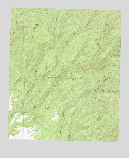
Bay Buck Peaks, NM USGS Topographic Map
Click on map above to begin viewing in our Map Viewer.

This topographic map contains these locations and features:
Feature Name Type Latitude Longitude GNIS ID View Map
Alexander MountainSummitN33.8034°W107.6098°903077View Map
Baney Park CanyonValleyN33.8434°W107.6248°903538View Map
Baney Park TankReservoirN33.8589°W107.5949°903539View Map
Bay Buck PeaksSummitN33.7917°W107.5331°903613View Map
Bear CanyonValleyN33.8206°W107.5289°903638View Map
Bear Trap CanyonValleyN33.7745°W107.6137°903685View Map
Bear Trap CorralLocaleN33.7951°W107.6103°913714View Map
Bitter CanyonValleyN33.7645°W107.6231°903843View Map
Bitter Creek TankReservoirN33.7981°W107.5565°903847View Map
Boulder TankReservoirN33.7572°W107.5837°913680View Map
Buck CanyonValleyN33.8206°W107.5289°904130View Map
Bull CanyonValleyN33.7609°W107.5542°904176View Map
Burnt CanyonValleyN33.8409°W107.5225°904216View Map
Chimney CanyonValleyN33.8217°W107.5345°905104View Map
Deer Spring CanyonValleyN33.8306°W107.5136°905705View Map
Dodson CanyonValleyN33.7773°W107.6112°905793View Map
Fisher CanyonValleyN33.8456°W107.5739°906282View Map
Foster DrawValleyN33.8165°W107.5564°906343View Map
Hay Ground DrawArroyoN33.7987°W107.5556°2025311View Map
Hughes CampgroundLocaleN33.8573°W107.5403°907154View Map
Indian CanyonValleyN33.7981°W107.5564°907193View Map
Mouth of Bear RanchLocaleN33.7748°W107.6156°913682View Map
Panther CanyonValleyN33.8551°W107.5181°909472View Map
Pigeon TankReservoirN33.7515°W107.5991°913681View Map
Pinnacle CanyonValleyN33.8137°W107.5823°909707View Map
Roberts Place TankReservoirN33.7608°W107.5550°910348View Map
Sawmill CanyonValleyN33.7706°W107.6189°910835View Map
Scrapes WindmillLocaleN33.7906°W107.5467°937073View Map
Spring CanyonValleyN33.7987°W107.5261°911323View Map
Spring Hollow CanyonValleyN33.8156°W107.5603°911334View Map
Tin Cup CanyonValleyN33.7612°W107.5528°911718View Map
Trough SpringSpringN33.8016°W107.6181°913683View Map
Turkey CreekStreamN33.8026°W107.5942°911868View Map
Turkey SaddleGapN33.8153°W107.5973°911890View Map
Wallace Trough CanyonValleyN33.7998°W107.5245°912147View Map

Note: Coordinates in the location and feature list above are referenced to NAD83 datum.


Copyright (C) 2008-2025 Ryan Niemi / Sunset Dynamics ... All Rights Reserved