TopoQuest Logo
Do you find TopoQuest useful?
Help keep TopoQuest running and adding new maps/features by donating!
Bitcoin:  19c7KJd3qBynnjoSw5npx9KScwjBe4ifkT
Litecoin:  LXs6TkuXGGXo1vDsWCkWVdjQX94eUKd6ui
Home View Maps Find Maps Find Places Resources & Links


Lunds, Wisconsin Topographic Map

USGS Map Title: Lunds, WI
USGS Map MRC: 44088F5
DRG (GeoTIFF) Download: o44088f5.tif


Neighboring USGS Topographic Map Quads:


  Thornton, WI  
44088G6
 

  Shawano, WI  
44088G5
 

  Cecil, WI  
44088G4
 

  Embarrass, WI  
44088F6
 

  Lunds, WI  
44088F5
 

  Bonduel, WI  
44088F4
 

  Bear Creek, WI  
44088E6
 

  Leeman, WI  
44088E5
 

  Nichols, WI  
44088E4


Map MRC Location:

N45°
W89°
N45°
W88°
H8 H7 H6 H5 H4 H3 H2 H1
G8 G7 G6 G5 G4 G3 G2 G1
F8 F7 F6 F5 F4 F3 F2 F1
E8 E7 E6 E5 E4 E3 E2 E1
D8 D7 D6 D5 D4 D3 D2 D1
C8 C7 C6 C5 C4 C3 C2 C1
B8 B7 B6 B5 B4 B3 B2 B1
A8 A7 A6 A5 A4 A3 A2 A1
N44°
W89°
N44°
W88°

Lunds, WI USGS 1:24K Topographic Map Preview:
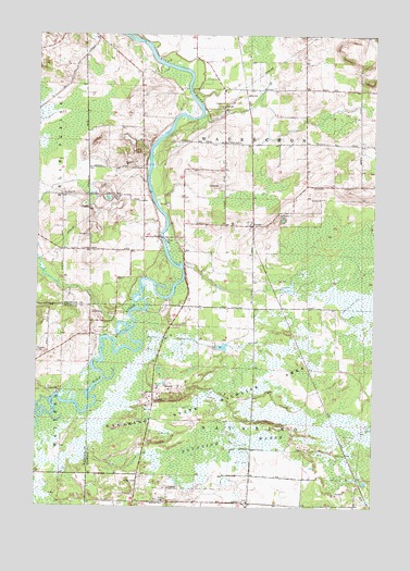
Lunds, WI USGS Topographic Map
Click on map above to begin viewing in our Map Viewer.

This topographic map contains these locations and features:
Feature Name Type Latitude Longitude GNIS ID View Map
Ascension ChurchChurchN44.6264°W88.5465°1560971View Map
First ChurchChurchN44.6267°W88.5776°1564967View Map
Hilda CemeteryCemeteryN44.6316°W88.5876°1566406View Map
Jerusalem CemeteryCemeteryN44.7019°W88.5354°1876882View Map
Jerusalem ChurchChurchN44.7025°W88.5354°1567172View Map
LundsPopulated PlaceN44.6994°W88.5454°1568809View Map
Navarino MarshSwampN44.6430°W88.5482°1570119View Map
Navarino Marsh 1 G12.470 DamDamN44.6583°W88.6001°1793291View Map
Navarino Marsh 2 G12.470 DamDamN44.6533°W88.6001°1793292View Map
Navarino Marsh 3 G12.470 DamDamN44.6500°W88.6001°1793293View Map
Navarino State Wildlife AreaParkN44.6575°W88.5537°1570121View Map
Saint Johns ChurchChurchN44.7072°W88.6165°1573100View Map
Saint Wenceslaus CemeteryCemeteryN44.7214°W88.5607°1876886View Map
Saint Wenceslaus ChurchChurchN44.7217°W88.5545°1573600View Map
Schoenick CreekStreamN44.6730°W88.5954°1577429View Map
School Section CreekStreamN44.7286°W88.5640°1577428View Map
Town of NavarinoCivilN44.6342°W88.5458°1583781View Map
Town of WaukechonCivilN44.7210°W88.5447°1584370View Map

Note: Coordinates in the location and feature list above are referenced to NAD83 datum.


Copyright (C) 2008-2025 Ryan Niemi / Sunset Dynamics ... All Rights Reserved