TopoQuest Logo
Do you find TopoQuest useful?
Help keep TopoQuest running and adding new maps/features by donating!
Bitcoin:  19c7KJd3qBynnjoSw5npx9KScwjBe4ifkT
Litecoin:  LXs6TkuXGGXo1vDsWCkWVdjQX94eUKd6ui
Home View Maps Find Maps Find Places Resources & Links


Embarrass, Wisconsin Topographic Map

USGS Map Title: Embarrass, WI
USGS Map MRC: 44088F6
DRG (GeoTIFF) Download: o44088f6.tif


Neighboring USGS Topographic Map Quads:


  Gresham, WI  
44088G7
 

  Thornton, WI  
44088G6
 

  Shawano, WI  
44088G5
 

  Clintonville North, WI  
44088F7
 

  Embarrass, WI  
44088F6
 

  Lunds, WI  
44088F5
 

  Clintonville South, WI  
44088E7
 

  Bear Creek, WI  
44088E6
 

  Leeman, WI  
44088E5


Map MRC Location:

N45°
W89°
N45°
W88°
H8 H7 H6 H5 H4 H3 H2 H1
G8 G7 G6 G5 G4 G3 G2 G1
F8 F7 F6 F5 F4 F3 F2 F1
E8 E7 E6 E5 E4 E3 E2 E1
D8 D7 D6 D5 D4 D3 D2 D1
C8 C7 C6 C5 C4 C3 C2 C1
B8 B7 B6 B5 B4 B3 B2 B1
A8 A7 A6 A5 A4 A3 A2 A1
N44°
W89°
N44°
W88°

Embarrass, WI USGS 1:24K Topographic Map Preview:
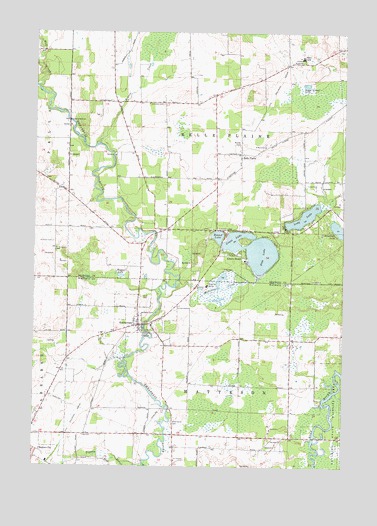
Embarrass, WI USGS Topographic Map
Click on map above to begin viewing in our Map Viewer.

This topographic map contains these locations and features:
Feature Name Type Latitude Longitude GNIS ID View Map
Adams BeachPopulated PlaceN44.6861°W88.6682°1560682View Map
Adams Beach Census Designated PlaceCensusN44.6859°W88.6711°2586447View Map
Beaver CreekStreamN44.7178°W88.7251°1561431View Map
Belle PlainePopulated PlaceN44.7153°W88.6662°1561533View Map
Big LakeLakeN44.6792°W88.6748°2784227View Map
Bomke CemeteryCemeteryN44.7178°W88.6665°1562049View Map
EmbarrassPopulated PlaceN44.6655°W88.7073°1564607View Map
Embarrass Volunteer Fire DepartmentBuildingN44.6647°W88.7061°2697760View Map
Friendship CemeteryCemeteryN44.7294°W88.6976°1565331View Map
Grass LakeLakeN44.6902°W88.6685°1565764View Map
Greenwood CemeteryCemeteryN44.6378°W88.6937°1565870View Map
Long LakeLakeN44.6971°W88.6410°1568543View Map
Matteson CreekStreamN44.6730°W88.6987°1569126View Map
Mill CreekStreamN44.7347°W88.7495°1560662View Map
Pine LakeLakeN44.6863°W88.6582°1571489View Map
Roosevelt School (historical)SchoolN44.6528°W88.7393°1850546View Map
Round LakeLakeN44.6913°W88.6760°1572647View Map
Saint Johns ChurchChurchN44.6266°W88.6923°1573098View Map
Saint Martin ChurchChurchN44.7175°W88.6568°1573250View Map
Saint Peter CemeteryCemeteryN44.6900°W88.7420°1573505View Map
Saint Peter ChurchChurchN44.6875°W88.7409°1573509View Map
Schoenick LakeLakeN44.6929°W88.6269°1573794View Map
Shawano Area Fire Department Station 3BuildingN44.6964°W88.6904°2696847View Map
Town of Belle PlaineCivilN44.7228°W88.6717°1582785View Map
Town of MattesonCivilN44.6340°W88.6689°1583671View Map
United ChurchChurchN44.7064°W88.6365°1575924View Map
Village of EmbarrassCivilN44.6685°W88.7037°1583162View Map
Wagner LakeLakeN44.6799°W88.7151°1576139View Map
Wolf River School (historical)SchoolN44.6633°W88.6257°1850603View Map
Woodland School (historical)SchoolN44.6303°W88.6829°1850605View Map
Zion CemeteryCemeteryN44.6741°W88.7065°1577145View Map

Note: Coordinates in the location and feature list above are referenced to NAD83 datum.


Copyright (C) 2008-2025 Ryan Niemi / Sunset Dynamics ... All Rights Reserved