TopoQuest Logo
Do you find TopoQuest useful?
Help keep TopoQuest running and adding new maps/features by donating!
Bitcoin:  19c7KJd3qBynnjoSw5npx9KScwjBe4ifkT
Litecoin:  LXs6TkuXGGXo1vDsWCkWVdjQX94eUKd6ui
Home View Maps Find Maps Find Places Resources & Links


Abbeville South, Georgia Topographic Map

USGS Map Title: Abbeville South, GA
USGS Map MRC: 31083H3
DRG (GeoTIFF) Download: o31083h3.tif


Neighboring USGS Topographic Map Quads:


  Pineview East, GA  
32083A4
 

  Abbeville North, GA  
32083A3
 

  Lake Cypress, GA  
32083A2
 

  Rochelle, GA  
31083H4
 

  Abbeville South, GA  
31083H3
 

  Rhine, GA  
31083H2
 

  Rebecca, GA  
31083G4
 

  Sibbie, GA  
31083G3
 

  Queensland, GA  
31083G2


Map MRC Location:

N32°
W84°
N32°
W83°
H8 H7 H6 H5 H4 H3 H2 H1
G8 G7 G6 G5 G4 G3 G2 G1
F8 F7 F6 F5 F4 F3 F2 F1
E8 E7 E6 E5 E4 E3 E2 E1
D8 D7 D6 D5 D4 D3 D2 D1
C8 C7 C6 C5 C4 C3 C2 C1
B8 B7 B6 B5 B4 B3 B2 B1
A8 A7 A6 A5 A4 A3 A2 A1
N31°
W84°
N31°
W83°

Abbeville South, GA USGS 1:24K Topographic Map Preview:
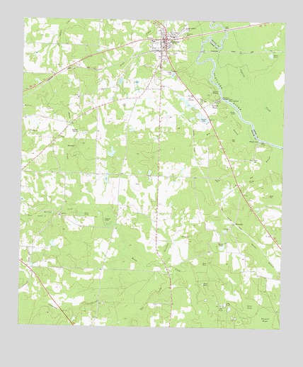
Abbeville South, GA USGS Topographic Map
Click on map above to begin viewing in our Map Viewer.

This topographic map contains these locations and features:
Feature Name Type Latitude Longitude GNIS ID View Map
AbbevillePopulated PlaceN31.9921°W83.3068°354256View Map
Abbeville DivisionCivilN31.9614°W83.3110°1936064View Map
Abbeville Elementary SchoolSchoolN31.9916°W83.3127°345458View Map
Abbeville Police DepartmentBuildingN31.9887°W83.3081°2733647View Map
Abbeville Post OfficePost OfficeN31.9921°W83.3088°1705321View Map
Abbeville Volunteer Fire DepartmentBuildingN31.9915°W83.3137°2603581View Map
Adam SpringsSpringN31.9674°W83.2754°310390View Map
Addison DamDamN31.9652°W83.2949°336205View Map
Addison LakeReservoirN31.9666°W83.2965°336206View Map
Antioch CemeteryCemeteryN31.9199°W83.3560°345459View Map
Antioch Missionary Baptist ChurchChurchN31.9205°W83.3560°354334View Map
Baldie PondLakeN31.9866°W83.2564°310751View Map
Ball CreekStreamN31.8985°W83.3010°310759View Map
Bay BranchStreamN31.9518°W83.2613°310878View Map
Big BranchStreamN31.9527°W83.2515°311311View Map
Boat Ramp Statham ShoalsBarN31.9680°W83.2774°311590View Map
Bowell CemeteryCemeteryN31.9791°W83.3040°311670View Map
Breakfast BranchStreamN31.8996°W83.3068°311745View Map
Brown CemeteryCemeteryN31.9288°W83.2563°311857View Map
Brown CemeteryCemeteryN31.9435°W83.2643°311858View Map
Brown LakeLakeN31.9632°W83.2727°311872View Map
BrowningPopulated PlaceN31.9174°W83.2724°354873View Map
Buzzard RoostSwampN31.8804°W83.2565°312120View Map
Cannon LakeReservoirN31.9353°W83.3342°341166View Map
Cannon Lake DamDamN31.9335°W83.3349°341165View Map
Church of GodChurchN31.9052°W83.3090°345465View Map
City of AbbevilleCivilN31.9925°W83.3068°2403056View Map
Clements CreekStreamN31.9005°W83.3127°312734View Map
Cypress CreekStreamN31.9546°W83.2635°313236View Map
Cypress PondLakeN31.9185°W83.3347°313255View Map
Fowl PondLakeN31.9205°W83.3457°314324View Map
Fuller DamDamN31.9593°W83.2868°336201View Map
Fullers LakeReservoirN31.9605°W83.2890°336202View Map
Fulmer LakeReservoirN31.9458°W83.3319°341164View Map
Fulmer Lake DamDamN31.9452°W83.3332°341163View Map
Gator SlideSwampN31.8840°W83.2643°314540View Map
Haw PondLakeN31.9211°W83.3596°315236View Map
Haw Pond CreekStreamN31.9282°W83.3452°315238View Map
Hogans SpringSpringN31.9546°W83.3477°315519View Map
Keen CemeteryCemeteryN31.9655°W83.3271°316331View Map
Lebanon CemeteryCemeteryN31.9160°W83.2749°345478View Map
Lebanon ChurchChurchN31.9155°W83.2752°316718View Map
Long PondReservoirN31.8845°W83.2764°317387View Map
McCall CemeteryCemeteryN31.9349°W83.2663°317845View Map
Mount Olive ChurchChurchN31.9643°W83.3738°318741View Map
Murry PondReservoirN31.9078°W83.2789°319171View Map
New Hope CemeteryCemeteryN31.9674°W83.2885°345483View Map
New Hope ChurchChurchN31.9674°W83.2890°319385View Map
Poplars CreekStreamN31.9477°W83.3524°321055View Map
Pot PondReservoirN31.8837°W83.2779°321089View Map
Reid CemeteryCemeteryN31.9516°W83.2746°321510View Map
Reid Hill CemeteryCemeteryN31.9360°W83.2813°321514View Map
Rhodes LakeLakeN31.9516°W83.2613°321553View Map
Riverside CemeteryCemeteryN31.9943°W83.2977°321643View Map
Siloam CemeteryCemeteryN31.9679°W83.3490°345496View Map
Siloam ChurchChurchN31.9682°W83.3477°322979View Map
Slate HoleLakeN31.9012°W83.2876°323070View Map
Statham ShoalsPopulated PlaceN31.9668°W83.2829°333119View Map
Stubbs CemeteryCemeteryN31.9868°W83.3046°323702View Map
Trout PondReservoirN31.8929°W83.2871°324339View Map
WaterholeLakeN31.9489°W83.3511°324896View Map
Wilcox County CourthouseBuildingN31.9927°W83.3065°345500View Map
Wilcox County JailBuildingN31.9926°W83.3058°2734094View Map
Wilcox County Sheriff's DepartmentBuildingN31.9927°W83.3058°2733593View Map
Wilcox State PrisonBuildingN31.9851°W83.3004°2735728View Map
Wilcox State Prison Fire DepartmentBuildingN31.9868°W83.3063°2604796View Map
Wolvins SpringsSpringN31.9710°W83.2813°325517View Map

Note: Coordinates in the location and feature list above are referenced to NAD83 datum.


Copyright (C) 2008-2025 Ryan Niemi / Sunset Dynamics ... All Rights Reserved