TopoQuest Logo
Do you find TopoQuest useful?
Help keep TopoQuest running and adding new maps/features by donating!
Bitcoin:  19c7KJd3qBynnjoSw5npx9KScwjBe4ifkT
Litecoin:  LXs6TkuXGGXo1vDsWCkWVdjQX94eUKd6ui
Home View Maps Find Maps Find Places Resources & Links


Rhine, Georgia Topographic Map

USGS Map Title: Rhine, GA
USGS Map MRC: 31083H2
DRG (GeoTIFF) Download: o31083h2.tif


Neighboring USGS Topographic Map Quads:


  Abbeville North, GA  
32083A3
 

  Lake Cypress, GA  
32083A2
 

  Milan, GA  
32083A1
 

  Abbeville South, GA  
31083H3
 

  Rhine, GA  
31083H2
 

  Cooks Still, GA  
31083H1
 

  Sibbie, GA  
31083G3
 

  Queensland, GA  
31083G2
 

  China Hill, GA  
31083G1


Map MRC Location:

N32°
W84°
N32°
W83°
H8 H7 H6 H5 H4 H3 H2 H1
G8 G7 G6 G5 G4 G3 G2 G1
F8 F7 F6 F5 F4 F3 F2 F1
E8 E7 E6 E5 E4 E3 E2 E1
D8 D7 D6 D5 D4 D3 D2 D1
C8 C7 C6 C5 C4 C3 C2 C1
B8 B7 B6 B5 B4 B3 B2 B1
A8 A7 A6 A5 A4 A3 A2 A1
N31°
W84°
N31°
W83°

Rhine, GA USGS 1:24K Topographic Map Preview:
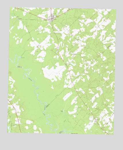
Rhine, GA USGS Topographic Map
Click on map above to begin viewing in our Map Viewer.

This topographic map contains these locations and features:
Feature Name Type Latitude Longitude GNIS ID View Map
Auston ChurchChurchN31.9905°W83.2410°310677View Map
Bethel ChurchChurchN31.9918°W83.1960°311168View Map
CopelandPopulated PlaceN31.9882°W83.2393°326234View Map
Cypress CreekStreamN31.9582°W83.2324°313240View Map
Dodges Lake LandingLocaleN31.8755°W83.1754°331565View Map
Fussell Airport (historical)AirportN31.8855°W83.1546°356924View Map
Griffin CreekStreamN31.8930°W83.1810°314905View Map
Hopewell Baptist ChurchChurchN31.9616°W83.2157°315648View Map
Matthews LakeReservoirN31.9006°W83.1256°341140View Map
Matthews Lake DamDamN31.9018°W83.1265°341139View Map
Mill Creek ChurchChurchN31.9616°W83.1474°348136View Map
Mizell CreekStreamN31.8799°W83.1824°318354View Map
Mount Zion CemeteryCemeteryN31.8816°W83.2399°345481View Map
Mount Zion ChurchChurchN31.8830°W83.2410°318962View Map
New Austin ChurchChurchN31.9996°W83.2415°348138View Map
New Mount Zion ChurchChurchN31.8818°W83.2418°319487View Map
Oak Grove ChurchChurchN31.9693°W83.1704°319785View Map
Pleasant Grove ChurchChurchN31.9543°W83.1746°320812View Map
Reaves-Bates CemeteryCemeteryN31.9802°W83.2310°321349View Map
RhinePopulated PlaceN31.9896°W83.2002°321548View Map
Rhine Baptist ChurchChurchN31.9902°W83.2007°348141View Map
Rhine Elementary SchoolSchoolN31.9921°W83.1985°348142View Map
Rhine Police DepartmentBuildingN31.9890°W83.2004°2734007View Map
Rhine Volunteer Fire DepartmentBuildingN31.9883°W83.2018°2604353View Map
SharonPopulated PlaceN31.8802°W83.1377°356952View Map
Sharon CemeteryCemeteryN31.8807°W83.1376°356953View Map
Sharon ChurchChurchN31.8807°W83.1374°322780View Map
Spring LakeReservoirN31.8968°W83.1841°323446View Map
TemperancePopulated PlaceN31.8896°W83.1463°333204View Map
Temperance ChurchChurchN31.9002°W83.1438°323977View Map
Town of RhineCivilN31.9891°W83.2000°2407203View Map
Walker CemeteryCemeteryN31.9818°W83.1468°324766View Map
Wilcox CemeteryCemeteryN31.9560°W83.2174°325263View Map
Williams CemeteryCemeteryN31.9002°W83.1543°356967View Map

Note: Coordinates in the location and feature list above are referenced to NAD83 datum.


Copyright (C) 2008-2025 Ryan Niemi / Sunset Dynamics ... All Rights Reserved