TopoQuest Logo
Do you find TopoQuest useful?
Help keep TopoQuest running and adding new maps/features by donating!
Bitcoin:  19c7KJd3qBynnjoSw5npx9KScwjBe4ifkT
Litecoin:  LXs6TkuXGGXo1vDsWCkWVdjQX94eUKd6ui
Home View Maps Find Maps Find Places Resources & Links


Lyman, Washington Topographic Map

USGS Map Title: Lyman, WA
USGS Map MRC: 48122E1
DRG (GeoTIFF) Download: o48122e1.tif


Neighboring USGS Topographic Map Quads:


  Acme, WA  
48122F2
 

  Cavanaugh Creek, WA  
48122F1
 

  Twin Sisters Mountain, WA  
48121F8
 

  Sedro-Woolley North, WA  
48122E2
 

  Lyman, WA  
48122E1
 

  Hamilton, WA  
48121E8
 

  Sedro-Woolley South, WA  
48122D2
 

  Haystack Mountain, WA  
48122D1
 

  Day Lake, WA  
48121D8


Map MRC Location:

N49°
W123°
N49°
W122°
H8 H7 H6 H5 H4 H3 H2 H1
G8 G7 G6 G5 G4 G3 G2 G1
F8 F7 F6 F5 F4 F3 F2 F1
E8 E7 E6 E5 E4 E3 E2 E1
D8 D7 D6 D5 D4 D3 D2 D1
C8 C7 C6 C5 C4 C3 C2 C1
B8 B7 B6 B5 B4 B3 B2 B1
A8 A7 A6 A5 A4 A3 A2 A1
N48°
W123°
N48°
W122°

Lyman, WA USGS 1:24K Topographic Map Preview:
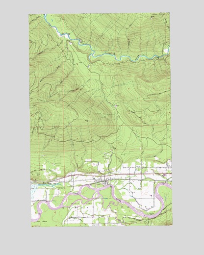
Lyman, WA USGS Topographic Map
Click on map above to begin viewing in our Map Viewer.

This topographic map contains these locations and features:
Feature Name Type Latitude Longitude GNIS ID View Map
Bacus HillSummitN48.5304°W122.1204°1528712View Map
Branshel FarmLocaleN48.5175°W122.0197°2703774View Map
Camp EighteenLocaleN48.5937°W122.0746°1526117View Map
Canyon CreekStreamN48.5993°W122.0402°1528713View Map
Childs CreekStreamN48.5254°W122.0990°1517702View Map
Davis SloughStreamN48.5246°W122.0057°1528709View Map
Day CreekStreamN48.5115°W122.0565°1518518View Map
Day Creek ChapelChurchN48.5006°W122.0659°2609832View Map
Deer CreekStreamN48.6101°W122.0946°1518620View Map
Fobes CreekStreamN48.6237°W122.1127°1528435View Map
Hamilton CemeteryCemeteryN48.5362°W122.0049°1528711View Map
Hamilton JunctionPopulated PlaceN48.5265°W122.0068°1520483View Map
Israel's Farm AirportAirportN48.5073°W122.0923°2443369View Map
Jims SloughStreamN48.5221°W122.0507°1519383View Map
Jones CreekStreamN48.5221°W122.0527°1521459View Map
Loretta CreekStreamN48.5062°W122.0246°1522453View Map
LymanPopulated PlaceN48.5271°W122.0618°1522592View Map
Lyman CemeteryCemeteryN48.5269°W122.0671°2605494View Map
Lyman Elementary SchoolSchoolN48.5280°W122.0697°1530623View Map
Lyman FerryLocaleN48.5068°W122.0221°1522595View Map
Lyman PassGapN48.5937°W122.0785°1522601View Map
Lyman Post OfficePost OfficeN48.5257°W122.0596°2606969View Map
Mannser CreekStreamN48.5221°W122.0527°1522678View Map
MinklerPopulated PlaceN48.5212°W122.1121°1523242View Map
Minkler LakeLakeN48.5243°W122.1074°1523243View Map
Morgan CreekStreamN48.5059°W122.0949°1523362View Map
Muddy CreekStreamN48.5262°W122.0054°1528710View Map
Plumbago CreekStreamN48.6121°W122.0977°1524517View Map
Red Cabin CreekStreamN48.5279°W122.0246°1524926View Map
Roaring CreekStreamN48.6018°W122.0888°1525087View Map
Ross IslandIslandN48.5054°W122.1127°1525221View Map
Skagit County Fire District 16 Day Creek Fire DepartmentBuildingN48.5019°W122.0602°2643660View Map
Skagit County Fire District 8 LymanBuildingN48.5260°W122.0601°2643582View Map
Skagit County Fire District 8 Punkin CenterBuildingN48.5310°W122.0053°2643593View Map
Sundstrom DairyLocaleN48.5061°W122.0706°2703772View Map
Tingley SchoolSchoolN48.5023°W122.0613°1527247View Map
Town of LymanCivilN48.5230°W122.0634°2412927View Map

Note: Coordinates in the location and feature list above are referenced to NAD83 datum.


Copyright (C) 2008-2025 Ryan Niemi / Sunset Dynamics ... All Rights Reserved