TopoQuest Logo
Do you find TopoQuest useful?
Help keep TopoQuest running and adding new maps/features by donating!
Bitcoin:  19c7KJd3qBynnjoSw5npx9KScwjBe4ifkT
Litecoin:  LXs6TkuXGGXo1vDsWCkWVdjQX94eUKd6ui
Home View Maps Find Maps Find Places Resources & Links


Acme, Washington Topographic Map

USGS Map Title: Acme, WA
USGS Map MRC: 48122F2
DRG (GeoTIFF) Download: o48122f2.tif


Neighboring USGS Topographic Map Quads:


  Lawrence, WA  
48122G3
 

  Deming, WA  
48122G2
 

  Canyon Lake, WA  
48122G1
 

  Lake Whatcom, WA  
48122F3
 

  Acme, WA  
48122F2
 

  Cavanaugh Creek, WA  
48122F1
 

  Alger, WA  
48122E3
 

  Sedro-Woolley North, WA  
48122E2
 

  Lyman, WA  
48122E1


Map MRC Location:

N49°
W123°
N49°
W122°
H8 H7 H6 H5 H4 H3 H2 H1
G8 G7 G6 G5 G4 G3 G2 G1
F8 F7 F6 F5 F4 F3 F2 F1
E8 E7 E6 E5 E4 E3 E2 E1
D8 D7 D6 D5 D4 D3 D2 D1
C8 C7 C6 C5 C4 C3 C2 C1
B8 B7 B6 B5 B4 B3 B2 B1
A8 A7 A6 A5 A4 A3 A2 A1
N48°
W123°
N48°
W122°

Acme, WA USGS 1:24K Topographic Map Preview:
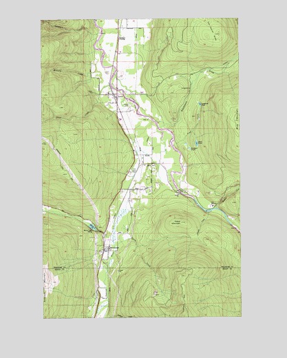
Acme, WA USGS Topographic Map
Click on map above to begin viewing in our Map Viewer.

This topographic map contains these locations and features:
Feature Name Type Latitude Longitude GNIS ID View Map
AcmePopulated PlaceN48.7171°W122.2052°1515719View Map
Acme Census Designated PlaceCensusN48.7146°W122.2293°2407694View Map
Acme Elementary SchoolSchoolN48.7189°W122.2090°1530710View Map
Acme FieldAirportN48.7138°W122.1960°1533654View Map
Acme Post OfficePost OfficeN48.7160°W122.2030°2606905View Map
Acme Presbyterian ChurchChurchN48.7165°W122.2029°2609215View Map
Anderson DairyLocaleN48.7194°W122.1969°2704157View Map
Blue MountainSummitN48.7029°W122.1288°1516709View Map
Christie CreekStreamN48.6693°W122.1457°1528847View Map
Coldstream FarmLocaleN48.7258°W122.1997°2704393View Map
ComarPopulated PlaceN48.7318°W122.2035°1517990View Map
Doolittle CreekStreamN48.6376°W122.2115°1528513View Map
DoranPopulated PlaceN48.6784°W122.1957°1518871View Map
Duck PondLakeN48.6975°W122.1535°1528917View Map
Eddys MountainSummitN48.6648°W122.1638°1528930View Map
Edfro CreekStreamN48.6618°W122.1257°1519184View Map
Ennis CreekStreamN48.6562°W122.2052°1519350View Map
Ferguson PondsLakeN48.6957°W122.1582°1528929View Map
Hutchinson CreekStreamN48.7065°W122.1788°1533342View Map
Jones CreekStreamN48.7209°W122.2074°1521460View Map
Kalsbeek DairyLocaleN48.7358°W122.2036°2703907View Map
Lonesome PondLakeN48.7139°W122.1512°1528916View Map
Lummi Indian Business Council Skookum Creek Fish HatcheryLocaleN48.6712°W122.1446°2605549View Map
Marona Mill PondReservoirN48.7182°W122.2146°1532816View Map
Marona Mill Pond DamDamN48.7182°W122.2146°1532815View Map
McCarty CreekStreamN48.7329°W122.2163°1522857View Map
Mirror LakeLakeN48.6630°W122.2199°1523259View Map
Mirror LakePopulated PlaceN48.6607°W122.2118°1523264View Map
Mirror Lake SidingLocaleN48.6623°W122.2193°1528846View Map
Pond CreekStreamN48.6971°W122.1665°1528848View Map
SaxonPopulated PlaceN48.6876°W122.1888°1525468View Map
Saxon BridgeBridgeN48.6779°W122.1652°1525469View Map
Saxon CemeteryCemeteryN48.6885°W122.1810°2605504View Map
Saxon QuarryMineN48.6802°W122.1790°2605590View Map
Shetler DairyLocaleN48.6944°W122.1928°2703919View Map
Skookum CreekStreamN48.6707°W122.1415°1525875View Map
Standard CreekStreamN48.7437°W122.2138°1528849View Map
Standard CrossingCrossingN48.7451°W122.2018°1526488View Map
Whatcom County Fire District 16BuildingN48.7163°W122.2030°2643606View Map
WickershamPopulated PlaceN48.6551°W122.2129°1528113View Map

Note: Coordinates in the location and feature list above are referenced to NAD83 datum.


Copyright (C) 2008-2025 Ryan Niemi / Sunset Dynamics ... All Rights Reserved