TopoQuest Logo
Do you find TopoQuest useful?
Help keep TopoQuest running and adding new maps/features by donating!
Bitcoin:  19c7KJd3qBynnjoSw5npx9KScwjBe4ifkT
Litecoin:  LXs6TkuXGGXo1vDsWCkWVdjQX94eUKd6ui
Home View Maps Find Maps Find Places Resources & Links


Cavanaugh Creek, Washington Topographic Map

USGS Map Title: Cavanaugh Creek, WA
USGS Map MRC: 48122F1
DRG (GeoTIFF) Download: o48122f1.tif


Neighboring USGS Topographic Map Quads:


  Deming, WA  
48122G2
 

  Canyon Lake, WA  
48122G1
 

  Groat Mountain, WA  
48121G8
 

  Acme, WA  
48122F2
 

  Cavanaugh Creek, WA  
48122F1
 

  Twin Sisters Mountain, WA  
48121F8
 

  Sedro-Woolley North, WA  
48122E2
 

  Lyman, WA  
48122E1
 

  Hamilton, WA  
48121E8


Map MRC Location:

N49°
W123°
N49°
W122°
H8 H7 H6 H5 H4 H3 H2 H1
G8 G7 G6 G5 G4 G3 G2 G1
F8 F7 F6 F5 F4 F3 F2 F1
E8 E7 E6 E5 E4 E3 E2 E1
D8 D7 D6 D5 D4 D3 D2 D1
C8 C7 C6 C5 C4 C3 C2 C1
B8 B7 B6 B5 B4 B3 B2 B1
A8 A7 A6 A5 A4 A3 A2 A1
N48°
W123°
N48°
W122°

Cavanaugh Creek, WA USGS 1:24K Topographic Map Preview:
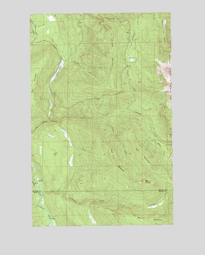
Cavanaugh Creek, WA USGS Topographic Map
Click on map above to begin viewing in our Map Viewer.

This topographic map contains these locations and features:
Feature Name Type Latitude Longitude GNIS ID View Map
Arlecho CreekStreamN48.6882°W122.0649°1515946View Map
Atherns PondLakeN48.6516°W122.1209°1529105View Map
Bald MountainSummitN48.6507°W122.0265°1516080View Map
Bear MountainSummitN48.6607°W122.0213°1529107View Map
Cavanaugh CreekStreamN48.6448°W122.1199°1517507View Map
Dailey PrairieFlatN48.7226°W122.0379°1518452View Map
Dyes RanchLocaleN48.6432°W122.1179°1519032View Map
Fish CreekStreamN48.6890°W122.0282°1519579View Map
Hayden CreekStreamN48.6771°W122.0168°1520619View Map
Miner MountainSummitN48.6273°W122.0110°1529104View Map
Musto MarshSwampN48.7169°W122.1016°1529472View Map
New York MountainSummitN48.6559°W122.0440°1529106View Map
Orsino CreekStreamN48.6904°W122.0407°1524081View Map
Peterson CreekStreamN48.7221°W122.0990°1524360View Map
Swen Larsen QuarryMineN48.7435°W122.0058°2605647View Map

Note: Coordinates in the location and feature list above are referenced to NAD83 datum.


Copyright (C) 2008-2025 Ryan Niemi / Sunset Dynamics ... All Rights Reserved