TopoQuest Logo
Do you find TopoQuest useful?
Help keep TopoQuest running and adding new maps/features by donating!
Bitcoin:  19c7KJd3qBynnjoSw5npx9KScwjBe4ifkT
Litecoin:  LXs6TkuXGGXo1vDsWCkWVdjQX94eUKd6ui
Home View Maps Find Maps Find Places Resources & Links


Lyons, New York Topographic Map

USGS Map Title: Lyons, NY
USGS Map MRC: 43076A8
DRG (GeoTIFF) Download: o43076a8.tif


Neighboring USGS Topographic Map Quads:


  Sodus, NY  
43077B1
 

  Rose, NY  
43076B8
 

  Wolcott, NY  
43076B7
 

  Newark, NY  
43077A1
 

  Lyons, NY  
43076A8
 

  Savannah, NY  
43076A7
 

  Phelps, NY  
42077H1
 

  Geneva North, NY  
42076H8
 

  Seneca Falls, NY  
42076H7


Map MRC Location:

N44°
W77°
N44°
W76°
H8 H7 H6 H5 H4 H3 H2 H1
G8 G7 G6 G5 G4 G3 G2 G1
F8 F7 F6 F5 F4 F3 F2 F1
E8 E7 E6 E5 E4 E3 E2 E1
D8 D7 D6 D5 D4 D3 D2 D1
C8 C7 C6 C5 C4 C3 C2 C1
B8 B7 B6 B5 B4 B3 B2 B1
A8 A7 A6 A5 A4 A3 A2 A1
N43°
W77°
N43°
W76°

Lyons, NY USGS 1:24K Topographic Map Preview:
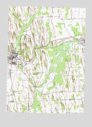
Lyons, NY USGS Topographic Map
Click on map above to begin viewing in our Map Viewer.

This topographic map contains these locations and features:
Feature Name Type Latitude Longitude GNIS ID View Map
AllowayPopulated PlaceN43.0237°W76.9886°942385View Map
Assembly of God of LyonsChurchN43.0667°W76.9910°2598189View Map
Bartons CornersLocaleN43.0544°W76.8850°2380740View Map
Black BrookStreamN43.0703°W76.9247°944086View Map
Canandaigua OutletStreamN43.0615°W76.9964°945741View Map
Creager BridgeBridgeN43.0309°W76.9547°947724View Map
Creager Bridge CemeteryCemeteryN43.0305°W76.9603°2495637View Map
D'Amico AirportAirportN43.0912°W76.9888°978126View Map
Dublin BrookStreamN43.0106°W76.9497°948721View Map
Elmwood CemeteryCemeteryN43.0747°W76.9889°949595View Map
Fellowship of FaithChurchN43.0796°W76.9463°2598204View Map
Fergusons CornersLocaleN43.1137°W76.9289°949984View Map
First Lutheran ChurchChurchN43.0638°W76.9947°2598206View Map
Grace Episcopal ChurchChurchN43.0653°W76.9897°2598211View Map
Leach Street BridgeBridgeN43.0622°W76.9964°2599568View Map
Lock BerlinPopulated PlaceN43.0790°W76.9461°955775View Map
Lock Berlin CemeteryCemeteryN43.0799°W76.9474°2495638View Map
Lock Number 2DamN43.0626°W76.9969°974714View Map
LyonsPopulated PlaceN43.0642°W76.9902°956197View Map
Lyons Census Designated PlaceCensusN43.0634°W76.9910°2784107View Map
Lyons Elementary SchoolSchoolN43.0658°W76.9907°2598179View Map
Lyons Fire DepartmentBuildingN43.0618°W76.9929°2700955View Map
Lyons Manor Assisted Living CenterBuildingN43.0632°W76.9948°2599560View Map
Lyons Middle SchoolSchoolN43.0646°W76.9843°2598182View Map
Lyons ParkParkN43.0642°W76.9833°956204View Map
Lyons Post OfficePost OfficeN43.0628°W76.9932°2599540View Map
Lyons School District Public LibraryBuildingN43.0645°W76.9894°2599587View Map
Lyons Senior High SchoolSchoolN43.0646°W76.9833°2598186View Map
Lyons United Methodist ChurchChurchN43.0654°W76.9917°2598217View Map
Maranatha Baptist ChurchChurchN43.0978°W76.9677°2598218View Map
MarengoPopulated PlaceN43.0259°W76.9105°956504View Map
Melvin BrookStreamN43.0890°W76.8914°956932View Map
Mount Zion Missionary Baptist ChurchChurchN43.0670°W76.9854°2598219View Map
Oak Hill CemeteryCemeteryN43.0866°W76.8813°2495639View Map
PilgrimportPopulated PlaceN43.0965°W76.9700°960399View Map
Pine Hill OrchardsLocaleN43.1061°W76.9881°2547491View Map
Pond BrookStreamN43.0281°W76.9522°960885View Map
Presbyterian Church of LyonsChurchN43.0655°W76.9924°2598226View Map
Rural CemeteryCemeteryN43.0716°W76.9860°963090View Map
Saint John's Lutheran ChurchChurchN43.0693°W76.9855°2598263View Map
Saint Johns CemeteryCemeteryN43.0832°W76.8839°963612View Map
Saint Michael's ChurchChurchN43.0673°W76.9888°2598264View Map
School Number 1 (historical)SchoolN43.0015°W76.9272°974911View Map
School Number 13 (historical)SchoolN43.0597°W76.9636°2380744View Map
School Number 18 (historical)SchoolN43.0303°W76.9603°2380745View Map
School Number 4 (historical)SchoolN43.0453°W76.8956°2380742View Map
School Number 7 (historical)SchoolN43.0014°W76.8978°2370149View Map
School Number 7 (historical)SchoolN43.1117°W76.9297°2380743View Map
Sodus DitchCanalN43.1184°W76.8858°965623View Map
South Lyons CemeteryCemeteryN43.0468°W76.9934°965812View Map
The Church of Jesus Christ of Latter Day SaintsChurchN43.0468°W76.9878°2598272View Map
ThompsonPopulated PlaceN43.0031°W76.9639°973151View Map
Thorns CornersLocaleN43.0261°W76.8800°2380741View Map
Town of GalenCivilN43.0705°W76.8847°978983View Map
Town of LyonsCivilN43.0882°W76.9997°979175View Map
Town of Lyons AmbulanceBuildingN43.0689°W76.9903°2719219View Map
Village of Lyons (historical)CivilN43.0634°W76.9926°2390953View Map
Wayne Hills Country ClubLocaleN43.0926°W76.9370°2599584View Map

Note: Coordinates in the location and feature list above are referenced to NAD83 datum.


Copyright (C) 2008-2025 Ryan Niemi / Sunset Dynamics ... All Rights Reserved