TopoQuest Logo
Do you find TopoQuest useful?
Help keep TopoQuest running and adding new maps/features by donating!
Bitcoin:  19c7KJd3qBynnjoSw5npx9KScwjBe4ifkT
Litecoin:  LXs6TkuXGGXo1vDsWCkWVdjQX94eUKd6ui
Home View Maps Find Maps Find Places Resources & Links


Macken Canyon, Oregon Topographic Map

USGS Map Title: Macken Canyon, OR
USGS Map MRC: 45120A6
DRG (GeoTIFF) Download: o45120a6.tif


Neighboring USGS Topographic Map Quads:


  Bronx Canyon, OR  
45120B7
 

  Kent, OR  
45120B6
 

  Horseshoe Bend, OR  
45120B5
 

  Shaniko, OR  
45120A7
 

  Macken Canyon, OR  
45120A6
 

  Bath Canyon, OR  
45120A5
 

  Shaniko Summit, OR  
44120H7
 

  Antelope, OR  
44120H6
 

  Hastings Peak, OR  
44120H5


Map MRC Location:

N46°
W121°
N46°
W120°
H8 H7 H6 H5 H4 H3 H2 H1
G8 G7 G6 G5 G4 G3 G2 G1
F8 F7 F6 F5 F4 F3 F2 F1
E8 E7 E6 E5 E4 E3 E2 E1
D8 D7 D6 D5 D4 D3 D2 D1
C8 C7 C6 C5 C4 C3 C2 C1
B8 B7 B6 B5 B4 B3 B2 B1
A8 A7 A6 A5 A4 A3 A2 A1
N45°
W121°
N45°
W120°

Macken Canyon, OR USGS 1:24K Topographic Map Preview:
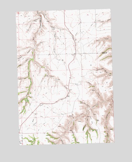
Macken Canyon, OR USGS Topographic Map
Click on map above to begin viewing in our Map Viewer.

This topographic map contains these locations and features:
Feature Name Type Latitude Longitude GNIS ID View Map
Brush CanyonValleyN45.0404°W120.6278°1118147View Map
Burgess CanyonValleyN45.0901°W120.7300°1118322View Map
Chapman HollowValleyN45.0212°W120.6795°1118827View Map
Fraser CanyonValleyN45.0040°W120.6970°1120959View Map
Howell CanyonValleyN45.1185°W120.7195°1122083View Map
Kelsey (historical)LocaleN45.0543°W120.6734°1167736View Map
Kelsey SpringSpringN45.0444°W120.6866°1122678View Map
Kibby CanyonValleyN45.1085°W120.7034°1122718View Map
Little Buck CanyonValleyN45.0329°W120.6581°1123141View Map
Little Thorn HollowValleyN45.0446°W120.7400°1123296View Map
Macken CanyonValleyN45.1226°W120.7214°1123661View Map
May CanyonValleyN45.0307°W120.6598°1123864View Map
Moonshine CanyonValleyN45.0179°W120.6617°1124327View Map
Shaniko Ranch AirportAirportN45.0046°W120.7439°2646041View Map
Taylor PointRidgeN45.0215°W120.6556°1127907View Map
Taylor SpringsSpringN45.0212°W120.6488°1127913View Map
Thompson CanyonValleyN45.0637°W120.7370°1128026View Map
Thorn HollowValleyN45.0796°W120.7320°1128042View Map
Wampus Cat CanyonValleyN45.0390°W120.6389°1128627View Map
Wood GulchValleyN45.0801°W120.7337°1129298View Map

Note: Coordinates in the location and feature list above are referenced to NAD83 datum.


Copyright (C) 2008-2025 Ryan Niemi / Sunset Dynamics ... All Rights Reserved