TopoQuest Logo
Do you find TopoQuest useful?
Help keep TopoQuest running and adding new maps/features by donating!
Bitcoin:  19c7KJd3qBynnjoSw5npx9KScwjBe4ifkT
Litecoin:  LXs6TkuXGGXo1vDsWCkWVdjQX94eUKd6ui
Home View Maps Find Maps Find Places Resources & Links


Horseshoe Bend, Oregon Topographic Map

USGS Map Title: Horseshoe Bend, OR
USGS Map MRC: 45120B5
DRG (GeoTIFF) Download: o45120b5.tif


Neighboring USGS Topographic Map Quads:


  Rosebush, OR  
45120C6
 

  Indian Cove, OR  
45120C5
 

  Indian Spring, OR  
45120C4
 

  Kent, OR  
45120B6
 

  Horseshoe Bend, OR  
45120B5
 

  Shoestring Ridge, OR  
45120B4
 

  Macken Canyon, OR  
45120A6
 

  Bath Canyon, OR  
45120A5
 

  Chimney Springs, OR  
45120A4


Map MRC Location:

N46°
W121°
N46°
W120°
H8 H7 H6 H5 H4 H3 H2 H1
G8 G7 G6 G5 G4 G3 G2 G1
F8 F7 F6 F5 F4 F3 F2 F1
E8 E7 E6 E5 E4 E3 E2 E1
D8 D7 D6 D5 D4 D3 D2 D1
C8 C7 C6 C5 C4 C3 C2 C1
B8 B7 B6 B5 B4 B3 B2 B1
A8 A7 A6 A5 A4 A3 A2 A1
N45°
W121°
N45°
W120°

Horseshoe Bend, OR USGS 1:24K Topographic Map Preview:
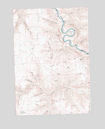
Horseshoe Bend, OR USGS Topographic Map
Click on map above to begin viewing in our Map Viewer.

This topographic map contains these locations and features:
Feature Name Type Latitude Longitude GNIS ID View Map
Adobe PointRidgeN45.2296°W120.5848°1116780View Map
Armstrong CanyonValleyN45.2387°W120.6131°1117042View Map
Buckskin CanyonValleyN45.2379°W120.5450°1118250View Map
Burned Out CanyonValleyN45.1523°W120.5798°1118336View Map
Chisholm CanyonValleyN45.2096°W120.5367°1118924View Map
Combine CanyonValleyN45.2343°W120.5442°1119177View Map
Compressor Station Number 10 Airstrip (historical)AirportN45.1332°W120.6178°1131405View Map
Cordwood CanyonValleyN45.2037°W120.5198°1119280View Map
Daugherty CanyonValleyN45.1515°W120.6175°1119696View Map
Eakin CanyonValleyN45.1498°W120.5684°1120273View Map
Finster CanyonValleyN45.1610°W120.5956°1120723View Map
George Wilson Ranch Airstrip (historical)AirportN45.1998°W120.6012°1131754View Map
Guyton CanyonValleyN45.1293°W120.5692°1121496View Map
Hannafin CanyonValleyN45.1607°W120.5887°1121563View Map
Hatley SpringsSpringN45.1798°W120.5381°1121662View Map
Horse Pasture SpringSpringN45.1884°W120.5168°1122012View Map
Horseshoe BendBendN45.2204°W120.5306°1122035View Map
Kelsay CanyonValleyN45.2496°W120.6117°1122677View Map
Kent Compressor StationLocaleN45.1285°W120.6142°1163726View Map
McInnes Norton RidgeRidgeN45.1829°W120.5545°1123972View Map
McInnes SpringSpringN45.1722°W120.5544°1123973View Map
Norton SpringSpringN45.1732°W120.5006°1124854View Map
Porter CanyonValleyN45.1368°W120.5717°1125570View Map
Potlatch CanyonValleyN45.2335°W120.5414°1125613View Map
Sand CanyonValleyN45.1621°W120.5912°1126550View Map
Stakely SpringSpringN45.1644°W120.5547°1127520View Map
Vaughn CanyonValleyN45.1998°W120.5609°1128514View Map
Warren SpringSpringN45.1722°W120.5138°1128675View Map
Wolf MountainSummitN45.1907°W120.5217°1129285View Map

Note: Coordinates in the location and feature list above are referenced to NAD83 datum.


Copyright (C) 2008-2025 Ryan Niemi / Sunset Dynamics ... All Rights Reserved