TopoQuest Logo
Do you find TopoQuest useful?
Help keep TopoQuest running and adding new maps/features by donating!
Bitcoin:  19c7KJd3qBynnjoSw5npx9KScwjBe4ifkT
Litecoin:  LXs6TkuXGGXo1vDsWCkWVdjQX94eUKd6ui
Home View Maps Find Maps Find Places Resources & Links


Madison East, Maine Topographic Map

USGS Map Title: Madison East, ME
USGS Map MRC: 44069G7
DRG (GeoTIFF) Download: o44069g7.tif


Neighboring USGS Topographic Map Quads:


  Embden Pond, ME  
44069H8
 

  Solon, ME  
44069H7
 

  Athens, ME  
44069H6
 

  Madison West, ME  
44069G8
 

  Madison East, ME  
44069G7
 

  Skowhegan, ME  
44069G6
 

  Mercer, ME  
44069F8
 

  Norridgewock, ME  
44069F7
 

  Hinckley, ME  
44069F6


Map MRC Location:

N45°
W70°
N45°
W69°
H8 H7 H6 H5 H4 H3 H2 H1
G8 G7 G6 G5 G4 G3 G2 G1
F8 F7 F6 F5 F4 F3 F2 F1
E8 E7 E6 E5 E4 E3 E2 E1
D8 D7 D6 D5 D4 D3 D2 D1
C8 C7 C6 C5 C4 C3 C2 C1
B8 B7 B6 B5 B4 B3 B2 B1
A8 A7 A6 A5 A4 A3 A2 A1
N44°
W70°
N44°
W69°

Madison East, ME USGS 1:24K Topographic Map Preview:
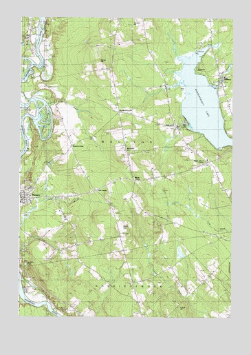
Madison East, ME USGS Topographic Map
Click on map above to begin viewing in our Map Viewer.

This topographic map contains these locations and features:
Feature Name Type Latitude Longitude GNIS ID View Map
Abnaki Camping CenterLocaleN44.8617°W69.7551°1908478View Map
Barron CornerPopulated PlaceN44.8209°W69.8445°579120View Map
Black PointCapeN44.8431°W69.7770°562480View Map
Blackwell CemeteryCemeteryN44.8194°W69.8007°2737011View Map
Blackwell CornerPopulated PlaceN44.8353°W69.8162°579141View Map
Blackwell HillSummitN44.8173°W69.8139°562535View Map
Eames HillSummitN44.8562°W69.8298°565510View Map
East MadisonPopulated PlaceN44.8495°W69.7564°565636View Map
East Madison DamDamN44.8500°W69.7568°1773725View Map
East Madison Dam CemeteryCemeteryN44.8463°W69.7585°2737018View Map
Ellis CornerPopulated PlaceN44.8028°W69.8295°579290View Map
Forest Hill CemeteryCemeteryN44.8037°W69.8697°566387View Map
Forest Hill CemeteryCemeteryN44.8042°W69.8701°1908549View Map
Jones CemeteryCemeteryN44.8482°W69.8616°2737028View Map
LakewoodPopulated PlaceN44.8314°W69.7781°569332View Map
Lakewood Golf CourseLocaleN44.8292°W69.7870°1908585View Map
Lakewood TheaterBuildingN44.8314°W69.7759°1908587View Map
Land of Rest CemeteryCemeteryN44.7601°W69.8614°569358View Map
Longley CemeteryCemeteryN44.7642°W69.8051°570341View Map
Madison Area Memorial High SchoolSchoolN44.8011°W69.8480°2738108View Map
Madison Census Designated PlaceCensusN44.8003°W69.8655°2377933View Map
Madison Fire Department East Madison StationBuildingN44.8562°W69.7601°2735790View Map
Madison Junior High SchoolSchoolN44.7979°W69.8750°1908604View Map
Martin CornerPopulated PlaceN44.8070°W69.8067°579503View Map
Morse CemeteryCemeteryN44.8003°W69.8064°571697View Map
Old Point PondLakeN44.7719°W69.8710°572721View Map
Pooler BrookStreamN44.8387°W69.8578°573620View Map
Sandy Beach Lakeside CampgroundLocaleN44.8542°W69.7817°1908677View Map
Tarbell HillSummitN44.7539°W69.7812°579030View Map
Thompson PointCapeN44.8534°W69.7720°577020View Map
Thurston HillSummitN44.8721°W69.8100°577083View Map
Town of MadisonCivilN44.8324°W69.8056°579027View Map
Union ChurchChurchN44.8512°W69.7581°577550View Map
Ward HillSummitN44.7865°W69.8128°577826View Map
Wesserunsett and Ice Seaplane BaseAirportN44.8423°W69.7689°582143View Map
Wesserunsett LakeReservoirN44.8397°W69.7677°578013View Map
Weston IslandIslandN44.8309°W69.8584°578276View Map
White School CornerPopulated PlaceN44.8148°W69.7637°579835View Map

Note: Coordinates in the location and feature list above are referenced to NAD83 datum.


Copyright (C) 2008-2025 Ryan Niemi / Sunset Dynamics ... All Rights Reserved