TopoQuest Logo
Do you find TopoQuest useful?
Help keep TopoQuest running and adding new maps/features by donating!
Bitcoin:  19c7KJd3qBynnjoSw5npx9KScwjBe4ifkT
Litecoin:  LXs6TkuXGGXo1vDsWCkWVdjQX94eUKd6ui
Home View Maps Find Maps Find Places Resources & Links


Madrid, Colorado Topographic Map

USGS Map Title: Madrid, CO
USGS Map MRC: 37104B6
DRG (GeoTIFF) Download: o37104b6.tif


Neighboring USGS Topographic Map Quads:


  Gulnare, CO  
37104C7
 

  Delagua, CO  
37104C6
 

  Ludlow, CO  
37104C5
 

  Weston, CO  
37104B7
 

  Madrid, CO  
37104B6
 

  Trinidad West, CO  
37104B5
 

  Little Pine Canyon, CO  
37104A7
 

  Valdez, CO  
37104A6
 

  Starkville, CO  
37104A5


Map MRC Location:

N38°
W105°
N38°
W104°
H8 H7 H6 H5 H4 H3 H2 H1
G8 G7 G6 G5 G4 G3 G2 G1
F8 F7 F6 F5 F4 F3 F2 F1
E8 E7 E6 E5 E4 E3 E2 E1
D8 D7 D6 D5 D4 D3 D2 D1
C8 C7 C6 C5 C4 C3 C2 C1
B8 B7 B6 B5 B4 B3 B2 B1
A8 A7 A6 A5 A4 A3 A2 A1
N37°
W105°
N37°
W104°

Madrid, CO USGS 1:24K Topographic Map Preview:
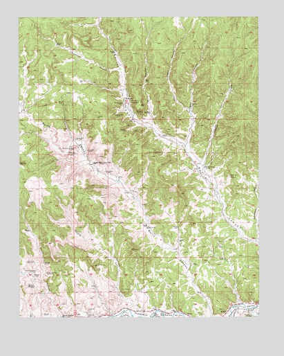
Madrid, CO USGS Topographic Map
Click on map above to begin viewing in our Map Viewer.

This topographic map contains these locations and features:
Feature Name Type Latitude Longitude GNIS ID View Map
Bon Carbo Volunteer Fire DepartmentBuildingN37.2049°W104.6881°2667156View Map
BoncarboPopulated PlaceN37.2167°W104.6950°194660View Map
Boncarbo MineMineN37.2145°W104.6964°194658View Map
Burro Canyon CemeteryCemeteryN37.1858°W104.7055°194653View Map
Chinamans CanyonValleyN37.2283°W104.6981°194666View Map
Colorado Standard SchoolLocaleN37.1253°W104.7283°194638View Map
Cottonwood CanyonValleyN37.1573°W104.6256°194637View Map
Crystal MineMineN37.1936°W104.6792°194655View Map
Deer Canyon MineMineN37.2100°W104.7189°1735205View Map
DickLocaleN37.2070°W104.6908°194668View Map
Dick Coal MineMineN37.2031°W104.6944°1735505View Map
Dicks MineMineN37.2031°W104.6947°194654View Map
Eureka MineMineN37.2147°W104.6917°194659View Map
Jacks MineMineN37.1947°W104.7147°194651View Map
Joger MineMineN37.1272°W104.6314°194824View Map
Joger MineMineN37.1278°W104.6314°194647View Map
Madrid (historical)Populated PlaceN37.1276°W104.6413°194645View Map
Madrid CanyonValleyN37.1276°W104.6343°194825View Map
Madrid DamDamN37.1267°W104.6289°200522View Map
Madrid ReservoirReservoirN37.1265°W104.6283°200523View Map
Martinez MineMineN37.1842°W104.6403°194662View Map
Middle Burro Canyon SchoolSchoolN37.1895°W104.7117°194652View Map
Midway SchoolLocaleN37.1875°W104.6539°194661View Map
Mulligan CanyonValleyN37.1970°W104.6628°194664View Map
Phelps CanyonValleyN37.1888°W104.6544°194663View Map
Pricco MineMineN37.1953°W104.7236°194649View Map
Primero (historical)Populated PlaceN37.1425°W104.7417°194641View Map
Primero Mine NorthMineN37.1447°W104.7422°194643View Map
Primero Mine SouthMineN37.1439°W104.7364°194642View Map
Primero Mine WestMineN37.1481°W104.7469°194644View Map
Primero ReservoirReservoirN37.1384°W104.7428°194640View Map
San Juan CemeteryCemeteryN37.1265°W104.7384°194639View Map
Sanchez MineMineN37.1934°W104.7205°194650View Map
Stanley MineMineN37.2095°W104.7000°194656View Map
TijerasPopulated PlaceN37.1259°W104.6630°203737View Map
Valdez CanyonValleyN37.1275°W104.6876°194648View Map
Viola MineMineN37.2134°W104.6847°194657View Map
West Mulligan CanyonValleyN37.2107°W104.6609°194665View Map
Wolf CanyonValleyN37.2049°W104.6811°194667View Map

Note: Coordinates in the location and feature list above are referenced to NAD83 datum.


Copyright (C) 2008-2024 Ryan Niemi / Sunset Dynamics ... All Rights Reserved