TopoQuest Logo
Do you find TopoQuest useful?
Help keep TopoQuest running and adding new maps/features by donating!
Bitcoin:  19c7KJd3qBynnjoSw5npx9KScwjBe4ifkT
Litecoin:  LXs6TkuXGGXo1vDsWCkWVdjQX94eUKd6ui
Home View Maps Find Maps Find Places Resources & Links


Magnolia, Alabama Topographic Map

USGS Map Title: Magnolia, AL
USGS Map MRC: 32087B6
DRG (GeoTIFF) Download: o32087b6.tif


Neighboring USGS Topographic Map Quads:


  Linden, AL  
32087C7
 

  Thomaston West, AL  
32087C6
 

  Thomaston East, AL  
32087C5
 

  Miller, AL  
32087B7
 

  Magnolia, AL  
32087B6
 

  Flatwood, AL  
32087B5
 

  Sweet Water, AL  
32087A7
 

  Surginer, AL  
32087A6
 

  Kimbrough, AL  
32087A5


Map MRC Location:

N33°
W88°
N33°
W87°
H8 H7 H6 H5 H4 H3 H2 H1
G8 G7 G6 G5 G4 G3 G2 G1
F8 F7 F6 F5 F4 F3 F2 F1
E8 E7 E6 E5 E4 E3 E2 E1
D8 D7 D6 D5 D4 D3 D2 D1
C8 C7 C6 C5 C4 C3 C2 C1
B8 B7 B6 B5 B4 B3 B2 B1
A8 A7 A6 A5 A4 A3 A2 A1
N32°
W88°
N32°
W87°

Magnolia, AL USGS 1:24K Topographic Map Preview:
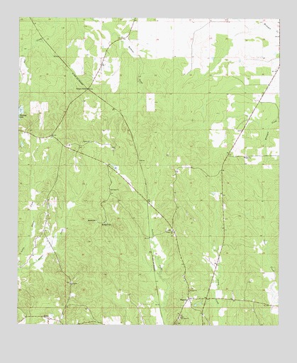
Magnolia, AL USGS Topographic Map
Click on map above to begin viewing in our Map Viewer.

This topographic map contains these locations and features:
Feature Name Type Latitude Longitude GNIS ID View Map
Bee BranchStreamN32.2407°W87.7392°137573View Map
C J Holy ChurchChurchN32.1254°W87.6747°115350View Map
Goose Creek School (historical)SchoolN32.1351°W87.6367°137606View Map
Groose CreekStreamN32.2065°W87.6297°137609View Map
Laurel ChurchChurchN32.1263°W87.7306°137618View Map
Little Beaver CreekStreamN32.1476°W87.7486°121703View Map
MagnoliaPopulated PlaceN32.1357°W87.6681°152200View Map
Magnolia CemeteryCemeteryN32.1385°W87.6678°137632View Map
Magnolia Post OfficePost OfficeN32.1351°W87.6690°168654View Map
Marengo County Lake DamDamN32.2118°W87.7483°130297View Map
Mooring CemeteryCemeteryN32.1676°W87.7125°123034View Map
Mount Pilgrim CemeteryCemeteryN32.1663°W87.7094°152480View Map
Mount Pilgrim ChurchChurchN32.1799°W87.7061°123337View Map
Mount Pilgrim Church (historical)ChurchN32.1663°W87.7072°137641View Map
New Hope CemeteryCemeteryN32.1285°W87.6719°1867930View Map
New Hope ChurchChurchN32.1279°W87.6719°123814View Map
Octagon StationLocaleN32.2213°W87.7172°124178View Map
Paradise CemeteryCemeteryN32.1996°W87.7156°1867899View Map
Paradise ChurchChurchN32.1999°W87.7161°124424View Map
Pleasant Hill CemeteryCemeteryN32.1635°W87.6761°1867904View Map
Pleasant Hill ChurchChurchN32.1635°W87.6761°152991View Map
Rock Spring ChurchChurchN32.1418°W87.7250°155220View Map
Rock Springs CemeteryCemeteryN32.1421°W87.7250°1867906View Map
Sardis ChurchChurchN32.1935°W87.6417°126410View Map
ShilohPopulated PlaceN32.1274°W87.7353°157050View Map
Surginer Volunteer Fire Department Station 2BuildingN32.1599°W87.7338°2691544View Map
Williamsburg (historical)Populated PlaceN32.1860°W87.7070°1730267View Map
Wolf BranchStreamN32.2404°W87.7422°137682View Map

Note: Coordinates in the location and feature list above are referenced to NAD83 datum.


Copyright (C) 2008-2025 Ryan Niemi / Sunset Dynamics ... All Rights Reserved