TopoQuest Logo
Do you find TopoQuest useful?
Help keep TopoQuest running and adding new maps/features by donating!
Bitcoin:  19c7KJd3qBynnjoSw5npx9KScwjBe4ifkT
Litecoin:  LXs6TkuXGGXo1vDsWCkWVdjQX94eUKd6ui
Home View Maps Find Maps Find Places Resources & Links


Malinta, Ohio Topographic Map

USGS Map Title: Malinta, OH
USGS Map MRC: 41084C1
DRG (GeoTIFF) Download: o41084c1.tif


Neighboring USGS Topographic Map Quads:


  Napoleon West, OH  
41084D2
 

  Napoleon East, OH  
41084D1
 

  Colton, OH  
41083D8
 

  Florida, OH  
41084C2
 

  Malinta, OH  
41084C1
 

  McClure, OH  
41083C8
 

  New Bavaria, OH  
41084B2
 

  Hamler, OH  
41084B1
 

  Deshler, OH  
41083B8


Map MRC Location:

N42°
W85°
N42°
W84°
H8 H7 H6 H5 H4 H3 H2 H1
G8 G7 G6 G5 G4 G3 G2 G1
F8 F7 F6 F5 F4 F3 F2 F1
E8 E7 E6 E5 E4 E3 E2 E1
D8 D7 D6 D5 D4 D3 D2 D1
C8 C7 C6 C5 C4 C3 C2 C1
B8 B7 B6 B5 B4 B3 B2 B1
A8 A7 A6 A5 A4 A3 A2 A1
N41°
W85°
N41°
W84°

Malinta, OH USGS 1:24K Topographic Map Preview:
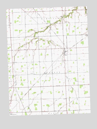
Malinta, OH USGS Topographic Map
Click on map above to begin viewing in our Map Viewer.

This topographic map contains these locations and features:
Feature Name Type Latitude Longitude GNIS ID View Map
Arps School (historical)SchoolN41.2681°W84.0569°1806389View Map
Ash RunStreamN41.2920°W84.0352°1037509View Map
Bickford School (historical)SchoolN41.3270°W84.0569°1806390View Map
Brush College (historical)SchoolN41.3270°W84.0186°1806392View Map
Brush CreekStreamN41.2614°W84.0969°1038403View Map
Deigle School (historical)SchoolN41.2973°W84.0958°1806395View Map
Dunbar School (historical)SchoolN41.2689°W84.0177°1806397View Map
EleryPopulated PlaceN41.2984°W84.0686°1064607View Map
Elery Post Office (historical)Post OfficeN41.2987°W84.0680°1994584View Map
Elery School (historical)SchoolN41.2978°W84.0569°1806399View Map
Emanuel Lutheran CemeteryCemeteryN41.2683°W84.0381°1806097View Map
Grelton CemeteryCemeteryN41.3476°W84.0005°1041182View Map
Grelton Methodist ChurchChurchN41.3414°W84.0008°1050161View Map
Henry CountyCivilN41.3339°W84.0682°1074047View Map
Henry County AirportAirportN41.3736°W84.0678°1082881View Map
Henry County South Joint Ambulance District Malinta Emergency Medical ServicesBuildingN41.3190°W84.0350°2550702View Map
Hope Lutheran CemeteryCemeteryN41.2542°W84.0563°1806098View Map
Hope Lutheran ChurchChurchN41.2542°W84.0566°1041765View Map
Huber School (historical)SchoolN41.2687°W84.0944°1806403View Map
Immanuel ChurchChurchN41.2684°W84.0374°1041927View Map
Knipp CemeteryCemeteryN41.3117°W84.1152°1806099View Map
Kratz School (historical)SchoolN41.3267°W84.0955°1806405View Map
Lost CreekStreamN41.3134°W84.0411°1042783View Map
MalintaPopulated PlaceN41.3226°W84.0380°1042904View Map
Malinta - Monroe Township Fire DepartmentBuildingN41.3190°W84.0349°2549963View Map
Malinta Post OfficePost OfficeN41.3223°W84.0374°1994573View Map
Malinta-Grelton Elementary SchoolSchoolN41.3237°W84.0361°1050160View Map
Saint John ChurchChurchN41.2970°W84.1172°1045502View Map
Saint Paul ChurchChurchN41.3125°W84.1155°1045747View Map
School CreekStreamN41.3401°W84.0833°1046011View Map
ShunkPopulated PlaceN41.3637°W84.0388°1046254View Map
Shunk Post Office (historical)Post OfficeN41.3639°W84.0388°1994596View Map
Struble School (historical)SchoolN41.2978°W84.0177°1806412View Map
Township of HarrisonCivilN41.3749°W84.0563°1086290View Map
Township of MonroeCivilN41.2977°W84.0567°1086293View Map
Village of MalintaCivilN41.3196°W84.0354°2399231View Map
West CreekStreamN41.2687°W84.0211°1047717View Map

Note: Coordinates in the location and feature list above are referenced to NAD83 datum.


Copyright (C) 2008-2025 Ryan Niemi / Sunset Dynamics ... All Rights Reserved