TopoQuest Logo
Do you find TopoQuest useful?
Help keep TopoQuest running and adding new maps/features by donating!
Bitcoin:  19c7KJd3qBynnjoSw5npx9KScwjBe4ifkT
Litecoin:  LXs6TkuXGGXo1vDsWCkWVdjQX94eUKd6ui
Home View Maps Find Maps Find Places Resources & Links


Napoleon East, Ohio Topographic Map

USGS Map Title: Napoleon East, OH
USGS Map MRC: 41084D1
DRG (GeoTIFF) Download: o41084d1.tif


Neighboring USGS Topographic Map Quads:


  Wauseon, OH  
41084E2
 

  Delta, OH  
41084E1
 

  Swanton, OH  
41083E8
 

  Napoleon West, OH  
41084D2
 

  Napoleon East, OH  
41084D1
 

  Colton, OH  
41083D8
 

  Florida, OH  
41084C2
 

  Malinta, OH  
41084C1
 

  McClure, OH  
41083C8


Map MRC Location:

N42°
W85°
N42°
W84°
H8 H7 H6 H5 H4 H3 H2 H1
G8 G7 G6 G5 G4 G3 G2 G1
F8 F7 F6 F5 F4 F3 F2 F1
E8 E7 E6 E5 E4 E3 E2 E1
D8 D7 D6 D5 D4 D3 D2 D1
C8 C7 C6 C5 C4 C3 C2 C1
B8 B7 B6 B5 B4 B3 B2 B1
A8 A7 A6 A5 A4 A3 A2 A1
N41°
W85°
N41°
W84°

Napoleon East, OH USGS 1:24K Topographic Map Preview:
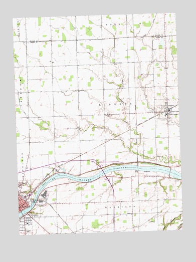
Napoleon East, OH USGS Topographic Map
Click on map above to begin viewing in our Map Viewer.

This topographic map contains these locations and features:
Feature Name Type Latitude Longitude GNIS ID View Map
City of NapoleonCivilN41.3978°W84.1244°2395148View Map
Cloverleaf (historical)Populated PlaceN41.4717°W84.0766°1050154View Map
Colonial Manor Mobile Home ParkPopulated PlaceN41.4483°W84.0078°2652197View Map
Countryside EstatesPopulated PlaceN41.3858°W84.1133°2652203View Map
Creager CemeteryCemeteryN41.4037°W84.0022°1039464View Map
Damascus (historical)Populated PlaceN41.4139°W84.0186°1065533View Map
Damascus CemeteryCemeteryN41.4177°W84.0184°1039564View Map
Damascus Post Office (historical)Post OfficeN41.4139°W84.0180°1994582View Map
Forest Hill CemeteryCemeteryN41.3913°W84.1093°1040561View Map
Henry County CourthouseBuildingN41.3909°W84.1244°1050151View Map
Henry County FairgroundLocaleN41.3795°W84.1238°1050150View Map
Henry County HospitalHospitalN41.4112°W84.0871°2548861View Map
Henry County JailBuildingN41.3912°W84.1238°1079877View Map
Henry County Sheriff's OfficeBuildingN41.3912°W84.1238°2733048View Map
Hoy CemeteryCemeteryN41.3776°W84.0377°1071007View Map
Konzem DitchCanalN41.4584°W84.1230°1065770View Map
Liberty - Washington Township Fire and Rescue DepartmentBuildingN41.4479°W84.0190°2549597View Map
Liberty CenterPopulated PlaceN41.4434°W84.0088°1064993View Map
Liberty Center Elementary SchoolSchoolN41.4417°W84.0097°1050156View Map
Liberty Center High SchoolSchoolN41.4409°W84.0105°1050155View Map
Liberty Center Post OfficePost OfficeN41.4431°W84.0083°1994578View Map
Liberty Center-Colton United Methodist ChurchChurchN41.4428°W84.0041°1071963View Map
Liberty Chapel CemeteryCemeteryN41.4720°W84.0477°1806069View Map
Liberty Chapel United Methodist ChurchChurchN41.4723°W84.0486°1072227View Map
Oak Mobile Home CourtPopulated PlaceN41.4458°W84.0019°2652198View Map
Oberhaus CreekStreamN41.4003°W84.1155°1070875View Map
Pilgrimage Holiness ChurchChurchN41.3842°W84.1174°1079878View Map
RatsvillePopulated PlaceN41.4717°W84.0763°1806408View Map
Saint Augustine Catholic ChurchChurchN41.3926°W84.1238°1050153View Map
Saint Augustine CemeteryCemeteryN41.3767°W84.1172°1045397View Map
Saint Augustine SchoolSchoolN41.3923°W84.1244°1050152View Map
Saint Pauls Lutheran ChurchChurchN41.4437°W84.0202°1072255View Map
Sharon United Methodist ChurchChurchN41.3856°W84.0386°1046136View Map
South Public School (historical)SchoolN41.3851°W84.1205°1079885View Map
Southside SchoolSchoolN41.3817°W84.1188°1079965View Map
Spiess Trailer ParkPopulated PlaceN41.4464°W84.0033°2652200View Map
Township of LibertyCivilN41.4470°W84.0579°1086291View Map
Van Hyning CreekStreamN41.3995°W84.1111°1066250View Map
Victory ChapelChurchN41.4681°W84.0180°1050157View Map
Village of Liberty CenterCivilN41.4436°W84.0078°2398435View Map
Young CemeteryCemeteryN41.4392°W84.0074°1048214View Map

Note: Coordinates in the location and feature list above are referenced to NAD83 datum.


Copyright (C) 2008-2024 Ryan Niemi / Sunset Dynamics ... All Rights Reserved