TopoQuest Logo
Do you find TopoQuest useful?
Help keep TopoQuest running and adding new maps/features by donating!
Bitcoin:  19c7KJd3qBynnjoSw5npx9KScwjBe4ifkT
Litecoin:  LXs6TkuXGGXo1vDsWCkWVdjQX94eUKd6ui
Home View Maps Find Maps Find Places Resources & Links


New Bavaria, Ohio Topographic Map

USGS Map Title: New Bavaria, OH
USGS Map MRC: 41084B2
DRG (GeoTIFF) Download: o41084b2.tif


Neighboring USGS Topographic Map Quads:


  Defiance East, OH  
41084C3
 

  Florida, OH  
41084C2
 

  Malinta, OH  
41084C1
 

  Ayersville, OH  
41084B3
 

  New Bavaria, OH  
41084B2
 

  Hamler, OH  
41084B1
 

  Continental, OH  
41084A3
 

  Miller City, OH  
41084A2
 

  Ottawa, OH  
41084A1


Map MRC Location:

N42°
W85°
N42°
W84°
H8 H7 H6 H5 H4 H3 H2 H1
G8 G7 G6 G5 G4 G3 G2 G1
F8 F7 F6 F5 F4 F3 F2 F1
E8 E7 E6 E5 E4 E3 E2 E1
D8 D7 D6 D5 D4 D3 D2 D1
C8 C7 C6 C5 C4 C3 C2 C1
B8 B7 B6 B5 B4 B3 B2 B1
A8 A7 A6 A5 A4 A3 A2 A1
N41°
W85°
N41°
W84°

New Bavaria, OH USGS 1:24K Topographic Map Preview:
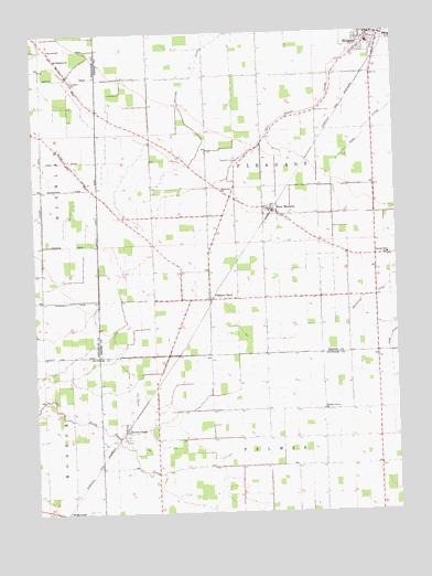
New Bavaria, OH USGS Topographic Map
Click on map above to begin viewing in our Map Viewer.

This topographic map contains these locations and features:
Feature Name Type Latitude Longitude GNIS ID View Map
Emanuels CemeteryCemeteryN41.1981°W84.1566°1050165View Map
Emmanuels United Church of ChristChurchN41.2089°W84.1855°1040185View Map
German Reformed CemeteryCemeteryN41.1923°W84.1413°1806063View Map
Henry County South Joint Ambulance District Holgate Emergency Medical ServicesBuildingN41.2490°W84.1297°2550701View Map
Hiltner AirportAirportN41.1547°W84.2174°1082904View Map
HolgatePopulated PlaceN41.2489°W84.1330°1064848View Map
Holgate High SchoolSchoolN41.2473°W84.1336°1050167View Map
Holgate Post OfficePost OfficeN41.2487°W84.1333°1994572View Map
Holgate Volunteer Fire DepartmentBuildingN41.2490°W84.1297°2549964View Map
Maple Grove DairyLocaleN41.1786°W84.2158°2703613View Map
New BavariaPopulated PlaceN41.2037°W84.1683°1043820View Map
New Bavaria - Pleasant Township Fire DepartmentBuildingN41.2042°W84.1689°2549961View Map
New Bavaria Post OfficePost OfficeN41.2042°W84.1680°1994575View Map
North CreekPopulated PlaceN41.1464°W84.2194°1057878View Map
North Creek Post Office (historical)Post OfficeN41.1459°W84.2194°2043344View Map
Old Saint Stephens Lutheran CemeteryCemeteryN41.2459°W84.2452°1961353View Map
Pleasant BendPopulated PlaceN41.1803°W84.1899°1057926View Map
Pleasant Bend Methodist ChurchChurchN41.1809°W84.1894°1050164View Map
Pleasant Grove ChurchChurchN41.1517°W84.1508°1044536View Map
Pleasant Township CemeteryCemeteryN41.2170°W84.1797°1806065View Map
Pleasantbend Post Office (historical)Post OfficeN41.1806°W84.1902°1994593View Map
Sacred Heart Catholic ChurchChurchN41.1912°W84.1277°1050166View Map
Sacred Heart CemeteryCemeteryN41.1923°W84.1269°1806066View Map
Sacred Heart School (historical)SchoolN41.1920°W84.1277°1048368View Map
Saint Johns CemeteryCemeteryN41.2298°W84.1519°1045520View Map
Saint Johns CemeteryCemeteryN41.2395°W84.1463°1050170View Map
Saint Marys CemeteryCemeteryN41.2395°W84.1455°1050169View Map
Saint Peters CemeteryCemeteryN41.2398°W84.1458°1050168View Map
Saint Stephens CemeteryCemeteryN41.2367°W84.2363°1045826View Map
Saint Stephens ChurchChurchN41.2434°W84.2419°1045828View Map
Township CemeteryCemeteryN41.2167°W84.1802°1047116View Map
Township of PleasantCivilN41.2096°W84.1704°1086295View Map
Village of HolgateCivilN41.2493°W84.1292°2398521View Map
Village of New BavariaCivilN41.2036°W84.1672°2399454View Map
Wezbra DairyLocaleN41.1333°W84.1578°2564646View Map

Note: Coordinates in the location and feature list above are referenced to NAD83 datum.


Copyright (C) 2008-2024 Ryan Niemi / Sunset Dynamics ... All Rights Reserved