TopoQuest Logo
Do you find TopoQuest useful?
Help keep TopoQuest running and adding new maps/features by donating!
Bitcoin:  19c7KJd3qBynnjoSw5npx9KScwjBe4ifkT
Litecoin:  LXs6TkuXGGXo1vDsWCkWVdjQX94eUKd6ui
Home View Maps Find Maps Find Places Resources & Links


Mallard Hill, Texas Topographic Map

USGS Map Title: Mallard Hill, TX
USGS Map MRC: 32095B8
DRG (GeoTIFF) Download: o32095b8.tif


Neighboring USGS Topographic Map Quads:


  Mabank, TX  
32096C1
 

  Stockard, TX  
32095C8
 

  Murchinson West, TX  
32095C7
 

  Malakoff, TX  
32096B1
 

  Mallard Hill, TX  
32095B8
 

  Athens, TX  
32095B7
 

  Creslenn Ranch, TX  
32096A1
 

  Cross Roads, TX  
32095A8
 

  Coon Creek Lake, TX  
32095A7


Map MRC Location:

N33°
W96°
N33°
W95°
H8 H7 H6 H5 H4 H3 H2 H1
G8 G7 G6 G5 G4 G3 G2 G1
F8 F7 F6 F5 F4 F3 F2 F1
E8 E7 E6 E5 E4 E3 E2 E1
D8 D7 D6 D5 D4 D3 D2 D1
C8 C7 C6 C5 C4 C3 C2 C1
B8 B7 B6 B5 B4 B3 B2 B1
A8 A7 A6 A5 A4 A3 A2 A1
N32°
W96°
N32°
W95°

Mallard Hill, TX USGS 1:24K Topographic Map Preview:
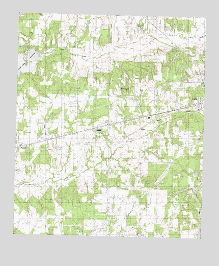
Mallard Hill, TX USGS Topographic Map
Click on map above to begin viewing in our Map Viewer.

This topographic map contains these locations and features:
Feature Name Type Latitude Longitude GNIS ID View Map
Circle R Ranch AirportAirportN32.1397°W95.9703°1387131View Map
Crescent HeightsPopulated PlaceN32.1868°W95.9433°1341554View Map
Crescent Heights Baptist ChurchChurchN32.1860°W95.9469°2021038View Map
DauphinPopulated PlaceN32.1871°W95.9166°1378203View Map
Dodd LakeLakeN32.1813°W95.9775°1334433View Map
First Assembly of God ChurchChurchN32.1752°W95.9950°2021035View Map
Forest Grove DamDamN32.2285°W95.9652°1862887View Map
Forest Grove ReservoirReservoirN32.2285°W95.9652°1862888View Map
Goodgame CemeteryCemeteryN32.1540°W95.9219°1336707View Map
Henderson County Constable's Office Precinct 5BuildingN32.1758°W95.9883°2751470View Map
Hollywood LakeReservoirN32.1276°W95.8759°1337968View Map
KCKL-FM (Malakoff)TowerN32.1468°W95.9739°1385928View Map
Larue BranchStreamN32.2396°W95.9011°1339643View Map
Malakoff CemeteryCemeteryN32.1935°W95.9964°1340878View Map
Mine Number FiveMineN32.1890°W95.9605°1341707View Map
Onemile CreekStreamN32.2382°W95.8800°1343278View Map
Saint John Lutheran ChurchChurchN32.2013°W95.8780°2020997View Map
Second Caney CreekStreamN32.2393°W95.8766°1346859View Map
Texas Department of Public Safety - Highway Patrol OfficeBuildingN32.2101°W95.8758°2751473View Map
Third Caney CreekStreamN32.2396°W95.8777°1348471View Map
Tri-Cities Gas FieldOilfieldN32.1343°W95.9269°1348766View Map
Tri-City ChurchChurchN32.1396°W95.9380°1348765View Map
Walnut Creek CemeteryCemeteryN32.1788°W95.9233°1349435View Map

Note: Coordinates in the location and feature list above are referenced to NAD83 datum.


Copyright (C) 2008-2025 Ryan Niemi / Sunset Dynamics ... All Rights Reserved