TopoQuest Logo
Do you find TopoQuest useful?
Help keep TopoQuest running and adding new maps/features by donating!
Bitcoin:  19c7KJd3qBynnjoSw5npx9KScwjBe4ifkT
Litecoin:  LXs6TkuXGGXo1vDsWCkWVdjQX94eUKd6ui
Home View Maps Find Maps Find Places Resources & Links


Malone, Washington Topographic Map

USGS Map Title: Malone, WA
USGS Map MRC: 46123H3
DRG (GeoTIFF) Download: o46123h3.tif


Neighboring USGS Topographic Map Quads:


  Elma, WA  
47123A4
 

  McCleary, WA  
47123A3
 

  Kamilche Valley, WA  
47123A2
 

  South Elma, WA  
46123H4
 

  Malone, WA  
46123H3
 

  Capitol Peak, WA  
46123H2
 

  Blue Mountain, WA  
46123G4
 

  Cedarville, WA  
46123G3
 

  Oakville, WA  
46123G2


Map MRC Location:

N47°
W124°
N47°
W123°
H8 H7 H6 H5 H4 H3 H2 H1
G8 G7 G6 G5 G4 G3 G2 G1
F8 F7 F6 F5 F4 F3 F2 F1
E8 E7 E6 E5 E4 E3 E2 E1
D8 D7 D6 D5 D4 D3 D2 D1
C8 C7 C6 C5 C4 C3 C2 C1
B8 B7 B6 B5 B4 B3 B2 B1
A8 A7 A6 A5 A4 A3 A2 A1
N46°
W124°
N46°
W123°

Malone, WA USGS 1:24K Topographic Map Preview:
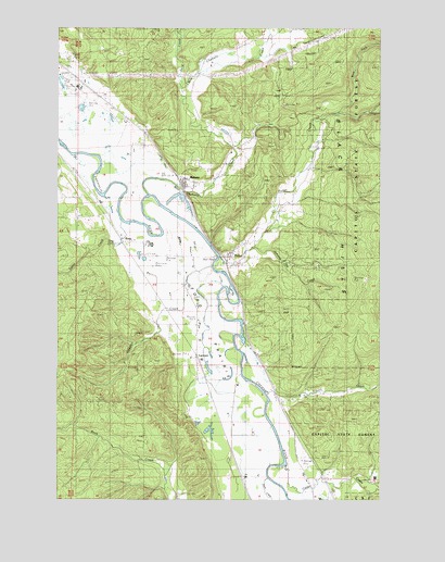
Malone, WA USGS Topographic Map
Click on map above to begin viewing in our Map Viewer.

This topographic map contains these locations and features:
Feature Name Type Latitude Longitude GNIS ID View Map
Cedar CreekStreamN46.8837°W123.2882°1503876View Map
Eaton CreekStreamN46.9559°W123.3585°1504665View Map
Ford PrairieFlatN46.9193°W123.3188°1504950View Map
Gaddis CreekStreamN46.9301°W123.3140°1505069View Map
Gibson CreekStreamN46.9034°W123.2957°1505124View Map
Grays Harbor Fire District 5 Station 52 PorterBuildingN46.9394°W123.3100°2619726View Map
GreenwoodPopulated PlaceN46.9840°W123.3665°1514848View Map
Greenwood Mobile Home ParkPopulated PlaceN46.9920°W123.3735°2607044View Map
Jamaica Day CreekStreamN46.9415°W123.2999°1509703View Map
LanknerPopulated PlaceN46.9137°W123.3221°1511088View Map
Little Spur Truck TrailTrailN46.9212°W123.2677°1506230View Map
MalonePopulated PlaceN46.9593°W123.3285°1514849View Map
Malone Assembly of God ChurchChurchN46.9602°W123.3273°2608990View Map
Malone Census Designated PlaceCensusN46.9779°W123.3035°2633137View Map
Malone Village Post OfficePost OfficeN46.9592°W123.3285°2606972View Map
Malone-Porter Census Designated Place (historical)CensusN46.9743°W123.3023°2408165View Map
Malone-Porter DivisionCivilN46.9391°W123.3170°1939554View Map
Mox Chehalis CreekStreamN46.9662°W123.3618°1506849View Map
PorterPopulated PlaceN46.9390°W123.3107°1507585View Map
Porter Census Designated PlaceCensusN46.9489°W123.2736°2585019View Map
Porter CreekStreamN46.9393°W123.3152°1507586View Map
Rock CreekStreamN46.8798°W123.2929°1507849View Map
RonyPopulated PlaceN46.9437°W123.3521°1511270View Map
Sand CreekStreamN46.9840°W123.3285°1508082View Map
Sharon CemeteryCemeteryN46.9287°W123.3224°1508252View Map
Sharon GrangeLocaleN46.9329°W123.3293°1508253View Map
Shelton CreekStreamN46.8779°W123.2535°1508290View Map
West Fork Porter CreekStreamN46.9784°W123.2679°1509401View Map

Note: Coordinates in the location and feature list above are referenced to NAD83 datum.


Copyright (C) 2008-2024 Ryan Niemi / Sunset Dynamics ... All Rights Reserved