TopoQuest Logo
Do you find TopoQuest useful?
Help keep TopoQuest running and adding new maps/features by donating!
Bitcoin:  19c7KJd3qBynnjoSw5npx9KScwjBe4ifkT
Litecoin:  LXs6TkuXGGXo1vDsWCkWVdjQX94eUKd6ui
Home View Maps Find Maps Find Places Resources & Links


Malpais Hill, New Mexico Topographic Map

USGS Map Title: Malpais Hill, NM
USGS Map MRC: 31107G7
DRG (GeoTIFF) Download: o31107g7.tif


Neighboring USGS Topographic Map Quads:


  Hermanas NW, NM  
31107H8
 

  West Lime Hills, NM  
31107H7
 

  North Peak, NM  
31107H6
 

  Hermanas, NM  
31107G8
 

  Malpais Hill, NM  
31107G7
 

  Columbus, NM  
31107G6


Map MRC Location:

N32°
W108°
N32°
W107°
H8 H7 H6 H5 H4 H3 H2 H1
G8 G7 G6 G5 G4 G3 G2 G1
F8 F7 F6 F5 F4 F3 F2 F1
E8 E7 E6 E5 E4 E3 E2 E1
D8 D7 D6 D5 D4 D3 D2 D1
C8 C7 C6 C5 C4 C3 C2 C1
B8 B7 B6 B5 B4 B3 B2 B1
A8 A7 A6 A5 A4 A3 A2 A1
N31°
W108°
N31°
W107°

Malpais Hill, NM USGS 1:24K Topographic Map Preview:
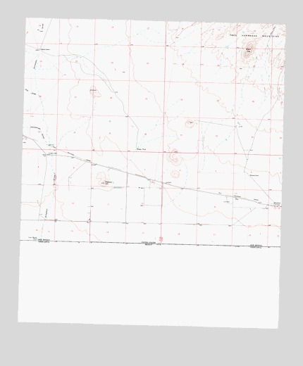
Malpais Hill, NM USGS Topographic Map
Click on map above to begin viewing in our Map Viewer.

This topographic map contains these locations and features:
Feature Name Type Latitude Longitude GNIS ID View Map
001161 Water WellWellN31.7859°W107.8347°923309View Map
01077 Water WellWellN31.8618°W107.8689°922435View Map
01124 Water WellWellN31.8112°W107.7625°930241View Map
01126 Water WellWellN31.8057°W107.7911°922440View Map
01127 Water WellWellN31.8015°W107.7770°923317View Map
01129 Water WellWellN31.7990°W107.7659°923313View Map
01130 Water WellWellN31.8004°W107.7500°927410View Map
01134 Water WellWellN31.8218°W107.8220°930244View Map
01136 Water WellWellN31.8195°W107.8634°923320View Map
01141 Water WellWellN31.8218°W107.8720°930245View Map
01149 Water WellWellN31.8037°W107.8386°930256View Map
01150 Water WellWellN31.7990°W107.8386°930250View Map
01151 Water WellWellN31.7957°W107.8422°922448View Map
01153 Water WellWellN31.8009°W107.8247°930255View Map
01154 Water WellWellN31.7990°W107.8256°923314View Map
01155 Water WellWellN31.8065°W107.8167°922442View Map
01157 Water WellWellN31.7998°W107.8134°930253View Map
01159 Water WellWellN31.7984°W107.8084°922450View Map
01162 Water WellWellN31.7859°W107.8425°923310View Map
01650 Water WellWellN31.8323°W107.7717°930237View Map
01657 Water WellWellN31.8101°W107.8167°922443View Map
01658 Water WellWellN31.7926°W107.8511°930247View Map
06126 Water WellWellN31.7998°W107.8134°930252View Map
06127 Water WellWellN31.8245°W107.8245°930235View Map
06157 Water WellWellN31.8279°W107.8245°930236View Map
10429 Water WellWellN31.8132°W107.7811°923319View Map
10430 Water WellWellN31.8048°W107.7864°922439View Map
10431 Water WellWellN31.7984°W107.7581°922449View Map
10432 Water WellWellN31.7926°W107.7872°930246View Map
10433 Water WellWellN31.7918°W107.7742°923312View Map
10437 Water WellWellN31.8073°W107.8717°930240View Map
10438 Water WellWellN31.8073°W107.8386°930257View Map
10439 Water WellWellN31.8057°W107.8256°922441View Map
10440 Water WellWellN31.7893°W107.8086°922445View Map
10441 Water WellWellN31.7920°W107.8589°922446View Map
1078 Water WellWellN31.8326°W107.8211°923324View Map
Black TopSummitN31.8651°W107.7670°899540View Map
Cox DrawValleyN31.8429°W107.8681°887996View Map
Dogtown RanchLocaleN31.8620°W107.8695°888439View Map
Edwards RanchLocaleN31.8129°W107.7661°888780View Map
Hermanas DrawValleyN31.8234°W107.8634°889916View Map
Hoppy TankReservoirN31.8223°W107.8208°890128View Map
Line Ranch TankReservoirN31.7843°W107.8671°891088View Map
M-3928 Water WellWellN31.8129°W107.7886°922444View Map
Malpais HillSummitN31.8082°W107.8367°891560View Map
MimbresPopulated PlaceN31.8007°W107.7545°898575View Map
Simpson DrawValleyN31.7837°W107.8659°894860View Map
Simpson WellWellN31.8193°W107.8631°894864View Map

Note: Coordinates in the location and feature list above are referenced to NAD83 datum.


Copyright (C) 2008-2025 Ryan Niemi / Sunset Dynamics ... All Rights Reserved