TopoQuest Logo
Do you find TopoQuest useful?
Help keep TopoQuest running and adding new maps/features by donating!
Bitcoin:  19c7KJd3qBynnjoSw5npx9KScwjBe4ifkT
Litecoin:  LXs6TkuXGGXo1vDsWCkWVdjQX94eUKd6ui
Home View Maps Find Maps Find Places Resources & Links


Hermanas, New Mexico Topographic Map

USGS Map Title: Hermanas, NM
USGS Map MRC: 31107G8
DRG (GeoTIFF) Download: o31107g8.tif


Neighboring USGS Topographic Map Quads:


  Flying W Mountain, NM  
31108H1
 

  Hermanas NW, NM  
31107H8
 

  West Lime Hills, NM  
31107H7
 

  Victorio Ranch SE, NM  
31108G1
 

  Hermanas, NM  
31107G8
 

  Malpais Hill, NM  
31107G7


Map MRC Location:

N32°
W108°
N32°
W107°
H8 H7 H6 H5 H4 H3 H2 H1
G8 G7 G6 G5 G4 G3 G2 G1
F8 F7 F6 F5 F4 F3 F2 F1
E8 E7 E6 E5 E4 E3 E2 E1
D8 D7 D6 D5 D4 D3 D2 D1
C8 C7 C6 C5 C4 C3 C2 C1
B8 B7 B6 B5 B4 B3 B2 B1
A8 A7 A6 A5 A4 A3 A2 A1
N31°
W108°
N31°
W107°

Hermanas, NM USGS 1:24K Topographic Map Preview:
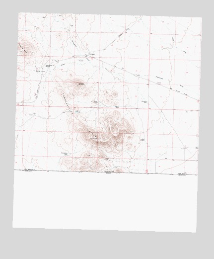
Hermanas, NM USGS Topographic Map
Click on map above to begin viewing in our Map Viewer.

This topographic map contains these locations and features:
Feature Name Type Latitude Longitude GNIS ID View Map
01137 Water WellWellN31.8148°W107.8845°930242View Map
01138 Water WellWellN31.8198°W107.8848°923321View Map
01139 Water WellWellN31.8201°W107.8806°930243View Map
01140 Water WellWellN31.8218°W107.8759°930234View Map
01143 Water WellWellN31.7990°W107.8984°930251View Map
01144 Water WellWellN31.7982°W107.8917°930249View Map
01145 Water WellWellN31.7990°W107.8931°923316View Map
01147 Water WellWellN31.7998°W107.8811°930254View Map
01148 Water WellWellN31.7990°W107.8761°923315View Map
01163 Water WellWellN31.7912°W107.8761°923311View Map
01166 Water WellWellN31.7926°W107.8848°930248View Map
01167 Water WellWellN31.7854°W107.8850°923308View Map
01651 Water WellWellN31.8479°W107.9556°922434View Map
01652 Water WellWellN31.8434°W107.9795°930239View Map
01653 Water WellWellN31.8459°W107.9786°930258View Map
01654 Water WellWellN31.8432°W107.9834°922433View Map
01655 Water WellWellN31.8243°W107.9450°923323View Map
01659 Water WellWellN31.8032°W107.9125°923318View Map
10421 Water WellWellN31.8237°W107.8753°923322View Map
10436 Water WellWellN31.7920°W107.8967°922447View Map
Baker DrawValleyN31.8470°W107.9528°897307View Map
Bartsdale TankReservoirN31.8253°W107.9115°886092View Map
CalumetMineN31.7912°W107.9389°916187View Map
Calumet MineMineN31.7915°W107.9386°887093View Map
Carrizalillo HillsSummitN31.8032°W107.9478°897328View Map
Corrizalillo SpringSpringN31.8446°W107.9811°887884View Map
Crowville WindmillLocaleN31.8029°W107.9120°888120View Map
HermanasPopulated PlaceN31.8509°W107.9520°899669View Map
Hermanas Post Office (historical)Post OfficeN31.8509°W107.9520°938379View Map
Hermanas Weather StationLocaleN31.8509°W107.9520°931649View Map
Johnson MountainSummitN31.8345°W107.9584°890506View Map
Johnson Ranchhouse Section Thirty Three ProspectMineN31.8340°W107.9656°916197View Map
Johnson Ranchhouse Section Twenty Eight ProspectMineN31.8395°W107.9695°916196View Map
Lower CorralLocaleN31.8162°W107.9884°891424View Map
Midway WindmillLocaleN31.8243°W107.9448°892026View Map
Number 1 TankReservoirN31.8219°W107.9328°898052View Map
Number 2 TankReservoirN31.8183°W107.9592°898062View Map
Schoolhouse WindmillLocaleN31.8482°W107.9550°894658View Map
Scott WindmillLocaleN31.7990°W107.8845°894671View Map
Thirtythree TankReservoirN31.7939°W107.9646°895621View Map

Note: Coordinates in the location and feature list above are referenced to NAD83 datum.


Copyright (C) 2008-2025 Ryan Niemi / Sunset Dynamics ... All Rights Reserved