TopoQuest Logo
Do you find TopoQuest useful?
Help keep TopoQuest running and adding new maps/features by donating!
Bitcoin:  19c7KJd3qBynnjoSw5npx9KScwjBe4ifkT
Litecoin:  LXs6TkuXGGXo1vDsWCkWVdjQX94eUKd6ui
Home View Maps Find Maps Find Places Resources & Links


Hermanas NW, New Mexico Topographic Map

USGS Map Title: Hermanas NW, NM
USGS Map MRC: 31107H8
DRG (GeoTIFF) Download: o31107h8.tif


Neighboring USGS Topographic Map Quads:


  Gage SE, NM  
32108A1
 

  Bisbee Hills, NM  
32107A8
 

  Midway Butte, NM  
32107A7
 

  Flying W Mountain, NM  
31108H1
 

  Hermanas NW, NM  
31107H8
 

  West Lime Hills, NM  
31107H7
 

  Victorio Ranch SE, NM  
31108G1
 

  Hermanas, NM  
31107G8
 

  Malpais Hill, NM  
31107G7


Map MRC Location:

N32°
W108°
N32°
W107°
H8 H7 H6 H5 H4 H3 H2 H1
G8 G7 G6 G5 G4 G3 G2 G1
F8 F7 F6 F5 F4 F3 F2 F1
E8 E7 E6 E5 E4 E3 E2 E1
D8 D7 D6 D5 D4 D3 D2 D1
C8 C7 C6 C5 C4 C3 C2 C1
B8 B7 B6 B5 B4 B3 B2 B1
A8 A7 A6 A5 A4 A3 A2 A1
N31°
W108°
N31°
W107°

Hermanas NW, NM USGS 1:24K Topographic Map Preview:
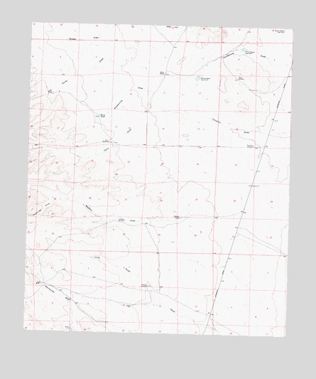
Hermanas NW, NM USGS Topographic Map
Click on map above to begin viewing in our Map Viewer.

This topographic map contains these locations and features:
Feature Name Type Latitude Longitude GNIS ID View Map
01074 Water WellWellN31.8784°W107.8923°922436View Map
01079 Water WellWellN31.8943°W107.9931°922438View Map
01081 Water WellWellN31.8940°W107.9423°922437View Map
01636 Water WellWellN31.9201°W107.9567°923327View Map
0166 Water WellWellN31.9787°W107.9014°922429View Map
01668 Water WellWellN31.9518°W107.8934°923329View Map
Art TankReservoirN31.9718°W107.9894°885910View Map
Corkscrew DrawValleyN31.9279°W107.9864°887847View Map
Cox RanchLocaleN31.8945°W107.9934°887998View Map
Frijole TankReservoirN31.9222°W107.9271°889239View Map
Horse DrawValleyN31.9801°W107.9373°890157View Map
Kent TankReservoirN31.9804°W107.9365°890671View Map
Long DrawValleyN31.8868°W107.9375°891300View Map
Midway WindmillLocaleN31.8940°W107.9423°892027View Map
Miller WindmillLocaleN31.9787°W107.9011°892065View Map
Miller-Gibson Dam Number 3DamN31.9795°W107.9200°898046View Map
Miller-Gibson Dam Number 4DamN31.9909°W107.8984°898047View Map
Ruckman WindmillLocaleN31.9520°W107.8931°894210View Map
Sacaton DrawValleyN31.9409°W107.8900°894241View Map
Sacaton WindmillLocaleN31.9204°W107.9564°894243View Map
Terry DrawValleyN31.9726°W107.9436°895594View Map
Terry TankReservoirN31.9628°W107.9671°895595View Map
Terry WindmillLocaleN31.9523°W107.9625°895597View Map

Note: Coordinates in the location and feature list above are referenced to NAD83 datum.


Copyright (C) 2008-2025 Ryan Niemi / Sunset Dynamics ... All Rights Reserved