TopoQuest Logo
Do you find TopoQuest useful?
Help keep TopoQuest running and adding new maps/features by donating!
Bitcoin:  19c7KJd3qBynnjoSw5npx9KScwjBe4ifkT
Litecoin:  LXs6TkuXGGXo1vDsWCkWVdjQX94eUKd6ui
Home View Maps Find Maps Find Places Resources & Links


Bayland SE, Mississippi Topographic Map

USGS Map Title: Bayland SE, MS
USGS Map MRC: 32090G5
DRG (GeoTIFF) Download: o32090g5.tif


Neighboring USGS Topographic Map Quads:


  Bayland, MS  
32090H6
 

  Louise, MS  
32090H5
 

  Carter, MS  
32090H4
 

  Holly Bluff, MS  
32090G6
 

  Bayland SE, MS  
32090G5
 

  Yazoo City, MS  
32090G4
 

  Lucre, MS  
32090F6
 

  Satartia, MS  
32090F5
 

  Tinsley, MS  
32090F4


Map MRC Location:

N33°
W91°
N33°
W90°
H8 H7 H6 H5 H4 H3 H2 H1
G8 G7 G6 G5 G4 G3 G2 G1
F8 F7 F6 F5 F4 F3 F2 F1
E8 E7 E6 E5 E4 E3 E2 E1
D8 D7 D6 D5 D4 D3 D2 D1
C8 C7 C6 C5 C4 C3 C2 C1
B8 B7 B6 B5 B4 B3 B2 B1
A8 A7 A6 A5 A4 A3 A2 A1
N32°
W91°
N32°
W90°

Bayland SE, MS USGS 1:24K Topographic Map Preview:
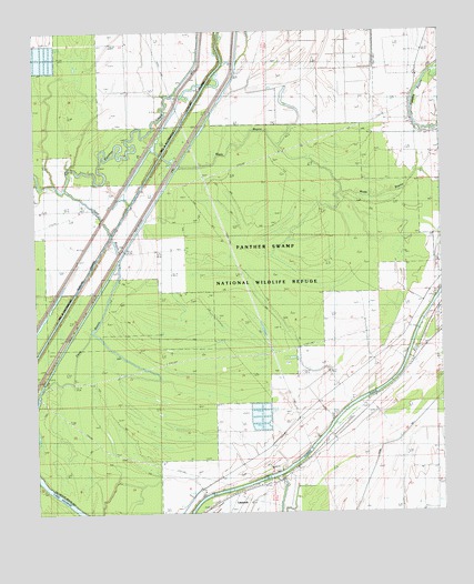
Bayland SE, MS USGS Topographic Map
Click on map above to begin viewing in our Map Viewer.

This topographic map contains these locations and features:
Feature Name Type Latitude Longitude GNIS ID View Map
Avoca LandingLocaleN32.7557°W90.5668°707837View Map
Banks CemeteryCemeteryN32.8479°W90.5043°666504View Map
Battaille SchoolSchoolN32.8587°W90.5090°666570View Map
Deep BayouGutN32.8143°W90.5987°669189View Map
Haw Bluff LandingLocaleN32.7593°W90.5507°707865View Map
Joes Walk LandingLocaleN32.7890°W90.5106°707876View Map
John Roberson CemeteryCemeteryN32.8515°W90.5081°671901View Map
Lake GeorgeLakeN32.7540°W90.6170°693292View Map
LimerickPopulated PlaceN32.7551°W90.5623°692005View Map
Limericks LandingLocaleN32.7629°W90.5445°707882View Map
Mayday CemeteryCemeteryN32.8657°W90.5034°673259View Map
Mount Olive ChurchChurchN32.8104°W90.5015°666111View Map
New Paradise ChurchChurchN32.7632°W90.5534°674795View Map
Oak Valley CemeteryCemeteryN32.7621°W90.5526°675106View Map
Oak Valley LandingLocaleN32.7749°W90.5334°707894View Map
Panther Swamp National Wildlife RefugeParkN32.8443°W90.5709°704482View Map
Pauls LandingLocaleN32.7796°W90.5262°707896View Map
Ratcliffs LandingLocaleN32.7737°W90.5329°707899View Map
Rough and Ready LandingLocaleN32.7974°W90.5087°707902View Map
Sherrards Old LandingLocaleN32.7779°W90.5270°707909View Map
Supervisor District 5CivilN32.8269°W90.5848°704467View Map
Triune ChurchChurchN32.8579°W90.5093°678890View Map
Twelve Mile Bayou LandingLocaleN32.7612°W90.5473°707915View Map
Wade BayouStreamN32.8399°W90.5801°679234View Map
Willowdale LandingLocaleN32.7810°W90.5184°679747View Map

Note: Coordinates in the location and feature list above are referenced to NAD83 datum.


Copyright (C) 2008-2025 Ryan Niemi / Sunset Dynamics ... All Rights Reserved