TopoQuest Logo
Do you find TopoQuest useful?
Help keep TopoQuest running and adding new maps/features by donating!
Bitcoin:  19c7KJd3qBynnjoSw5npx9KScwjBe4ifkT
Litecoin:  LXs6TkuXGGXo1vDsWCkWVdjQX94eUKd6ui
Home View Maps Find Maps Find Places Resources & Links


Tinsley, Mississippi Topographic Map

USGS Map Title: Tinsley, MS
USGS Map MRC: 32090F4
DRG (GeoTIFF) Download: o32090f4.tif


Neighboring USGS Topographic Map Quads:


  Bayland SE, MS  
32090G5
 

  Yazoo City, MS  
32090G4
 

  Benton, MS  
32090G3
 

  Satartia, MS  
32090F5
 

  Tinsley, MS  
32090F4
 

  Bentonia, MS  
32090F3
 

  Phoenix, MS  
32090E5
 

  Coxs Ferry, MS  
32090E4
 

  Flora, MS  
32090E3


Map MRC Location:

N33°
W91°
N33°
W90°
H8 H7 H6 H5 H4 H3 H2 H1
G8 G7 G6 G5 G4 G3 G2 G1
F8 F7 F6 F5 F4 F3 F2 F1
E8 E7 E6 E5 E4 E3 E2 E1
D8 D7 D6 D5 D4 D3 D2 D1
C8 C7 C6 C5 C4 C3 C2 C1
B8 B7 B6 B5 B4 B3 B2 B1
A8 A7 A6 A5 A4 A3 A2 A1
N32°
W91°
N32°
W90°

Tinsley, MS USGS 1:24K Topographic Map Preview:
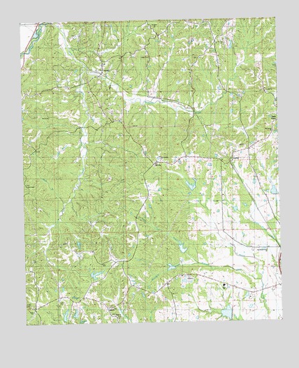
Tinsley, MS USGS Topographic Map
Click on map above to begin viewing in our Map Viewer.

This topographic map contains these locations and features:
Feature Name Type Latitude Longitude GNIS ID View Map
AndingPopulated PlaceN32.6921°W90.3979°690981View Map
Bentonia Gibbs Elementary SchoolSchoolN32.6398°W90.4033°670374View Map
Bentonia Watershed Structure 1 DamDamN32.6468°W90.4301°681556View Map
Bentonia Watershed Structure 2 DamDamN32.6568°W90.4234°681564View Map
Bentonia Watershed Structure 3 DamDamN32.6735°W90.4218°681574View Map
Bentonia Watershed Structure 4 DamDamN32.6685°W90.3918°681571View Map
Bentonia Watershed Structure 5 DamDamN32.6768°W90.3768°681578View Map
Bentonia Watershed Structure 7 DamDamN32.6268°W90.3968°681541View Map
Bill Link Pond DamDamN32.6268°W90.4734°681542View Map
Brickyard CreekStreamN32.6482°W90.4162°667563View Map
Cessna CemeteryCemeteryN32.7351°W90.4373°668292View Map
Chethams (historical)Populated PlaceN32.6640°W90.4445°686660View Map
Concord ChurchChurchN32.7201°W90.3806°668738View Map
Ditch BranchStreamN32.6749°W90.4787°669274View Map
Hudson CemeteryCemeteryN32.7401°W90.4004°671558View Map
Lewis School (historical)SchoolN32.6460°W90.4954°691148View Map
Logan BranchStreamN32.6993°W90.4706°672768View Map
Mount Ever ChurchChurchN32.7104°W90.4870°673989View Map
New Concord ChurchChurchN32.6926°W90.4329°691074View Map
New Pleasant Grove ChurchChurchN32.6546°W90.3812°691161View Map
Ogden CemeteryCemeteryN32.6343°W90.4834°675145View Map
Ogden CemeteryCemeteryN32.6312°W90.4570°1959756View Map
Ogden ChurchChurchN32.6307°W90.4587°675146View Map
Oil CityPopulated PlaceN32.6912°W90.4340°675147View Map
Old Concord ChurchChurchN32.7035°W90.3776°691137View Map
Perry ChapelChurchN32.6818°W90.4990°675623View Map
Perry CreekStreamN32.7496°W90.4837°675625View Map
Providence ChurchChurchN32.7474°W90.4340°676381View Map
Ralph Fears Lake DamDamN32.6451°W90.4684°681553View Map
Saint Paul ChurchChurchN32.6429°W90.4176°677192View Map
Sandy CreekStreamN32.6482°W90.4162°677384View Map
Scotland CreekStreamN32.6418°W90.3845°677467View Map
Supervisor District 1CivilN32.6769°W90.4347°712153View Map
Thompson CreekStreamN32.7315°W90.4693°678709View Map
TinsleyPopulated PlaceN32.7321°W90.4604°690992View Map
Tinsley Baptist ChurchChurchN32.7324°W90.4598°686689View Map
Tinsley Oil FieldOilfieldN32.6979°W90.4618°678770View Map
Tinsley Post OfficePost OfficeN32.7287°W90.4612°712941View Map
V W Landen Pond DamDamN32.7168°W90.3968°681600View Map
Woodbine Plantation (historical)LocaleN32.6279°W90.4043°686692View Map

Note: Coordinates in the location and feature list above are referenced to NAD83 datum.


Copyright (C) 2008-2025 Ryan Niemi / Sunset Dynamics ... All Rights Reserved