TopoQuest Logo
Do you find TopoQuest useful?
Help keep TopoQuest running and adding new maps/features by donating!
Bitcoin:  19c7KJd3qBynnjoSw5npx9KScwjBe4ifkT
Litecoin:  LXs6TkuXGGXo1vDsWCkWVdjQX94eUKd6ui
Home View Maps Find Maps Find Places Resources & Links


Carter, Mississippi Topographic Map

USGS Map Title: Carter, MS
USGS Map MRC: 32090H4
DRG (GeoTIFF) Download: o32090h4.tif


Neighboring USGS Topographic Map Quads:


  Midnight, MS  
33090A5
 

  Silver City, MS  
33090A4
 

  Thornton, MS  
33090A3
 

  Louise, MS  
32090H5
 

  Carter, MS  
32090H4
 

  Eden, MS  
32090H3
 

  Bayland SE, MS  
32090G5
 

  Yazoo City, MS  
32090G4
 

  Benton, MS  
32090G3


Map MRC Location:

N33°
W91°
N33°
W90°
H8 H7 H6 H5 H4 H3 H2 H1
G8 G7 G6 G5 G4 G3 G2 G1
F8 F7 F6 F5 F4 F3 F2 F1
E8 E7 E6 E5 E4 E3 E2 E1
D8 D7 D6 D5 D4 D3 D2 D1
C8 C7 C6 C5 C4 C3 C2 C1
B8 B7 B6 B5 B4 B3 B2 B1
A8 A7 A6 A5 A4 A3 A2 A1
N32°
W91°
N32°
W90°

Carter, MS USGS 1:24K Topographic Map Preview:
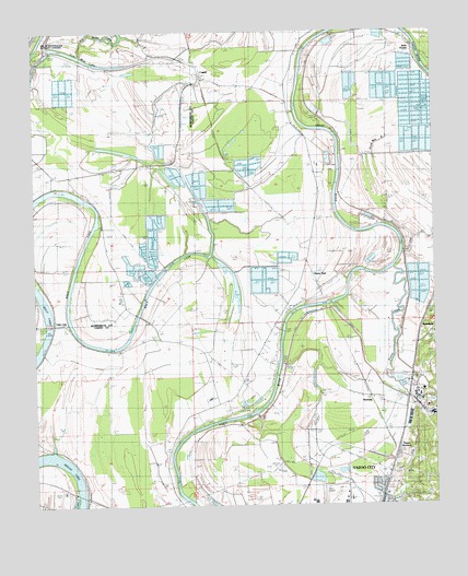
Carter, MS USGS Topographic Map
Click on map above to begin viewing in our Map Viewer.

This topographic map contains these locations and features:
Feature Name Type Latitude Longitude GNIS ID View Map
Altons LandingLocaleN32.9496°W90.4043°686652View Map
Antioch ChurchChurchN32.8996°W90.3937°666315View Map
Ashwood LandingLocaleN32.9576°W90.4051°707836View Map
Beech Grove LandingLocaleN32.9904°W90.3793°707838View Map
Belle PrairiePopulated PlaceN32.9951°W90.3812°683135View Map
Bethel ChurchChurchN32.9746°W90.4248°666925View Map
Boston Place LandingLocaleN32.9201°W90.4220°707842View Map
Boston Plantation (historical)LocaleN32.8974°W90.4265°686656View Map
Broad LakeLakeN32.8882°W90.4987°667584View Map
Brown CemeteryCemeteryN32.9496°W90.4759°667618View Map
Burrus Line SchoolSchoolN32.9246°W90.4895°667842View Map
CarterPopulated PlaceN32.9890°W90.4493°668106View Map
Cedar Falls SchoolSchoolN32.9637°W90.4159°668188View Map
Center Point ChurchChurchN32.9643°W90.4895°668243View Map
Christian Grove ChurchChurchN32.9051°W90.4115°668423View Map
Church of GodChurchN32.9437°W90.4770°668464View Map
Coleman Catfish Ponds DamDamN32.9585°W90.4334°681761View Map
Coleman Lake DamDamN32.9651°W90.4584°681764View Map
CrumpPopulated PlaceN32.9890°W90.4195°686662View Map
Crumps Lower LandingLocaleN32.9771°W90.4181°707844View Map
Crumps Upper LandingLocaleN32.9912°W90.4165°707845View Map
Cypress LakeLakeN32.9710°W90.4334°686663View Map
Downings LandingLocaleN32.9254°W90.4204°707848View Map
Eureka LandingLocaleN32.9640°W90.4051°707855View Map
Excelsior LandingLocaleN32.9621°W90.4040°707856View Map
Federal Correctional Institution Yazoo City MediumBuildingN32.8842°W90.4385°2739799View Map
Five Mile LakeLakeN32.9918°W90.4812°670006View Map
Gassaway Ferry (historical)CrossingN32.8779°W90.4551°707859View Map
Gassaway LandingLocaleN32.8779°W90.4556°707860View Map
Good Hope ChurchChurchN32.9293°W90.4718°670481View Map
Good Hope ChurchChurchN32.9321°W90.4737°670482View Map
Hagans LandingLocaleN32.8812°W90.4568°707862View Map
Henderson Catfish Ponds DamDamN32.9835°W90.3834°681774View Map
Hillmans LandingLocaleN32.9701°W90.4054°707867View Map
Holly Green ChurchChurchN32.8799°W90.4179°671310View Map
Holly Green SchoolSchoolN32.8807°W90.4031°671311View Map
Home ParkLocaleN32.9396°W90.4173°671375View Map
Home Park LandingLocaleN32.9196°W90.4234°707872View Map
Jack Williamson Pond DamDamN32.9335°W90.4684°681745View Map
Koalensa Plantation (historical)LocaleN32.9460°W90.4043°686674View Map
Koalusha LandingLocaleN32.9485°W90.4023°707879View Map
Lake CityPopulated PlaceN32.9232°W90.4931°672255View Map
Linden LandingLocaleN32.8982°W90.4390°707883View Map
Lintonia LandingLocaleN32.8974°W90.4401°707884View Map
Martins LandingLocaleN32.9271°W90.4123°686678View Map
Morrison Catfish Ponds DamDamN32.9401°W90.4268°681750View Map
Mount Salem ChurchChurchN32.9199°W90.4262°674262View Map
Mount Salem SchoolSchoolN32.9199°W90.4270°674263View Map
New Bethel ChurchChurchN32.9351°W90.4723°674579View Map
New Zion ChurchChurchN32.8868°W90.3809°674883View Map
NorwayPopulated PlaceN32.9040°W90.3981°674979View Map
Phillips CemeteryCemeteryN32.9954°W90.3868°675683View Map
Piney CreekStreamN32.9379°W90.3901°675890View Map
Pleasant Green ChurchChurchN32.8987°W90.4465°675969View Map
RenshawPopulated PlaceN32.9207°W90.3793°676604View Map
Saint Luke ChurchChurchN32.9901°W90.3856°677112View Map
Simmons Plantation (historical)LocaleN32.9224°W90.4918°707911View Map
United States Penitentiary Yazoo CityBuildingN32.8920°W90.4443°2766897View Map
Wilson LakeLakeN32.9618°W90.4582°684993View Map
WilzonePopulated PlaceN32.9349°W90.4987°684994View Map
Wolf LakeLakeN32.9285°W90.4968°679822View Map
Wolf Lake ChurchChurchN32.9229°W90.4912°679823View Map
Wolf Lake LandingLocaleN32.8893°W90.4581°707922View Map
Yazoo City High SchoolSchoolN32.8761°W90.4139°707926View Map
Yazoo County AirportAirportN32.8851°W90.4623°2676431View Map
Yazoo JunctionPopulated PlaceN32.8882°W90.3895°679924View Map

Note: Coordinates in the location and feature list above are referenced to NAD83 datum.


Copyright (C) 2008-2024 Ryan Niemi / Sunset Dynamics ... All Rights Reserved