TopoQuest Logo
Do you find TopoQuest useful?
Help keep TopoQuest running and adding new maps/features by donating!
Bitcoin:  19c7KJd3qBynnjoSw5npx9KScwjBe4ifkT
Litecoin:  LXs6TkuXGGXo1vDsWCkWVdjQX94eUKd6ui
Home View Maps Find Maps Find Places Resources & Links


Manastash Lake, Washington Topographic Map

USGS Map Title: Manastash Lake, WA
USGS Map MRC: 46120H8
DRG (GeoTIFF) Download: o46120h8.tif


Neighboring USGS Topographic Map Quads:


  Quartz Mountain, WA  
47121A1
 

  Frost Mountain, WA  
47120A8
 

  Taneum Canyon, WA  
47120A7
 

  Cliffdell, WA  
46121H1
 

  Manastash Lake, WA  
46120H8
 

  Hudson Creek, WA  
46120H7
 

  Meeks Table, WA  
46121G1
 

  Nile, WA  
46120G8
 

  Milk Canyon, WA  
46120G7


Map MRC Location:

N47°
W121°
N47°
W120°
H8 H7 H6 H5 H4 H3 H2 H1
G8 G7 G6 G5 G4 G3 G2 G1
F8 F7 F6 F5 F4 F3 F2 F1
E8 E7 E6 E5 E4 E3 E2 E1
D8 D7 D6 D5 D4 D3 D2 D1
C8 C7 C6 C5 C4 C3 C2 C1
B8 B7 B6 B5 B4 B3 B2 B1
A8 A7 A6 A5 A4 A3 A2 A1
N46°
W121°
N46°
W120°

Manastash Lake, WA USGS 1:24K Topographic Map Preview:
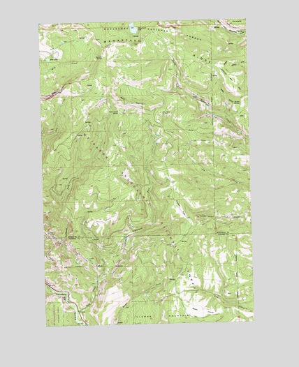
Manastash Lake, WA USGS Topographic Map
Click on map above to begin viewing in our Map Viewer.

This topographic map contains these locations and features:
Feature Name Type Latitude Longitude GNIS ID View Map
Bald MountainSummitN46.9660°W120.9442°1516082View Map
Barber SpringsSpringN46.9651°W120.8804°1516127View Map
Canteen FlatsFlatN46.9218°W120.9179°1517335View Map
Cattle Camp SpringSpringN46.9629°W120.9527°1517506View Map
Devils SlideCliffN46.9690°W120.9962°1518720View Map
Gold Creek TrailTrailN46.9712°W120.9851°1520091View Map
Lefthand Fork Rock CreekStreamN46.8929°W120.9695°1521998View Map
Manastash LakeLakeN46.9970°W120.9445°1522672View Map
Milk LakeLakeN46.9850°W120.9961°1523136View Map
Nile - Cliffdell Fire DepartmentBuildingN46.8787°W120.9806°2619406View Map
Righthand Fork Rock CreekStreamN46.8929°W120.9698°1525049View Map
Rock CreekStreamN46.8762°W120.9795°1525113View Map
Rocky PrairieFlatN46.8796°W120.9067°1525175View Map
Rocky SaddleGapN46.9976°W120.9856°1525181View Map
Summit SpringSpringN46.9857°W120.9626°1526727View Map
Summit TrailTrailN46.9729°W120.9631°1526728View Map
The IslandSummitN46.9985°W120.8781°1527042View Map
Two Point SpringSpringN46.9617°W120.9288°1527576View Map

Note: Coordinates in the location and feature list above are referenced to NAD83 datum.


Copyright (C) 2008-2025 Ryan Niemi / Sunset Dynamics ... All Rights Reserved