TopoQuest Logo
Do you find TopoQuest useful?
Help keep TopoQuest running and adding new maps/features by donating!
Bitcoin:  19c7KJd3qBynnjoSw5npx9KScwjBe4ifkT
Litecoin:  LXs6TkuXGGXo1vDsWCkWVdjQX94eUKd6ui
Home View Maps Find Maps Find Places Resources & Links


Milk Canyon, Washington Topographic Map

USGS Map Title: Milk Canyon, WA
USGS Map MRC: 46120G7
DRG (GeoTIFF) Download: o46120g7.tif


Neighboring USGS Topographic Map Quads:


  Manastash Lake, WA  
46120H8
 

  Hudson Creek, WA  
46120H7
 

  Manastash Creek, WA  
46120H6
 

  Nile, WA  
46120G8
 

  Milk Canyon, WA  
46120G7
 

  Wenas Lake, WA  
46120G6
 

  Weddle Canyon, WA  
46120F8
 

  Tieton, WA  
46120F7
 

  Naches, WA  
46120F6


Map MRC Location:

N47°
W121°
N47°
W120°
H8 H7 H6 H5 H4 H3 H2 H1
G8 G7 G6 G5 G4 G3 G2 G1
F8 F7 F6 F5 F4 F3 F2 F1
E8 E7 E6 E5 E4 E3 E2 E1
D8 D7 D6 D5 D4 D3 D2 D1
C8 C7 C6 C5 C4 C3 C2 C1
B8 B7 B6 B5 B4 B3 B2 B1
A8 A7 A6 A5 A4 A3 A2 A1
N46°
W121°
N46°
W120°

Milk Canyon, WA USGS 1:24K Topographic Map Preview:
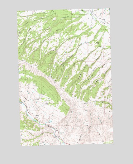
Milk Canyon, WA USGS Topographic Map
Click on map above to begin viewing in our Map Viewer.

This topographic map contains these locations and features:
Feature Name Type Latitude Longitude GNIS ID View Map
Box Spring CanyonValleyN46.8701°W120.8251°1516906View Map
Cleman MountainRidgeN46.8198°W120.8492°1517849View Map
Cougar CanyonValleyN46.7604°W120.8320°1518149View Map
Cow CanyonValleyN46.8723°W120.8267°1518210View Map
Evans CanyonValleyN46.8604°W120.7698°1519398View Map
Fisher FlatFlatN46.8393°W120.7634°1519606View Map
Horseshoe BendBendN46.7626°W120.8251°1520946View Map
Jones CanyonValleyN46.8535°W120.7584°1521455View Map
Middle Fork CanyonValleyN46.8579°W120.7620°1523064View Map
Milk CanyonValleyN46.8682°W120.7901°1523129View Map
Mill CanyonValleyN46.8671°W120.8401°1523150View Map
Mud LakeLakeN46.7723°W120.8348°1523471View Map
Nile ValleyValleyN46.7898°W120.8717°1534089View Map
North Fork Wenas CreekStreamN46.8718°W120.7842°1523878View Map
Oak Creek State Wildlife AreaParkN46.8735°W120.7526°1530439View Map
Sandstone SpringSpringN46.8433°W120.7661°1525426View Map
Sanford CanyonValleyN46.7573°W120.8245°1525431View Map
South Fork Wenas CreekStreamN46.8718°W120.7842°1526282View Map
WenasPopulated PlaceN46.8726°W120.7740°1527893View Map

Note: Coordinates in the location and feature list above are referenced to NAD83 datum.


Copyright (C) 2008-2025 Ryan Niemi / Sunset Dynamics ... All Rights Reserved