TopoQuest Logo
Do you find TopoQuest useful?
Help keep TopoQuest running and adding new maps/features by donating!
Bitcoin:  19c7KJd3qBynnjoSw5npx9KScwjBe4ifkT
Litecoin:  LXs6TkuXGGXo1vDsWCkWVdjQX94eUKd6ui
Home View Maps Find Maps Find Places Resources & Links


Manatee Springs, Florida Topographic Map

USGS Map Title: Manatee Springs, FL
USGS Map MRC: 29082D8
DRG (GeoTIFF) Download: o29082d8.tif


Neighboring USGS Topographic Map Quads:


  Eugene, FL  
29083E1
 

  Fanning Springs, FL  
29082E8
 

  Trenton, FL  
29082E7
 

  Vista, FL  
29083D1
 

  Manatee Springs, FL  
29082D8
 

  Chiefland, FL  
29082D7
 

  East Pass, FL  
29083C1
 

  Chiefland SW, FL  
29082C8
 

  Otter Creek, FL  
29082C7


Map MRC Location:

N30°
W83°
N30°
W82°
H8 H7 H6 H5 H4 H3 H2 H1
G8 G7 G6 G5 G4 G3 G2 G1
F8 F7 F6 F5 F4 F3 F2 F1
E8 E7 E6 E5 E4 E3 E2 E1
D8 D7 D6 D5 D4 D3 D2 D1
C8 C7 C6 C5 C4 C3 C2 C1
B8 B7 B6 B5 B4 B3 B2 B1
A8 A7 A6 A5 A4 A3 A2 A1
N29°
W83°
N29°
W82°

Manatee Springs, FL USGS 1:24K Topographic Map Preview:
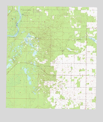
Manatee Springs, FL USGS Topographic Map
Click on map above to begin viewing in our Map Viewer.

This topographic map contains these locations and features:
Feature Name Type Latitude Longitude GNIS ID View Map
Alligator LakeLakeN29.4843°W82.9903°277795View Map
Antioch CemeteryCemeteryN29.4330°W82.9351°304698View Map
Bonnet PondLakeN29.4618°W82.9616°279224View Map
Camp PondLakeN29.4606°W82.9566°279927View Map
Chiefland DivisionCivilN29.4357°W82.8787°1935722View Map
Cook SinkBasinN29.4469°W82.9223°280737View Map
Dipple Field (historical)AirportN29.4466°W82.9051°309321View Map
Drummond PondLakeN29.4560°W82.9700°281783View Map
Hardee CemeteryCemeteryN29.4877°W82.8790°303689View Map
JanneyLocaleN29.4272°W82.9387°303690View Map
Long PondLakeN29.4599°W82.8785°298029View Map
Long Pond ChurchChurchN29.4602°W82.8973°286069View Map
Lower Clay LandingLocaleN29.4622°W82.9898°295420View Map
Manatee (historical)LocaleN29.4975°W82.9818°303688View Map
Manatee SpringsSpringN29.4902°W82.9771°286365View Map
Manatee Springs AirportAirportN29.4944°W82.9902°309759View Map
Manatee Springs State ParkParkN29.4938°W82.9726°286366View Map
Piney PrairieFlatN29.4486°W82.9129°288966View Map
Sand PondLakeN29.4632°W82.9712°290561View Map
Sunnyvale Fish CampLocaleN29.4802°W82.9876°300241View Map
Willow SinkBasinN29.4772°W82.8893°293362View Map
WTBH-FM (Chiefland)TowerN29.4600°W82.8979°310165View Map

Note: Coordinates in the location and feature list above are referenced to NAD83 datum.


Copyright (C) 2008-2024 Ryan Niemi / Sunset Dynamics ... All Rights Reserved