TopoQuest Logo
Do you find TopoQuest useful?
Help keep TopoQuest running and adding new maps/features by donating!
Bitcoin:  19c7KJd3qBynnjoSw5npx9KScwjBe4ifkT
Litecoin:  LXs6TkuXGGXo1vDsWCkWVdjQX94eUKd6ui
Home View Maps Find Maps Find Places Resources & Links


Trenton, Florida Topographic Map

USGS Map Title: Trenton, FL
USGS Map MRC: 29082E7
DRG (GeoTIFF) Download: o29082e7.tif


Neighboring USGS Topographic Map Quads:


  Wannee, FL  
29082F8
 

  Fourmile Lake, FL  
29082F7
 

  Waters Lake, FL  
29082F6
 

  Fanning Springs, FL  
29082E8
 

  Trenton, FL  
29082E7
 

  Newberry SW, FL  
29082E6
 

  Manatee Springs, FL  
29082D8
 

  Chiefland, FL  
29082D7
 

  Bronson, FL  
29082D6


Map MRC Location:

N30°
W83°
N30°
W82°
H8 H7 H6 H5 H4 H3 H2 H1
G8 G7 G6 G5 G4 G3 G2 G1
F8 F7 F6 F5 F4 F3 F2 F1
E8 E7 E6 E5 E4 E3 E2 E1
D8 D7 D6 D5 D4 D3 D2 D1
C8 C7 C6 C5 C4 C3 C2 C1
B8 B7 B6 B5 B4 B3 B2 B1
A8 A7 A6 A5 A4 A3 A2 A1
N29°
W83°
N29°
W82°

Trenton, FL USGS 1:24K Topographic Map Preview:
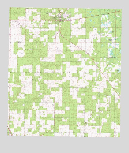
Trenton, FL USGS Topographic Map
Click on map above to begin viewing in our Map Viewer.

This topographic map contains these locations and features:
Feature Name Type Latitude Longitude GNIS ID View Map
Ames FieldAirportN29.5881°W82.8713°309936View Map
Bethel African Methodist Episcopal ChurchChurchN29.6158°W82.8197°2352471View Map
Brookins Air StripAirportN29.5123°W82.8601°309316View Map
City of TrentonCivilN29.6094°W82.8147°2405604View Map
Community Church of the NazareneChurchN29.6117°W82.8508°2352484View Map
Double SinkLocaleN29.5189°W82.7893°303692View Map
Ebenezer Baptist ChurchChurchN29.6169°W82.8200°2352468View Map
Gilchrist Adult EducationSchoolN29.6203°W82.8209°297875View Map
Gilchrist County CourthouseBuildingN29.6131°W82.8178°2352251View Map
Gilchrist County Public LibraryBuildingN29.6211°W82.8181°2352466View Map
Gilchrist County School BoardBuildingN29.6206°W82.8208°2352467View Map
Gilchrist County Sheriff's OfficeBuildingN29.6019°W82.8192°2333106View Map
Haven WinquipinLakeN29.5652°W82.7512°283817View Map
Jesus Way Church of DeliveranceChurchN29.6206°W82.8183°2352465View Map
John Morse High School (historical)SchoolN29.6175°W82.8218°284842View Map
Lancaster Correctional InstitutionBuildingN29.6086°W82.8644°2753054View Map
Lancaster Correctional InstitutionSchoolN29.6105°W82.8654°307651View Map
Living Praise Church of GodChurchN29.6203°W82.8178°2352464View Map
Neal FieldAirportN29.5571°W82.8693°309319View Map
Pine Grove Baptist ChurchChurchN29.5716°W82.7762°288840View Map
Pine Grove CemeteryCemeteryN29.5722°W82.7736°2352243View Map
Raulison PondReservoirN29.5949°W82.7619°289510View Map
Shady Grove CemeteryCemeteryN29.5778°W82.7642°2352244View Map
Shady Grove Primitive Baptist ChurchChurchN29.5775°W82.7651°290901View Map
Spring PondReservoirN29.6026°W82.7619°291564View Map
TrentonPopulated PlaceN29.6133°W82.8176°292420View Map
Trenton Church of ChristChurchN29.6167°W82.8100°2352246View Map
Trenton Elementary SchoolSchoolN29.6146°W82.8293°2352483View Map
Trenton First Baptist ChurchChurchN29.6136°W82.8156°2352248View Map
Trenton High SchoolSchoolN29.6197°W82.8193°297874View Map
Trenton High School Football StadiumParkN29.6181°W82.8200°2352469View Map
Trenton Police DepartmentBuildingN29.6101°W82.8179°2352250View Map
Trenton Post OfficePost OfficeN29.6152°W82.7989°2352245View Map
Trenton State ParkParkN29.6103°W82.8167°2352249View Map
Trenton United Methodist ChurchChurchN29.6161°W82.8161°2352247View Map
Trenton Water TowerTowerN29.6150°W82.8194°2352463View Map
WCWB-FM (Trenton)TowerN29.6113°W82.8537°310270View Map
Westside Church of ChristChurchN29.6153°W82.8217°2352470View Map
White Farms AirportAirportN29.5142°W82.8732°309317View Map
Windy Acres AirportAirportN29.5658°W82.8687°309320View Map

Note: Coordinates in the location and feature list above are referenced to NAD83 datum.


Copyright (C) 2008-2024 Ryan Niemi / Sunset Dynamics ... All Rights Reserved