TopoQuest Logo
Do you find TopoQuest useful?
Help keep TopoQuest running and adding new maps/features by donating!
Bitcoin:  19c7KJd3qBynnjoSw5npx9KScwjBe4ifkT
Litecoin:  LXs6TkuXGGXo1vDsWCkWVdjQX94eUKd6ui
Home View Maps Find Maps Find Places Resources & Links


Manchester, Montana Topographic Map

USGS Map Title: Manchester, MT
USGS Map MRC: 47111E4
DRG (GeoTIFF) Download: o47111e4.tif


Neighboring USGS Topographic Map Quads:


  Vaughn NE, MT  
47111F5
 

  Benton Lake West, MT  
47111F4
 

  Benton Lake East, MT  
47111F3
 

  Vaughn, MT  
47111E5
 

  Manchester, MT  
47111E4
 

  Northwest Great Falls, MT  
47111E3
 

  Ulm, MT  
47111D5
 

  Antelope Butte, MT  
47111D4
 

  Southwest Great Falls, MT  
47111D3


Map MRC Location:

N48°
W112°
N48°
W111°
H8 H7 H6 H5 H4 H3 H2 H1
G8 G7 G6 G5 G4 G3 G2 G1
F8 F7 F6 F5 F4 F3 F2 F1
E8 E7 E6 E5 E4 E3 E2 E1
D8 D7 D6 D5 D4 D3 D2 D1
C8 C7 C6 C5 C4 C3 C2 C1
B8 B7 B6 B5 B4 B3 B2 B1
A8 A7 A6 A5 A4 A3 A2 A1
N47°
W112°
N47°
W111°

Manchester, MT USGS 1:24K Topographic Map Preview:
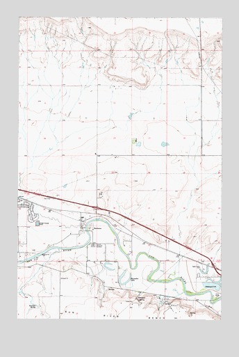
Manchester, MT USGS Topographic Map
Click on map above to begin viewing in our Map Viewer.

This topographic map contains these locations and features:
Feature Name Type Latitude Longitude GNIS ID View Map
20N02E01AABA01 WellWellN47.5233°W111.4133°823593View Map
20N02E01CCCB01 WellWellN47.5097°W111.4311°823484View Map
20N02E01CCCC01 SpringSpringN47.5083°W111.4259°823477View Map
20N02E02C___01 WellWellN47.5127°W111.4480°823502View Map
20N02E03BAAD01 WellWellN47.5230°W111.4641°823592View Map
20N02E09____01 WellWellN47.5016°W111.4852°823434View Map
20N03E06DCDC01 WellWellN47.5088°W111.3991°823473View Map
21N02E13BDCD01 WellWellN47.5758°W111.4255°823845View Map
21N02E34ABCC01 WellWellN47.5352°W111.4619°823657View Map
Horseshoe LakeLakeN47.5151°W111.4347°772570View Map
Interchange 282CrossingN47.5230°W111.3800°1761782View Map
Interchange 286CrossingN47.5463°W111.4522°1761783View Map
KEIN-AM (Great Falls)TowerN47.5222°W111.3891°806619View Map
ManchesterLocaleN47.5408°W111.4622°1762349View Map
ManchesterPopulated PlaceN47.5408°W111.4622°773856View Map
Manchester CemeteryCemeteryN47.5308°W111.4544°777338View Map
Manchester Post Office (historical)Post OfficeN47.5408°W111.4622°1762348View Map
Manchester School (historical)SchoolN47.5688°W111.4508°1761922View Map
Newman SpringSpringN47.5058°W111.4894°774610View Map
Payton Place DamDamN47.5850°W111.4325°798371View Map
Sun PrairiePopulated PlaceN47.5369°W111.4814°1867343View Map
Sun Prairie Census Designated PlaceCensusN47.5385°W111.4919°2410026View Map
Vaughn Volunteer Fire Department - Sun Prairie Volunteer Fire DepartmentBuildingN47.5476°W111.4992°2546460View Map
Vaughn Volunteer Fire Department Manchester StationBuildingN47.5240°W111.4501°2546522View Map
Wadsworth ParkParkN47.5130°W111.3789°802210View Map

Note: Coordinates in the location and feature list above are referenced to NAD83 datum.


Copyright (C) 2008-2024 Ryan Niemi / Sunset Dynamics ... All Rights Reserved