TopoQuest Logo
Do you find TopoQuest useful?
Help keep TopoQuest running and adding new maps/features by donating!
Bitcoin:  19c7KJd3qBynnjoSw5npx9KScwjBe4ifkT
Litecoin:  LXs6TkuXGGXo1vDsWCkWVdjQX94eUKd6ui
Home View Maps Find Maps Find Places Resources & Links


Mantee, Mississippi Topographic Map

USGS Map Title: Mantee, MS
USGS Map MRC: 33089F1
DRG (GeoTIFF) Download: o33089f1.tif


Neighboring USGS Topographic Map Quads:


  Atlanta, MS  
33089G2
 

  Woodland, MS  
33089G1
 

  Sparta, MS  
33088G8
 

  Hohenlinden, MS  
33089F2
 

  Mantee, MS  
33089F1
 

  Montpelier, MS  
33088F8
 

  Sapa, MS  
33089E2
 

  Maben, MS  
33089E1
 

  Pheba, MS  
33088E8


Map MRC Location:

N34°
W90°
N34°
W89°
H8 H7 H6 H5 H4 H3 H2 H1
G8 G7 G6 G5 G4 G3 G2 G1
F8 F7 F6 F5 F4 F3 F2 F1
E8 E7 E6 E5 E4 E3 E2 E1
D8 D7 D6 D5 D4 D3 D2 D1
C8 C7 C6 C5 C4 C3 C2 C1
B8 B7 B6 B5 B4 B3 B2 B1
A8 A7 A6 A5 A4 A3 A2 A1
N33°
W90°
N33°
W89°

Mantee, MS USGS 1:24K Topographic Map Preview:
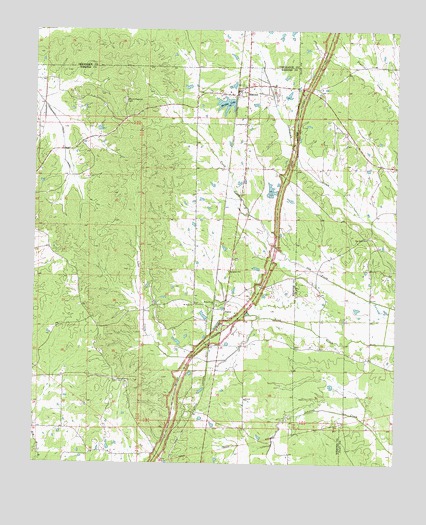
Mantee, MS USGS Topographic Map
Click on map above to begin viewing in our Map Viewer.

This topographic map contains these locations and features:
Feature Name Type Latitude Longitude GNIS ID View Map
Antioch ChurchChurchN33.6437°W89.0517°666324View Map
Choctaw RidgeRidgeN33.6543°W89.0959°682822View Map
Dalton (historical)LocaleN33.6840°W89.0570°682831View Map
DancyPopulated PlaceN33.6696°W89.0590°669093View Map
Davis Store (historical)LocaleN33.6501°W89.1151°682832View Map
Dixie (historical)LocaleN33.7432°W89.0126°684754View Map
Harrington Lake DamDamN33.7051°W89.0417°682304View Map
Kirby (historical)LocaleN33.7043°W89.0403°685192View Map
ManteePopulated PlaceN33.7315°W89.0553°673117View Map
Mantee Baptist ChurchChurchN33.7323°W89.0581°705701View Map
Mantee LakeReservoirN33.7288°W89.0593°673118View Map
Mantee Lake DamDamN33.7285°W89.0567°682315View Map
Mantee Post OfficePost OfficeN33.7315°W89.0552°712907View Map
Mantee Volunteer Fire DepartmentBuildingN33.7318°W89.0557°2665930View Map
Mount Hope CemeteryCemeteryN33.6715°W89.0698°705709View Map
Mount Hope ChurchChurchN33.6707°W89.0695°674030View Map
Mount Pleasant Baptist Church (historical)ChurchN33.7298°W89.0934°705711View Map
Mount Pleasant CemeteryCemeteryN33.7296°W89.0939°674217View Map
Old Carlson ChurchChurchN33.6490°W89.0956°675167View Map
Old Cumberland (historical)LocaleN33.6432°W89.0723°705716View Map
Pine Bluff (historical)LocaleN33.6904°W89.0098°684790View Map
Pine Bluff Baptist ChurchChurchN33.6901°W89.0101°675797View Map
Pine Bluff CemeteryCemeteryN33.6907°W89.0089°684791View Map
Pisgah CemeteryCemeteryN33.6593°W89.0351°705719View Map
Pisgah Methodist Church (historical)ChurchN33.6593°W89.0356°705720View Map
ShebaLocaleN33.6840°W89.0428°692341View Map
Talley Post Office (historical)Post OfficeN33.6840°W89.0428°712157View Map
Union Valley (historical)LocaleN33.7118°W89.0695°705737View Map
Village of ManteeCivilN33.7226°W89.0597°2407495View Map
Wake Forest CemeteryCemeteryN33.6715°W89.0617°705738View Map
Wake Forest ChurchChurchN33.6707°W89.0617°679245View Map

Note: Coordinates in the location and feature list above are referenced to NAD83 datum.


Copyright (C) 2008-2024 Ryan Niemi / Sunset Dynamics ... All Rights Reserved