TopoQuest Logo
Do you find TopoQuest useful?
Help keep TopoQuest running and adding new maps/features by donating!
Bitcoin:  19c7KJd3qBynnjoSw5npx9KScwjBe4ifkT
Litecoin:  LXs6TkuXGGXo1vDsWCkWVdjQX94eUKd6ui
Home View Maps Find Maps Find Places Resources & Links


Atlanta, Mississippi Topographic Map

USGS Map Title: Atlanta, MS
USGS Map MRC: 33089G2
DRG (GeoTIFF) Download: o33089g2.tif


Neighboring USGS Topographic Map Quads:


  Bruce, MS  
33089H3
 

  Vardaman, MS  
33089H2
 

  Houston West, MS  
33089H1
 

  Calhoun City, MS  
33089G3
 

  Atlanta, MS  
33089G2
 

  Woodland, MS  
33089G1
 

  Bellefontaine, MS  
33089F3
 

  Hohenlinden, MS  
33089F2
 

  Mantee, MS  
33089F1


Map MRC Location:

N34°
W90°
N34°
W89°
H8 H7 H6 H5 H4 H3 H2 H1
G8 G7 G6 G5 G4 G3 G2 G1
F8 F7 F6 F5 F4 F3 F2 F1
E8 E7 E6 E5 E4 E3 E2 E1
D8 D7 D6 D5 D4 D3 D2 D1
C8 C7 C6 C5 C4 C3 C2 C1
B8 B7 B6 B5 B4 B3 B2 B1
A8 A7 A6 A5 A4 A3 A2 A1
N33°
W90°
N33°
W89°

Atlanta, MS USGS 1:24K Topographic Map Preview:
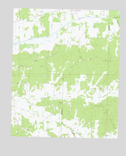
Atlanta, MS USGS Topographic Map
Click on map above to begin viewing in our Map Viewer.

This topographic map contains these locations and features:
Feature Name Type Latitude Longitude GNIS ID View Map
AtlantaPopulated PlaceN33.7984°W89.1476°666419View Map
Atlanta Colored School (historical)SchoolN33.7979°W89.1512°710249View Map
Atlanta Methodist Church (historical)ChurchN33.7987°W89.1506°710250View Map
Atlanta School (historical)SchoolN33.7982°W89.1512°710251View Map
Bentley ChurchChurchN33.7573°W89.2337°666834View Map
BentlyPopulated PlaceN33.7576°W89.2326°705954View Map
Bently CemeteryCemeteryN33.7571°W89.2340°705955View Map
Bowles (historical)Populated PlaceN33.8251°W89.1367°688702View Map
Buck CreekStreamN33.7729°W89.2237°667729View Map
Bull CreekStreamN33.8682°W89.1601°667770View Map
Cane CreekStreamN33.8590°W89.1903°668025View Map
Clemons BranchStreamN33.8662°W89.1712°668595View Map
Collage Hill ChurchChurchN33.7837°W89.1909°668692View Map
College Hill Church (historical)ChurchN33.7746°W89.1820°688708View Map
Erin (historical)LocaleN33.8293°W89.1834°683372View Map
Hamilton Lookout TowerTowerN33.8243°W89.2245°711240View Map
HollisPopulated PlaceN33.8634°W89.2417°683377View Map
Inman Lake DamDamN33.8451°W89.1901°682365View Map
Johnson CreekStreamN33.8657°W89.1287°671940View Map
Little Topashaw CreekStreamN33.7573°W89.1781°672702View Map
Meridian CreekStreamN33.8493°W89.2051°673492View Map
Midway Baptist ChurchChurchN33.8254°W89.1390°673554View Map
Midway CemeteryCemeteryN33.8257°W89.1364°710328View Map
Midway CemeteryCemeteryN33.8265°W89.1612°705970View Map
Midway ChurchChurchN33.8268°W89.1598°673555View Map
Mount Zion (historical)LocaleN33.8251°W89.1676°683384View Map
Mud CreekStreamN33.8676°W89.1437°674432View Map
Naron CreekStreamN33.8676°W89.1645°674507View Map
New Providence ChurchChurchN33.8190°W89.2420°674822View Map
Old Pleasant Grove CemeteryCemeteryN33.7812°W89.1456°675226View Map
Old Providence CemeteryCemeteryN33.8168°W89.2390°705974View Map
Pleasant Grove Baptist ChurchChurchN33.7746°W89.1370°676030View Map
Pleasant Grove CemeteryCemeteryN33.7746°W89.1359°710360View Map
Providence CemeteryCemeteryN33.8176°W89.2401°705978View Map
Recorrhodes Chapel Volunteer Fire Department Station 2BuildingN33.7989°W89.1477°2666061View Map
Shady Grove ChurchChurchN33.8184°W89.2134°677586View Map
Supervisor District 5CivilN33.8722°W89.2082°711792View Map
Tetter Lake DamDamN33.8451°W89.1751°682364View Map
Wade FieldAirportN33.7723°W89.2453°2676396View Map

Note: Coordinates in the location and feature list above are referenced to NAD83 datum.


Copyright (C) 2008-2025 Ryan Niemi / Sunset Dynamics ... All Rights Reserved